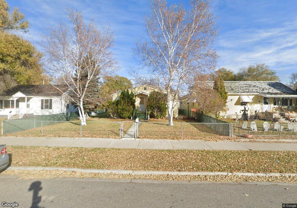
1143 Cook Ave Billings, MT 59102
East Central Billings NeighborhoodEstimated Value: $249,000 - $267,881
5
Beds
4
Baths
1,966
Sq Ft
$132/Sq Ft
Est. Value
About This Home
This home is located at 1143 Cook Ave, Billings, MT 59102 and is currently estimated at $260,470, approximately $132 per square foot. 1143 Cook Ave is a home located in Yellowstone County with nearby schools including Washington School, Lewis & Clark Junior High School, and Billings Senior High School.
Ownership History
Date
Name
Owned For
Owner Type
Purchase Details
Closed on
Oct 8, 2024
Sold by
Niess Thomas L
Bought by
Stellar Property Services Llc
Current Estimated Value
Home Financials for this Owner
Home Financials are based on the most recent Mortgage that was taken out on this home.
Original Mortgage
$177,600
Outstanding Balance
$174,903
Interest Rate
6.46%
Mortgage Type
New Conventional
Estimated Equity
$85,567
Purchase Details
Closed on
Dec 16, 2020
Sold by
Taylor Charlotte and Selvig Charlotte T
Bought by
Ness Thomas
Create a Home Valuation Report for This Property
The Home Valuation Report is an in-depth analysis detailing your home's value as well as a comparison with similar homes in the area
Home Values in the Area
Average Home Value in this Area
Purchase History
| Date | Buyer | Sale Price | Title Company |
|---|---|---|---|
| Stellar Property Services Llc | -- | None Listed On Document | |
| Ness Thomas | -- | None Listed On Document |
Source: Public Records
Mortgage History
| Date | Status | Borrower | Loan Amount |
|---|---|---|---|
| Open | Stellar Property Services Llc | $177,600 |
Source: Public Records
Tax History Compared to Growth
Tax History
| Year | Tax Paid | Tax Assessment Tax Assessment Total Assessment is a certain percentage of the fair market value that is determined by local assessors to be the total taxable value of land and additions on the property. | Land | Improvement |
|---|---|---|---|---|
| 2025 | $2,684 | $293,250 | $37,400 | $255,850 |
| 2024 | $2,684 | $270,830 | $37,300 | $233,530 |
| 2023 | $2,689 | $270,830 | $37,300 | $233,530 |
| 2022 | $2,346 | $205,760 | $0 | $0 |
| 2021 | $2,241 | $206,080 | $0 | $0 |
| 2020 | $2,179 | $186,310 | $0 | $0 |
| 2019 | $2,080 | $186,310 | $0 | $0 |
| 2018 | $1,874 | $162,260 | $0 | $0 |
| 2017 | $1,823 | $162,260 | $0 | $0 |
| 2016 | $1,710 | $152,910 | $0 | $0 |
| 2015 | $1,663 | $152,910 | $0 | $0 |
| 2014 | $1,638 | $80,378 | $0 | $0 |
Source: Public Records
Map
Nearby Homes
- 1132 Saint Johns Ave
- 1122 Howard Ave
- 1205 Lynn Ave
- 1120 Miles Ave
- 947 Howard Ave
- 1125 Custer Ave
- 937 Miles Ave
- 925 Miles Ave
- 926 Terry Ave
- 1342 Custer Ave
- 43 Prickett Ln
- 1009 Wyoming Ave
- 1310 Yellowstone Ave Unit 6
- 1310 Yellowstone Ave Unit 16
- 1310 Yellowstone Ave
- 226 Moore Ln
- 1003 Wyoming Ave
- 109 16th St W
- 1230 Clark Ave
- 723 Cook Ave