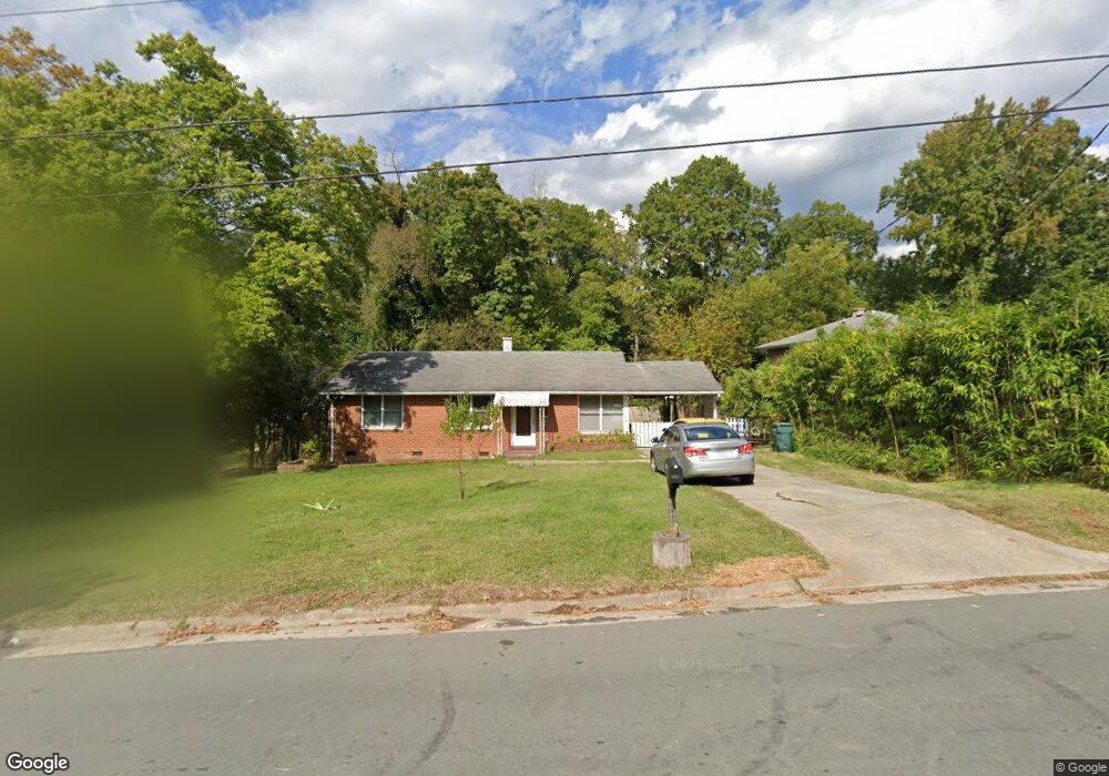
1147 Raynor St Durham, NC 27703
East Durham NeighborhoodEstimated Value: $213,118 - $278,000
3
Beds
1
Bath
1,075
Sq Ft
$223/Sq Ft
Est. Value
About This Home
This home is located at 1147 Raynor St, Durham, NC 27703 and is currently estimated at $239,373, approximately $222 per square foot. 1147 Raynor St is a home located in Durham County with nearby schools including Y E Smith Elementary, W.G. Pearson Elementary School, and Brogden Middle.
Ownership History
Date
Name
Owned For
Owner Type
Purchase Details
Closed on
Jan 20, 2015
Sold by
Mccallum Carrie C
Bought by
Abuamra Mohammed and Abuamra Crystal
Current Estimated Value
Purchase Details
Closed on
Jul 28, 2000
Sold by
Storey Naomi M
Bought by
Mccallum Haywood L and Mccallum Carrie C
Home Financials for this Owner
Home Financials are based on the most recent Mortgage that was taken out on this home.
Original Mortgage
$90,000
Interest Rate
8.23%
Mortgage Type
VA
Create a Home Valuation Report for This Property
The Home Valuation Report is an in-depth analysis detailing your home's value as well as a comparison with similar homes in the area
Home Values in the Area
Average Home Value in this Area
Purchase History
| Date | Buyer | Sale Price | Title Company |
|---|---|---|---|
| Abuamra Mohammed | $45,000 | None Available | |
| Mccallum Haywood L | $90,000 | -- |
Source: Public Records
Mortgage History
| Date | Status | Borrower | Loan Amount |
|---|---|---|---|
| Previous Owner | Mccallum Haywood L | $90,000 |
Source: Public Records
Tax History Compared to Growth
Tax History
| Year | Tax Paid | Tax Assessment Tax Assessment Total Assessment is a certain percentage of the fair market value that is determined by local assessors to be the total taxable value of land and additions on the property. | Land | Improvement |
|---|---|---|---|---|
| 2025 | $2,276 | $229,603 | $94,500 | $135,103 |
| 2024 | $1,524 | $109,284 | $18,930 | $90,354 |
| 2023 | $1,432 | $109,284 | $18,930 | $90,354 |
| 2022 | $1,399 | $109,284 | $18,930 | $90,354 |
| 2021 | $1,392 | $109,284 | $18,930 | $90,354 |
| 2020 | $1,359 | $109,284 | $18,930 | $90,354 |
| 2019 | $1,359 | $109,284 | $18,930 | $90,354 |
| 2018 | $1,133 | $83,517 | $22,085 | $61,432 |
| 2017 | $1,125 | $83,517 | $22,085 | $61,432 |
| 2016 | $1,087 | $83,517 | $22,085 | $61,432 |
| 2015 | $1,135 | $82,008 | $20,605 | $61,403 |
| 2014 | $568 | $82,008 | $20,605 | $61,403 |
Source: Public Records
Map
Nearby Homes
- 1121 Raynor St
- 1116 Delano St
- 113 Herbert St
- 525 N Hoover Rd
- 1304 Castlebay Rd
- 647 N Hardee St
- 1115 Benning St
- 612 Raynor St
- 610 Raynor St
- 1505 Juniper St
- 2513 Rochelle St
- 1603 Robinhood Rd
- 314 N Briggs Ave
- 518 N Guthrie Ave
- 1112 N Driver St
- 1304 Holloway St
- 2015 Cheek Rd
- 1113 N Driver St
- 1410 Braxton St
- 2125 Cheek Rd
- 1143 Raynor St
- 1151 Raynor St
- 419 N Hardee St
- 1141 Raynor St
- 1144 Raynor St
- 1146 Raynor St
- 1140 Raynor St
- 1139 Raynor St
- 421 N Hardee St
- 1138 Raynor St
- 416 N Hardee St
- 405 N Hardee St
- 1137 Raynor St
- 418 N Hardee St
- 1134 Raynor St
- 420 N Hardee St
- 1150 Delano St
- 414 N Hardee St
- 1158 Delano St
- 1156 Delano St