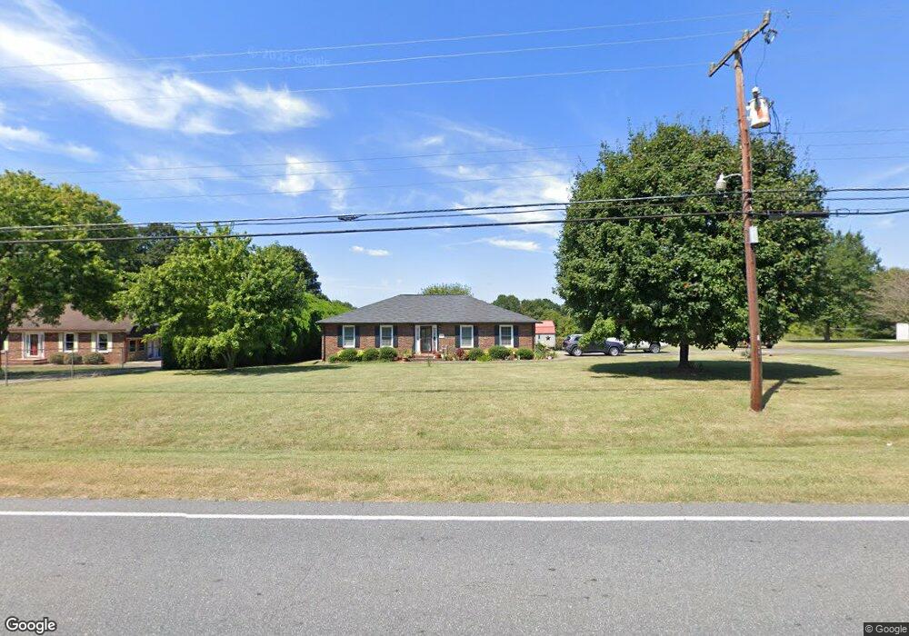
1149 Startown Rd Lincolnton, NC 28092
Estimated Value: $274,010 - $354,000
3
Beds
2
Baths
1,363
Sq Ft
$233/Sq Ft
Est. Value
About This Home
This home is located at 1149 Startown Rd, Lincolnton, NC 28092 and is currently estimated at $318,003, approximately $233 per square foot. 1149 Startown Rd is a home located in Lincoln County with nearby schools including Norris S. Childers Elementary School, Lincolnton Middle School, and Lincolnton High School.
Ownership History
Date
Name
Owned For
Owner Type
Purchase Details
Closed on
Feb 15, 2008
Sold by
Hovis Gregory Todd and Hovis Robyn Michelle
Bought by
Sigmon Henry and Sigmon Ruth L
Current Estimated Value
Home Financials for this Owner
Home Financials are based on the most recent Mortgage that was taken out on this home.
Original Mortgage
$65,000
Outstanding Balance
$40,113
Interest Rate
5.65%
Mortgage Type
Purchase Money Mortgage
Estimated Equity
$277,890
Purchase Details
Closed on
Mar 22, 1989
Bought by
Hovis Gregory Todd
Create a Home Valuation Report for This Property
The Home Valuation Report is an in-depth analysis detailing your home's value as well as a comparison with similar homes in the area
Home Values in the Area
Average Home Value in this Area
Purchase History
| Date | Buyer | Sale Price | Title Company |
|---|---|---|---|
| Sigmon Henry | $128,000 | None Available | |
| Hovis Gregory Todd | $60,000 | -- |
Source: Public Records
Mortgage History
| Date | Status | Borrower | Loan Amount |
|---|---|---|---|
| Open | Sigmon Henry | $65,000 |
Source: Public Records
Tax History Compared to Growth
Tax History
| Year | Tax Paid | Tax Assessment Tax Assessment Total Assessment is a certain percentage of the fair market value that is determined by local assessors to be the total taxable value of land and additions on the property. | Land | Improvement |
|---|---|---|---|---|
| 2025 | $1,600 | $241,685 | $27,494 | $214,191 |
| 2024 | $1,580 | $241,685 | $27,494 | $214,191 |
| 2023 | $1,539 | $241,685 | $27,494 | $214,191 |
| 2022 | $1,183 | $150,688 | $22,000 | $128,688 |
| 2021 | $1,153 | $150,688 | $22,000 | $128,688 |
| 2020 | $1,008 | $150,688 | $22,000 | $128,688 |
| 2019 | $1,008 | $150,688 | $22,000 | $128,688 |
| 2018 | $958 | $125,889 | $19,500 | $106,389 |
| 2017 | $820 | $125,889 | $19,500 | $106,389 |
| 2016 | $820 | $125,889 | $19,500 | $106,389 |
| 2015 | $889 | $125,889 | $19,500 | $106,389 |
| 2014 | $869 | $124,163 | $20,000 | $104,163 |
Source: Public Records
Map
Nearby Homes
- 801 N Grove St
- 815 N Laurel St
- 743 Lore Rd
- 1074 Better Brook Ln
- 2350, 1912 N Aspen St
- 535 Norman Fair Ave
- 1939 River Rd
- 834 N Flint St
- 502 Forney Ave
- #168 Rolling Rd
- 327 Bonview Ave
- 000 Better Brook Ln
- 524 Bonview Ave
- 1712 Cline Farm Rd
- 826 E Alexander St
- 958 Hillard Ln
- 423 N Cedar St
- 316 N Government St
- 915 Danbrook Cir
- 1231 Better Brook Ln
- 1133 Startown Rd
- 1159 Startown Rd
- 1150 Startown Rd
- 1150 Startown Rd Unit 1
- 1102 Startown Rd
- 1100 Startown Rd
- 1096 Startown Rd
- 1094 Startown Rd
- 1090 Startown Rd
- 1088 Startown Rd
- 1174 Startown Rd
- 1085 Startown Rd
- 1098 Startown Rd
- 1084 Startown Rd
- 1082 Startown Rd
- 1078 Startown Rd
- 1076 Startown Rd
- 1219 Startown Rd
- 884 Clear Creek Cir
- 894 Clear Creek Cir