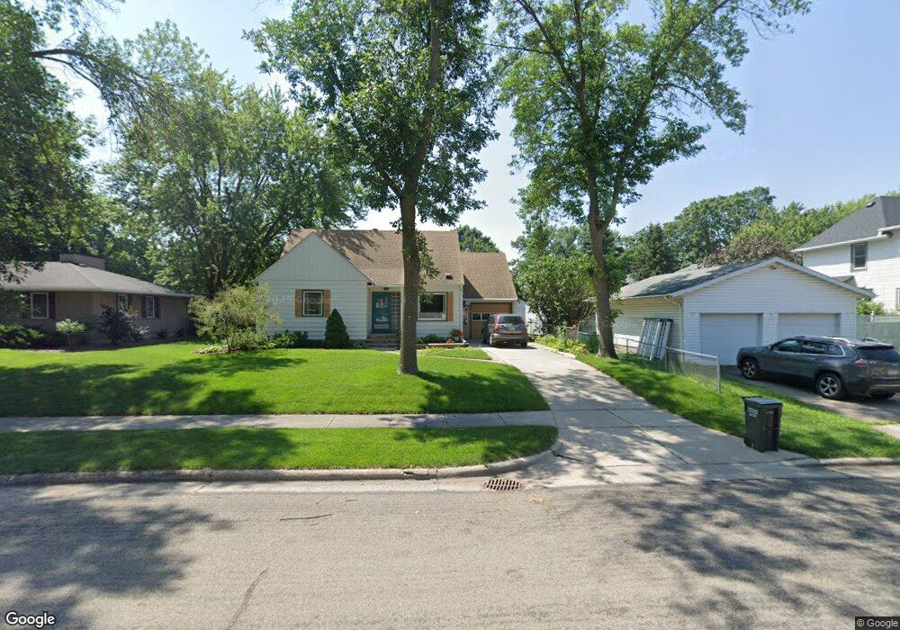
115 Hobart St Owatonna, MN 55060
Estimated Value: $229,000 - $243,000
3
Beds
1
Bath
1,376
Sq Ft
$174/Sq Ft
Est. Value
About This Home
This home is located at 115 Hobart St, Owatonna, MN 55060 and is currently estimated at $238,745, approximately $173 per square foot. 115 Hobart St is a home located in Steele County with nearby schools including Lincoln Elementary School, Owatonna Middle School, and Owatonna Senior High School.
Ownership History
Date
Name
Owned For
Owner Type
Purchase Details
Closed on
Dec 9, 2016
Sold by
Blade Donna A and Blade Timothy C
Bought by
Smith Marcia J
Current Estimated Value
Home Financials for this Owner
Home Financials are based on the most recent Mortgage that was taken out on this home.
Original Mortgage
$106,400
Outstanding Balance
$85,783
Interest Rate
3.47%
Mortgage Type
New Conventional
Estimated Equity
$152,962
Purchase Details
Closed on
May 6, 2010
Sold by
Blade Donna A and Blade Timothy C
Bought by
Blade Donna A and Blade Timothy C
Create a Home Valuation Report for This Property
The Home Valuation Report is an in-depth analysis detailing your home's value as well as a comparison with similar homes in the area
Home Values in the Area
Average Home Value in this Area
Purchase History
| Date | Buyer | Sale Price | Title Company |
|---|---|---|---|
| Smith Marcia J | $133,000 | North American Title | |
| Blade Donna A | -- | None Available |
Source: Public Records
Mortgage History
| Date | Status | Borrower | Loan Amount |
|---|---|---|---|
| Open | Smith Marcia J | $106,400 |
Source: Public Records
Tax History Compared to Growth
Tax History
| Year | Tax Paid | Tax Assessment Tax Assessment Total Assessment is a certain percentage of the fair market value that is determined by local assessors to be the total taxable value of land and additions on the property. | Land | Improvement |
|---|---|---|---|---|
| 2025 | $2,868 | $227,900 | $35,200 | $192,700 |
| 2024 | $2,726 | $213,200 | $31,800 | $181,400 |
| 2023 | $2,770 | $195,500 | $25,000 | $170,500 |
| 2022 | $2,408 | $190,200 | $23,700 | $166,500 |
| 2021 | $2,206 | $153,272 | $21,560 | $131,712 |
| 2020 | $2,162 | $141,120 | $21,560 | $119,560 |
| 2019 | $1,804 | $133,868 | $21,560 | $112,308 |
| 2018 | $1,648 | $121,716 | $19,894 | $101,822 |
| 2017 | $1,560 | $113,288 | $18,228 | $95,060 |
| 2016 | $1,462 | $108,976 | $18,228 | $90,748 |
| 2015 | -- | $0 | $0 | $0 |
| 2014 | -- | $0 | $0 | $0 |
Source: Public Records
Map
Nearby Homes
- 203 E Mckinley St
- 1212 S Grove Ave
- 1031 S Cedar Ave
- 1047 S Oak Ave
- 228 13th St SW
- 222 W Mckinley St
- 1003 S Elm Ave
- 317 Havana Rd
- 1031 Grandview Ave
- 1031 1031 Grandview Ave
- 318 13th St SW
- 819 S Cedar Ave
- 819 819 S Cedar Ave
- 1132 Butternut Ave
- 349 13th St SW
- 240 South St
- 916 Linn Ave SW
- 339 South St
- 241 Prospect St
- 338 South St
- 121 Hobart St
- 1223 S Cedar Ave
- 1217 1217 Cedar Ave S
- 1217 S Cedar Ave
- 118 E Park St
- 124 E Park St
- 1231 S Cedar Ave
- 1231 Cedar Ave S
- 1231 1231 Cedar Ave S
- 127 Hobart St
- 130 E Park St
- 116 Hobart St
- 122 Hobart St
- 128 Hobart St
- 139 Hobart St
- 134 E Park St
- 134 Hobart St
- 1226 S Cedar Ave
- 140 E Park St
- 138 Hobart St