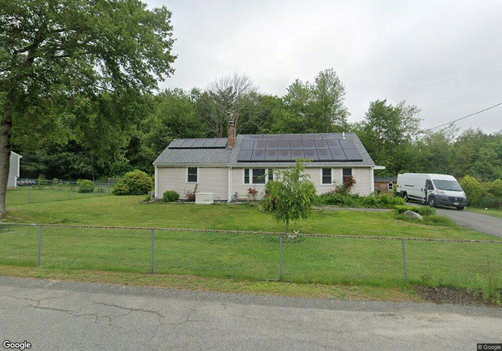
115 Hubbard Ave Brockton, MA 02301
Campello NeighborhoodEstimated Value: $543,000 - $602,000
4
Beds
2
Baths
1,874
Sq Ft
$303/Sq Ft
Est. Value
About This Home
This home is located at 115 Hubbard Ave, Brockton, MA 02301 and is currently estimated at $568,385, approximately $303 per square foot. 115 Hubbard Ave is a home located in Plymouth County with nearby schools including Davis K-8 School, John F. Kennedy Elementary School, and South Middle School.
Ownership History
Date
Name
Owned For
Owner Type
Purchase Details
Closed on
Dec 15, 2008
Sold by
Linehan Richard J
Bought by
Linehan Doreen M
Current Estimated Value
Create a Home Valuation Report for This Property
The Home Valuation Report is an in-depth analysis detailing your home's value as well as a comparison with similar homes in the area
Home Values in the Area
Average Home Value in this Area
Purchase History
| Date | Buyer | Sale Price | Title Company |
|---|---|---|---|
| Linehan Doreen M | -- | -- |
Source: Public Records
Mortgage History
| Date | Status | Borrower | Loan Amount |
|---|---|---|---|
| Open | Linehan Doreen M | $75,000 | |
| Previous Owner | Linehan Doreen M | $115,000 | |
| Previous Owner | Linehan Doreen M | $10,000 |
Source: Public Records
Tax History Compared to Growth
Tax History
| Year | Tax Paid | Tax Assessment Tax Assessment Total Assessment is a certain percentage of the fair market value that is determined by local assessors to be the total taxable value of land and additions on the property. | Land | Improvement |
|---|---|---|---|---|
| 2025 | $5,526 | $456,300 | $167,800 | $288,500 |
| 2024 | $5,308 | $441,600 | $167,800 | $273,800 |
| 2023 | $5,222 | $402,300 | $118,800 | $283,500 |
| 2022 | $5,093 | $364,600 | $108,000 | $256,600 |
| 2021 | $4,660 | $321,400 | $100,400 | $221,000 |
| 2020 | $4,883 | $322,300 | $87,500 | $234,800 |
| 2019 | $4,741 | $305,100 | $84,000 | $221,100 |
| 2018 | $4,386 | $273,100 | $84,000 | $189,100 |
| 2017 | $4,141 | $257,200 | $84,000 | $173,200 |
| 2016 | $3,927 | $226,200 | $80,200 | $146,000 |
| 2015 | $3,646 | $200,900 | $80,200 | $120,700 |
| 2014 | $3,709 | $204,600 | $80,200 | $124,400 |
Source: Public Records
Map
Nearby Homes
- 358 Copeland St
- 15 Longworth Ave Unit 231
- 35 Longworth Ave Unit 17
- 13 Finny's Way
- 15 Fieldstone Dr
- 1 Fairway Dr
- 47 Southworth St
- 57 Copeland St
- 21 Roosevelt Ave
- 115 Leach Ave
- 163 S Leyden St
- 115 Market St
- 16 Friendship Dr
- 223 Clinton St Unit 10
- 223 Clinton St Unit 3
- 65 Tremont St
- 18 American Ave
- 58 Calmar St
- 137 Channing Ave
- 977 Warren Ave
- 125 Hubbard Ave
- 104 Hubbard Ave
- 110 Hubbard Ave
- 95 Hubbard Ave
- 126 Hubbard Ave
- 92 Hubbard Ave
- 57 Glendale Ave
- 63 Glendale Ave
- 130 Hubbard Ave
- 85 Hubbard Ave
- 133 Hubbard Ave
- 101 Stockholm Ave
- 67 Glendale Ave
- 47 Glendale Ave
- 71 Glendale Ave
- 111 Stockholm Ave
- 86 Hubbard Ave
- 77 Glendale Ave
- 35 Glendale Ave
- 137 Hubbard Ave