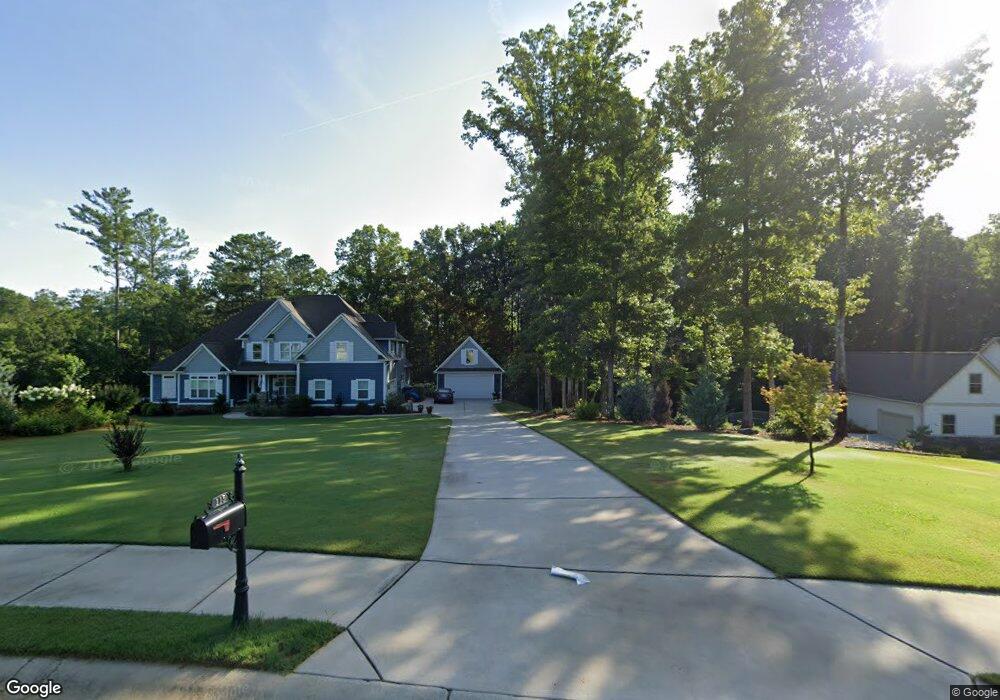
115 Laurel Forest Dr Unit 1-10 Tyrone, GA 30290
Estimated Value: $978,000 - $1,085,000
--
Bed
1
Bath
4,008
Sq Ft
$253/Sq Ft
Est. Value
About This Home
This home is located at 115 Laurel Forest Dr Unit 1-10, Tyrone, GA 30290 and is currently estimated at $1,013,147, approximately $252 per square foot. 115 Laurel Forest Dr Unit 1-10 is a home located in Fayette County with nearby schools including Crabapple Lane Elementary School, Flat Rock Middle School, and Sandy Creek High School.
Ownership History
Date
Name
Owned For
Owner Type
Purchase Details
Closed on
Feb 28, 2025
Sold by
Cooper Thomas and Cooper Karen
Bought by
Broxton Sandra Mae and Broxton Tyrone Carlos
Current Estimated Value
Home Financials for this Owner
Home Financials are based on the most recent Mortgage that was taken out on this home.
Original Mortgage
$749,250
Outstanding Balance
$745,430
Interest Rate
6.89%
Mortgage Type
VA
Estimated Equity
$267,717
Purchase Details
Closed on
Jun 15, 2018
Sold by
Delos Reys Alejandro
Bought by
Cooper Thomas and Cooper Karen
Purchase Details
Closed on
May 15, 2015
Sold by
Robert Graham Homes Inc
Bought by
Reyes Alejandro De Los
Home Financials for this Owner
Home Financials are based on the most recent Mortgage that was taken out on this home.
Original Mortgage
$335,300
Interest Rate
3.79%
Mortgage Type
New Conventional
Create a Home Valuation Report for This Property
The Home Valuation Report is an in-depth analysis detailing your home's value as well as a comparison with similar homes in the area
Home Values in the Area
Average Home Value in this Area
Purchase History
| Date | Buyer | Sale Price | Title Company |
|---|---|---|---|
| Broxton Sandra Mae | $965,000 | None Listed On Document | |
| Cooper Thomas | $542,500 | -- | |
| Reyes Alejandro De Los | $431,900 | -- |
Source: Public Records
Mortgage History
| Date | Status | Borrower | Loan Amount |
|---|---|---|---|
| Open | Broxton Sandra Mae | $749,250 | |
| Previous Owner | Reyes Alejandro De Los | $335,300 |
Source: Public Records
Tax History Compared to Growth
Tax History
| Year | Tax Paid | Tax Assessment Tax Assessment Total Assessment is a certain percentage of the fair market value that is determined by local assessors to be the total taxable value of land and additions on the property. | Land | Improvement |
|---|---|---|---|---|
| 2024 | $4,899 | $376,124 | $52,800 | $323,324 |
| 2023 | $4,899 | $360,280 | $52,800 | $307,480 |
| 2022 | $8,227 | $347,520 | $52,800 | $294,720 |
| 2021 | $7,416 | $279,800 | $32,000 | $247,800 |
| 2020 | $6,437 | $209,840 | $32,000 | $177,840 |
| 2019 | $6,726 | $217,000 | $27,320 | $189,680 |
| 2018 | $6,549 | $208,000 | $32,000 | $176,000 |
| 2017 | $6,236 | $232,320 | $32,000 | $200,320 |
| 2016 | $5,556 | $172,756 | $23,436 | $149,320 |
| 2015 | $837 | $25,200 | $25,200 | $0 |
| 2014 | $1,596 | $18,900 | $18,900 | $0 |
Source: Public Records
Map
Nearby Homes
- 575 Laurelwood Dr
- 200 Chaparral Trace
- 110 Calypso Ct
- 100 Clydesdale Ct
- 110 Kylemore Pass
- 475 Castlewood Rd
- 91 Goodlin Rd
- 125 Meadowview Cir
- 131 Lincoln Rd
- 140 Palmetto Pines Rd
- 2185 Castle Lake Dr
- 28 Border Point
- 240 Lynnwood Ave
- 110 Valley View Ct
- 104 Ashland Trail
- 100 Ashland Trail
- 78 Rosebay Ln
- 135 Crimson Ridge
- 101 Westmont Way
- 125 Westmont Way
- 115 Laurel Forest Dr Unit 2
- 125 Laurel Forest Dr Unit 3
- 105 Laurel Forest Dr
- 105 Laurel Forest Dr Unit 1
- 100 Laurel Forest Dr Unit 10
- 100 Laurel Forest Dr
- 135 Laurel Forest Dr
- 135 Laurel Forest Dr Unit 4
- 595 Laurelwood Dr
- 145 Laurel Forest Dr Unit 5
- 145 Laurel Forest Dr
- 0 Laurel Forest Unit 2952967
- 0 Laurel Forest Dr Unit 2 7192905
- 0 Laurel Forest Unit 8123293
- 0 Laurel Forest Dr Unit 8339707
- 0 Laurel Forest Dr Unit 8535256
- 110 Laurel Forest Dr
- 110 Laurel Forest Dr Unit 9
- 545 Laurelwood Dr
- 565 Laurelwood Dr