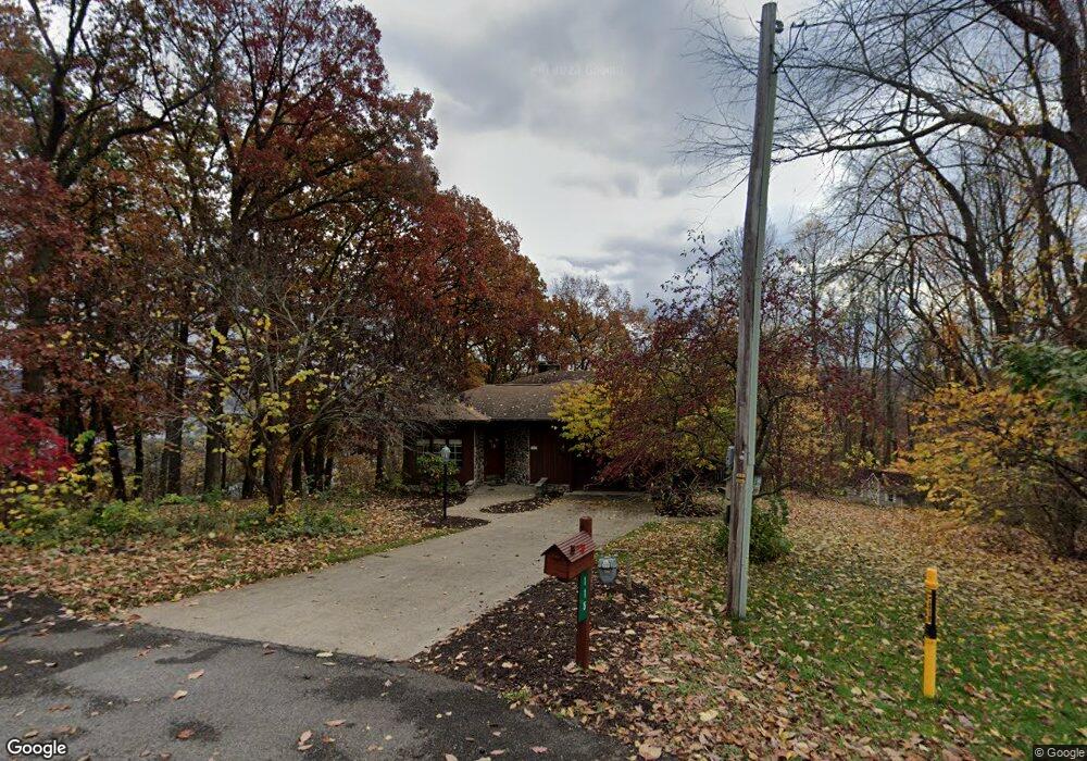
115 Maple Ln Kittanning, PA 16201
East Franklin Township NeighborhoodEstimated Value: $280,000 - $429,000
3
Beds
3
Baths
2,417
Sq Ft
$153/Sq Ft
Est. Value
About This Home
This home is located at 115 Maple Ln, Kittanning, PA 16201 and is currently estimated at $370,824, approximately $153 per square foot. 115 Maple Ln is a home located in Armstrong County with nearby schools including West Hills Intermediate School, West Hills Primary School, and Harvest Christian School.
Ownership History
Date
Name
Owned For
Owner Type
Purchase Details
Closed on
Sep 28, 2010
Sold by
Casilli Leon J and Gasilli Jeanne M
Bought by
Sperl Shaun M and Sperl Jennifer A
Current Estimated Value
Home Financials for this Owner
Home Financials are based on the most recent Mortgage that was taken out on this home.
Original Mortgage
$280,250
Outstanding Balance
$185,029
Interest Rate
4.36%
Mortgage Type
New Conventional
Estimated Equity
$185,795
Purchase Details
Closed on
Dec 30, 1993
Create a Home Valuation Report for This Property
The Home Valuation Report is an in-depth analysis detailing your home's value as well as a comparison with similar homes in the area
Home Values in the Area
Average Home Value in this Area
Purchase History
| Date | Buyer | Sale Price | Title Company |
|---|---|---|---|
| Sperl Shaun M | $347,300 | Pennsylvania Land Titles | |
| -- | $149,000 | -- |
Source: Public Records
Mortgage History
| Date | Status | Borrower | Loan Amount |
|---|---|---|---|
| Open | Sperl Shaun M | $280,250 |
Source: Public Records
Tax History Compared to Growth
Tax History
| Year | Tax Paid | Tax Assessment Tax Assessment Total Assessment is a certain percentage of the fair market value that is determined by local assessors to be the total taxable value of land and additions on the property. | Land | Improvement |
|---|---|---|---|---|
| 2025 | $9,117 | $102,790 | $55,400 | $47,390 |
| 2024 | $8,604 | $102,790 | $55,400 | $47,390 |
| 2023 | $6,624 | $102,790 | $55,400 | $47,390 |
| 2022 | $6,624 | $102,790 | $55,400 | $47,390 |
| 2021 | $6,624 | $102,790 | $55,400 | $47,390 |
| 2020 | $6,624 | $102,790 | $55,400 | $47,390 |
| 2019 | $6,644 | $102,790 | $55,400 | $47,390 |
| 2018 | $6,637 | $79,145 | $11,445 | $67,700 |
| 2017 | $6,588 | $102,790 | $55,400 | $47,390 |
| 2016 | $6,588 | $102,790 | $55,400 | $47,390 |
| 2015 | $5,601 | $102,790 | $55,400 | $47,390 |
| 2014 | $5,601 | $102,790 | $55,400 | $47,390 |
Source: Public Records
Map
Nearby Homes
- 223 Cedar Dr
- 1409 Orr Ave
- 536 1/2 Butler Rd
- 1033 Wilson Ave
- 935 Orr Ave
- 1017 Johnston Ave
- 422-424 Highland Ave
- 418 Pine Hill Rd
- 509 N Jefferson St
- 435 1/2 Reesman Dr Unit 2
- 0 Wible Rd
- 121 Oak Ave
- 166 Clearfield Pike
- 139 Oak Ave
- 397 E Brady Rd
- 143 N Grant Ave
- 428 Dewey St
- 228 Arthur St
- 114 S Mckean St
- 514 Southern Ave