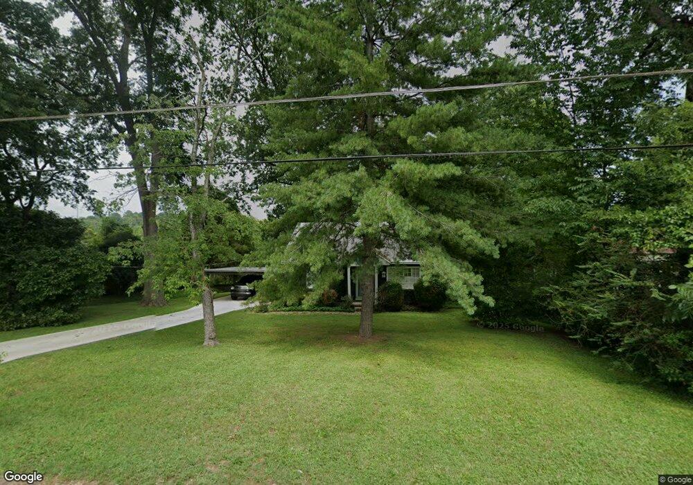
115 Pine St Pulaski, TN 38478
Estimated Value: $185,000 - $197,000
2
Beds
2
Baths
1,104
Sq Ft
$172/Sq Ft
Est. Value
About This Home
This home is located at 115 Pine St, Pulaski, TN 38478 and is currently estimated at $190,168, approximately $172 per square foot. 115 Pine St is a home located in Giles County with nearby schools including Pulaski Elementary School, Southside Elementary School, and Bridgeforth Middle School.
Ownership History
Date
Name
Owned For
Owner Type
Purchase Details
Closed on
Aug 10, 2007
Sold by
Clay Styles A
Bought by
Neuenschwander John E
Current Estimated Value
Purchase Details
Closed on
Dec 1, 2003
Sold by
Scott Linda G
Bought by
Styles A Clay
Home Financials for this Owner
Home Financials are based on the most recent Mortgage that was taken out on this home.
Original Mortgage
$60,254
Interest Rate
5.98%
Purchase Details
Closed on
Feb 8, 1999
Sold by
Smith Roma B
Bought by
Scott Linda G
Purchase Details
Closed on
Aug 2, 1996
Sold by
Wilson Alan K
Bought by
Smith Roma and Smith Linda
Purchase Details
Closed on
Dec 4, 1989
Bought by
Wilson Alan K and Wilson Susan W
Purchase Details
Closed on
Jan 1, 1955
Bought by
Bertrand R W
Create a Home Valuation Report for This Property
The Home Valuation Report is an in-depth analysis detailing your home's value as well as a comparison with similar homes in the area
Home Values in the Area
Average Home Value in this Area
Purchase History
| Date | Buyer | Sale Price | Title Company |
|---|---|---|---|
| Neuenschwander John E | $83,500 | -- | |
| Styles A Clay | $61,200 | -- | |
| Scott Linda G | $54,000 | -- | |
| Smith Roma | $48,000 | -- | |
| Wilson Alan K | -- | -- | |
| Bertrand R W | -- | -- |
Source: Public Records
Mortgage History
| Date | Status | Borrower | Loan Amount |
|---|---|---|---|
| Previous Owner | Bertrand R W | $60,254 |
Source: Public Records
Tax History Compared to Growth
Tax History
| Year | Tax Paid | Tax Assessment Tax Assessment Total Assessment is a certain percentage of the fair market value that is determined by local assessors to be the total taxable value of land and additions on the property. | Land | Improvement |
|---|---|---|---|---|
| 2024 | $842 | $34,975 | $10,425 | $24,550 |
| 2023 | $842 | $34,975 | $10,425 | $24,550 |
| 2022 | $842 | $34,975 | $10,425 | $24,550 |
| 2021 | $567 | $16,750 | $3,275 | $13,475 |
| 2020 | $567 | $16,750 | $3,275 | $13,475 |
| 2019 | $473 | $16,750 | $3,275 | $13,475 |
| 2018 | $567 | $16,750 | $3,275 | $13,475 |
| 2017 | $567 | $16,750 | $3,275 | $13,475 |
| 2016 | $576 | $16,250 | $2,500 | $13,750 |
| 2015 | $543 | $16,250 | $2,500 | $13,750 |
| 2014 | $543 | $16,244 | $0 | $0 |
Source: Public Records
Map
Nearby Homes
- 115 Horseshoe St
- 442 Longmeadow Cir
- 207 N Cedar Ln
- 306 Longmeadow Cir
- 534 E College St
- 527 E Madison St
- 635 Cleveland St Unit 637
- 515 S Cedar Ln
- 1 Magazine Rd
- 0 Marietta St
- 310 Glendale Dr
- 326 Ballentine St
- 403 Victoria St
- 439 E Madison St
- 528 Maple St
- 123 S Sam Davis Ave
- 300 Longview Dr
- 308 Longview Dr
- 630 Marietta St
- 525 Culpepper St Extended