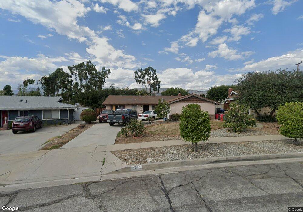
115 W Ronwood St Glendora, CA 91740
South Glendora NeighborhoodEstimated Value: $758,455 - $830,000
3
Beds
2
Baths
1,363
Sq Ft
$589/Sq Ft
Est. Value
About This Home
This home is located at 115 W Ronwood St, Glendora, CA 91740 and is currently estimated at $802,614, approximately $588 per square foot. 115 W Ronwood St is a home located in Los Angeles County with nearby schools including Washington Elementary School, Royal Oak Middle School, and Charter Oak High School.
Ownership History
Date
Name
Owned For
Owner Type
Purchase Details
Closed on
Dec 18, 1998
Sold by
Baruth Clarice F Tr Baruth Trust
Bought by
Rouse Andrew K and Rouse Kimberley
Current Estimated Value
Home Financials for this Owner
Home Financials are based on the most recent Mortgage that was taken out on this home.
Original Mortgage
$153,000
Interest Rate
6.73%
Create a Home Valuation Report for This Property
The Home Valuation Report is an in-depth analysis detailing your home's value as well as a comparison with similar homes in the area
Home Values in the Area
Average Home Value in this Area
Purchase History
| Date | Buyer | Sale Price | Title Company |
|---|---|---|---|
| Rouse Andrew K | $170,000 | Southland Title |
Source: Public Records
Mortgage History
| Date | Status | Borrower | Loan Amount |
|---|---|---|---|
| Previous Owner | Rouse Andrew K | $153,000 |
Source: Public Records
Tax History
| Year | Tax Paid | Tax Assessment Tax Assessment Total Assessment is a certain percentage of the fair market value that is determined by local assessors to be the total taxable value of land and additions on the property. | Land | Improvement |
|---|---|---|---|---|
| 2025 | $3,563 | $266,482 | $154,094 | $112,388 |
| 2024 | $3,563 | $261,258 | $151,073 | $110,185 |
| 2023 | $3,482 | $256,136 | $148,111 | $108,025 |
| 2022 | $3,437 | $251,114 | $145,207 | $105,907 |
| 2021 | $3,383 | $246,191 | $142,360 | $103,831 |
| 2019 | $3,312 | $238,891 | $138,139 | $100,752 |
| 2018 | $3,063 | $234,208 | $135,431 | $98,777 |
| 2016 | $2,924 | $225,116 | $130,173 | $94,943 |
| 2015 | $2,912 | $221,735 | $128,218 | $93,517 |
| 2014 | $2,913 | $217,393 | $125,707 | $91,686 |
Source: Public Records
Map
Nearby Homes
- 205 W Linfield St
- 119 W Gladstone St
- 605 W Gaillard St
- 1039 Brightview Dr
- 337 W Route 66 Unit 58
- 748 Brightview Dr
- 315 E Juanita Ave
- 732 E Route 66 Unit 4
- 732 E Route 66 Unit 7
- 304 S Minnesota Ave
- 723 E Route 66
- 725 E Route 66
- 729 E Route 66
- 733 E Route 66
- 1700 S Glendora Ave Unit 43
- 201 E Arrow Hwy Unit 64
- 201 E Arrow Hwy Unit 70
- 201 E Arrow Hwy Unit 73
- 732 W Bagnall St
- 826 E Route 66
- 111 W Ronwood St
- 119 W Ronwood St
- 107 W Ronwood St
- 123 W Ronwood St
- 965 S Glendora Ave
- 1008 S Danehurst Ave
- 104 W Ronwood St
- 0 S Glendora Unit AR13030527
- 132 W Tedrow Dr
- 138 W Tedrow Dr
- 125 W Ronwood St
- 128 W Tedrow Dr
- 144 W Tedrow Dr
- 122 W Tedrow Dr
- 1010 S Danehurst Ave
- 1032 S Glendora Ave
- 124 W Ronwood St
- 148 W Tedrow Dr
- 137 W Ronwood St
- 116 W Tedrow Dr
Your Personal Tour Guide
Ask me questions while you tour the home.