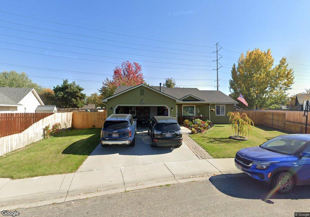
1150 S Scranton Ave Boise, ID 83709
Southwest Boise NeighborhoodEstimated Value: $400,000 - $419,000
3
Beds
2
Baths
1,323
Sq Ft
$308/Sq Ft
Est. Value
About This Home
This home is located at 1150 S Scranton Ave, Boise, ID 83709 and is currently estimated at $407,915, approximately $308 per square foot. 1150 S Scranton Ave is a home located in Ada County with nearby schools including Pepper Ridge Elementary, Lewis & Clark Middle School, and Centennial High School.
Ownership History
Date
Name
Owned For
Owner Type
Purchase Details
Closed on
Feb 20, 2008
Sold by
Stanton Kathleen H
Bought by
Stanton Tad D
Current Estimated Value
Home Financials for this Owner
Home Financials are based on the most recent Mortgage that was taken out on this home.
Original Mortgage
$112,220
Outstanding Balance
$70,004
Interest Rate
5.85%
Mortgage Type
Stand Alone Refi Refinance Of Original Loan
Estimated Equity
$337,911
Purchase Details
Closed on
Oct 8, 1998
Sold by
Griffin David D and Griffin Diane H
Bought by
Stanton Tad D and Stanton Misty D
Home Financials for this Owner
Home Financials are based on the most recent Mortgage that was taken out on this home.
Original Mortgage
$98,108
Interest Rate
6.88%
Mortgage Type
FHA
Create a Home Valuation Report for This Property
The Home Valuation Report is an in-depth analysis detailing your home's value as well as a comparison with similar homes in the area
Home Values in the Area
Average Home Value in this Area
Purchase History
| Date | Buyer | Sale Price | Title Company |
|---|---|---|---|
| Stanton Tad D | -- | Alliance Title | |
| Stanton Tad D | -- | Alliance Title Company |
Source: Public Records
Mortgage History
| Date | Status | Borrower | Loan Amount |
|---|---|---|---|
| Open | Stanton Tad D | $112,220 | |
| Closed | Stanton Tad D | $98,108 |
Source: Public Records
Tax History Compared to Growth
Tax History
| Year | Tax Paid | Tax Assessment Tax Assessment Total Assessment is a certain percentage of the fair market value that is determined by local assessors to be the total taxable value of land and additions on the property. | Land | Improvement |
|---|---|---|---|---|
| 2025 | $1,581 | $369,400 | -- | -- |
| 2024 | $1,514 | $363,100 | -- | -- |
| 2023 | $1,514 | $341,500 | $0 | $0 |
| 2022 | $2,007 | $421,200 | $0 | $0 |
| 2021 | $1,853 | $335,600 | $0 | $0 |
| 2020 | $1,392 | $239,100 | $0 | $0 |
| 2019 | $1,720 | $234,000 | $0 | $0 |
| 2018 | $1,381 | $193,900 | $0 | $0 |
| 2017 | $1,319 | $173,300 | $0 | $0 |
| 2016 | $1,293 | $165,600 | $0 | $0 |
| 2015 | $1,182 | $156,900 | $0 | $0 |
| 2012 | -- | $108,700 | $0 | $0 |
Source: Public Records
Map
Nearby Homes
- 12152 W Lewisburg Ct
- 12410 W Lewisburg Dr
- 11829 W Camas St
- 11683 W Aldershot St
- 12158 W Silverking Ct
- 1132 S Amaya Ave
- 4345 E Vacheron St
- 4216 Woodmurra St
- 11899 W Blueberry Ct
- 4202 Woodmurra St
- 681 S Kiser Ave
- 704 S Kiser Ave
- 4187 E Blueberry St
- 3970 E Overland Rd
- 1961 S Peppercorn Place
- 330 S Winthrop Place
- 4132 E Silverking Ln
- 11225 W Camas St
- 4630 E Goldstone Dr
- 3820 E Overland Rd
- 1126 S Scranton Ave
- 12273 W Lewisburg Dr
- 1137 S Scranton Ave
- 1108 S Scranton Ave
- 12285 W Lewisburg Dr
- 12306 W Lewisburg Dr
- 12295 W Camas Dr
- 12309 W Lewisburg Dr
- 12174 W Lewisburg Ct
- 1255 S Cloverdale Rd
- 1150 S Cloverdale Rd
- 12328 W Lewisburg Dr
- 12311 W Camas Dr
- 12331 W Lewisburg Dr
- 1230 S Cloverdale Rd
- 12337 W Camas Dr
- 1262 S Cloverdale Rd
- 12353 W Lewisburg Dr
- 12350 W Castlewood Dr
- 12119 Camas St