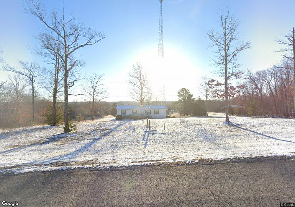
11556 State Route 8 Dunlap, TN 37327
Cagle-Fredonia NeighborhoodEstimated Value: $108,000
--
Bed
2
Baths
1,104
Sq Ft
$98/Sq Ft
Est. Value
About This Home
This home is located at 11556 State Route 8, Dunlap, TN 37327 and is currently estimated at $108,000, approximately $97 per square foot. 11556 State Route 8 is a home located in Sequatchie County with nearby schools including Griffith Elementary School, Sequatchie County Middle School, and Sequatchie County High School.
Ownership History
Date
Name
Owned For
Owner Type
Purchase Details
Closed on
Jan 8, 2020
Sold by
Midwest Tennessee Land Company Llc
Bought by
Rbj Acquisitions Llc
Current Estimated Value
Purchase Details
Closed on
Nov 30, 2013
Sold by
Woodland Ridge Land
Bought by
Midwest Tennessee Land Company
Purchase Details
Closed on
Dec 27, 2005
Sold by
Woodland Ridge Land Compan
Bought by
Sandhu Harpal S
Purchase Details
Closed on
Oct 6, 2005
Sold by
Woodland Ridge Land Compan
Bought by
Borgia Gary M
Purchase Details
Closed on
Oct 4, 2005
Sold by
Woodland Ridge Land Compan
Bought by
Armondo Galella
Purchase Details
Closed on
Sep 9, 2005
Sold by
Woodland Ridge Land Compan
Bought by
Mariyill Noda
Purchase Details
Closed on
Sep 6, 2005
Sold by
Woodland Ridge Land Compan
Bought by
Sandhu Previnder S
Purchase Details
Closed on
Dec 22, 2004
Sold by
Woodland Ridge Land Compan
Bought by
Walker Lonnie E
Purchase Details
Closed on
Dec 22, 2003
Bought by
Wpp Llc
Purchase Details
Closed on
Jul 18, 2002
Sold by
Woodland Ridge Land Co
Bought by
Fowler and Pam
Home Financials for this Owner
Home Financials are based on the most recent Mortgage that was taken out on this home.
Original Mortgage
$108,400
Interest Rate
6.67%
Purchase Details
Closed on
Mar 18, 2002
Sold by
Woodland Ridge Land Co
Bought by
Bowlin David D and Bowlin Priscilla D
Home Financials for this Owner
Home Financials are based on the most recent Mortgage that was taken out on this home.
Original Mortgage
$188,200
Interest Rate
6.85%
Purchase Details
Closed on
Aug 7, 2001
Sold by
J M Huber Corp
Bought by
Blc Properties Llc
Purchase Details
Closed on
Sep 13, 1999
Bought by
Woodland Ridge Land Compan Y
Purchase Details
Closed on
Mar 3, 1999
Bought by
Southern Pine Plantation
Purchase Details
Closed on
Jan 1, 1982
Create a Home Valuation Report for This Property
The Home Valuation Report is an in-depth analysis detailing your home's value as well as a comparison with similar homes in the area
Home Values in the Area
Average Home Value in this Area
Purchase History
| Date | Buyer | Sale Price | Title Company |
|---|---|---|---|
| Rbj Acquisitions Llc | -- | None Available | |
| Midwest Tennessee Land Company | -- | -- | |
| Sandhu Harpal S | $23,726 | -- | |
| Borgia Gary M | $150,000 | -- | |
| Armondo Galella | $25,624 | -- | |
| Mariyill Noda | $37,487 | -- | |
| Sandhu Previnder S | $32,000 | -- | |
| Walker Lonnie E | $25,000 | -- | |
| Wpp Llc | $1,809,000 | -- | |
| Fowler | $19,572 | -- | |
| Bowlin David D | $20,709 | -- | |
| Blc Properties Llc | $45,000 | -- | |
| Woodland Ridge Land Compan Y | $755,900 | -- | |
| Southern Pine Plantation | $7,834,000 | -- | |
| -- | $500,000 | -- |
Source: Public Records
Mortgage History
| Date | Status | Borrower | Loan Amount |
|---|---|---|---|
| Previous Owner | -- | $108,400 | |
| Previous Owner | -- | $188,200 |
Source: Public Records
Tax History Compared to Growth
Tax History
| Year | Tax Paid | Tax Assessment Tax Assessment Total Assessment is a certain percentage of the fair market value that is determined by local assessors to be the total taxable value of land and additions on the property. | Land | Improvement |
|---|---|---|---|---|
| 2025 | $126 | $6,875 | $0 | $0 |
| 2024 | $126 | $6,875 | $6,875 | $0 |
| 2023 | $126 | $6,875 | $6,875 | $0 |
| 2022 | $145 | $5,925 | $5,925 | $0 |
| 2021 | $145 | $5,925 | $5,925 | $0 |
| 2020 | $151 | $5,925 | $5,925 | $0 |
| 2019 | $151 | $6,200 | $6,200 | $0 |
| 2018 | $151 | $6,200 | $6,200 | $0 |
| 2017 | $526 | $21,525 | $6,625 | $14,900 |
| 2016 | $518 | $20,150 | $6,425 | $13,725 |
| 2015 | $518 | $20,150 | $6,425 | $13,725 |
| 2014 | $518 | $20,150 | $6,425 | $13,725 |
Source: Public Records
Map
Nearby Homes
- 11556 R 8
- 0 S R 8
- 13 N Greenfields Way
- 1231 Black Mountain Rd
- 0 Woods Rd Unit RTC3042786
- 0 Woods Rd Unit 1523709
- 218 Black Mountain Rd W
- 67 Locust Rd
- 200 Coyote Trail
- Lot 61 River Ridge Dr
- 163 Thompson Rd
- 408 Sherman Rd
- 10 Laurel Brook Rd
- 13 Bear Wallow Rd
- Lot 13 Bear Wallow Rd
- 40 Mccarver Loop
- 0 Tennessee 399
- 55 Rustling Pines Rd
- 95 Rustling Pines Rd
- 266AC Meadow Lark
- 11469 Highway 8
- 100 S R 8
- 11465 State Route 8
- 11465 State Route 8
- 11551 Tn-8
- 135 Green Pond Rd
- 294 Green Pond Rd
- 175 Green Pond Rd
- 11371 State Route 8
- 0 State Route 8 Hwy 111 Unit RTC2727196
- 0 State Route 8 Hwy 111 Unit RTC2334990
- 000 State Route 8 Hwy 111
- 16 Green Pond Rd
- 15 Green Pond
- 61 Whisper Ln
- 21 Green Pond Rd
- 87 Whisper Ln
- 11363 State Route 8
- 650 Green Forest Rd
- 12 Poplar Creek Rd