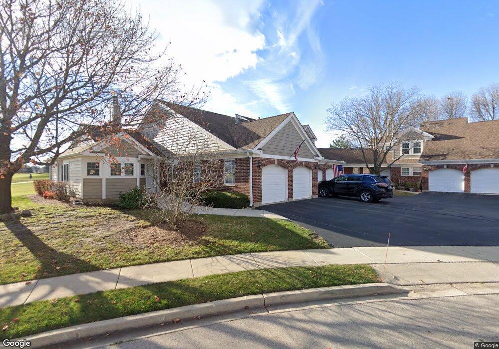
1157 Saint Andrews Ct Unit 261 Algonquin, IL 60102
Estimated Value: $238,939 - $280,000
2
Beds
2
Baths
1,574
Sq Ft
$170/Sq Ft
Est. Value
About This Home
This home is located at 1157 Saint Andrews Ct Unit 261, Algonquin, IL 60102 and is currently estimated at $267,235, approximately $169 per square foot. 1157 Saint Andrews Ct Unit 261 is a home located in McHenry County with nearby schools including Westfield Community School, Kenneth E Neubert Elementary School, and Harry D Jacobs High School.
Ownership History
Date
Name
Owned For
Owner Type
Purchase Details
Closed on
Feb 12, 2015
Sold by
Perillo Richard L and Perillo Tara M L
Bought by
Perillo Richard L
Current Estimated Value
Purchase Details
Closed on
Aug 1, 2003
Sold by
Perillo Daniel and Perillo Kathleen A
Bought by
Perillo Richard L
Home Financials for this Owner
Home Financials are based on the most recent Mortgage that was taken out on this home.
Original Mortgage
$146,400
Interest Rate
7.8%
Mortgage Type
Purchase Money Mortgage
Create a Home Valuation Report for This Property
The Home Valuation Report is an in-depth analysis detailing your home's value as well as a comparison with similar homes in the area
Home Values in the Area
Average Home Value in this Area
Purchase History
| Date | Buyer | Sale Price | Title Company |
|---|---|---|---|
| Perillo Richard L | -- | None Available | |
| Perillo Richard L | $183,000 | -- |
Source: Public Records
Mortgage History
| Date | Status | Borrower | Loan Amount |
|---|---|---|---|
| Closed | Perillo Richard L | $146,400 |
Source: Public Records
Tax History Compared to Growth
Tax History
| Year | Tax Paid | Tax Assessment Tax Assessment Total Assessment is a certain percentage of the fair market value that is determined by local assessors to be the total taxable value of land and additions on the property. | Land | Improvement |
|---|---|---|---|---|
| 2024 | $4,992 | $71,809 | $15,898 | $55,911 |
| 2023 | $4,707 | $64,224 | $14,219 | $50,005 |
| 2022 | $4,824 | $62,255 | $22,849 | $39,406 |
| 2021 | $4,614 | $57,998 | $21,287 | $36,711 |
| 2020 | $4,485 | $55,944 | $20,533 | $35,411 |
| 2019 | $4,366 | $53,546 | $19,653 | $33,893 |
| 2018 | $3,988 | $47,842 | $18,155 | $29,687 |
| 2017 | $3,891 | $45,070 | $17,103 | $27,967 |
| 2016 | $3,814 | $42,272 | $16,041 | $26,231 |
| 2013 | -- | $43,279 | $14,965 | $28,314 |
Source: Public Records
Map
Nearby Homes
- 1405 Surrey Ln
- 1 N Hubbard St
- SWC Talaga and Algonquin Rd
- 1820 Crofton Dr
- 2043 Peach Tree Ln Unit 4122
- 741 Regal Ln
- 1801 Arbordale Ln
- 000 County Line Rd
- 1900 Waverly Ln
- 700 Fairfield Ln
- 30 Arbordale Ct Unit 4284
- 2233 Dawson Ln Unit 312
- 710 Braewood Dr
- 710 Sprucetree Ln
- Adams Plan at Algonquin Meadows - Single Family
- Sequoia Plan at Algonquin Meadows - Single Family
- Bryce Plan at Algonquin Meadows - Single Family
- Rainier Plan at Algonquin Meadows - Single Family
- Santa Rosa Plan at Algonquin Meadows - Single Family
- Biscayne Plan at Algonquin Meadows - Single Family
- 1155 Saint Andrews Ct Unit 262
- 1151 Saint Andrews Ct
- 1153 Saint Andrews Ct Unit 263
- 1153 Saint Andrews Ct Unit 1153
- 1137 Saint Andrews Ct
- 1161 Saint Andrews Ct
- 1161 St Andrews Ct
- 1135 Saint Andrews Ct
- 1144 Saint Andrews Ct Unit 224
- 1163 Saint Andrews Ct
- 1142 Saint Andrews Ct Unit 223
- 1165 Saint Andrews Ct
- 1165 St Andrews Ct Unit 1165
- 1167 Saint Andrews Ct Unit 253
- 1167 St Andrews Ct
- 1167 St Andrews Ct Unit 1167
- 1171 Saint Andrews Ct
- 1133 Saint Andrews Ct Unit 273
- 1152 Saint Andrews Ct Unit 231
- 1152 St Andrews Ct Unit 1152