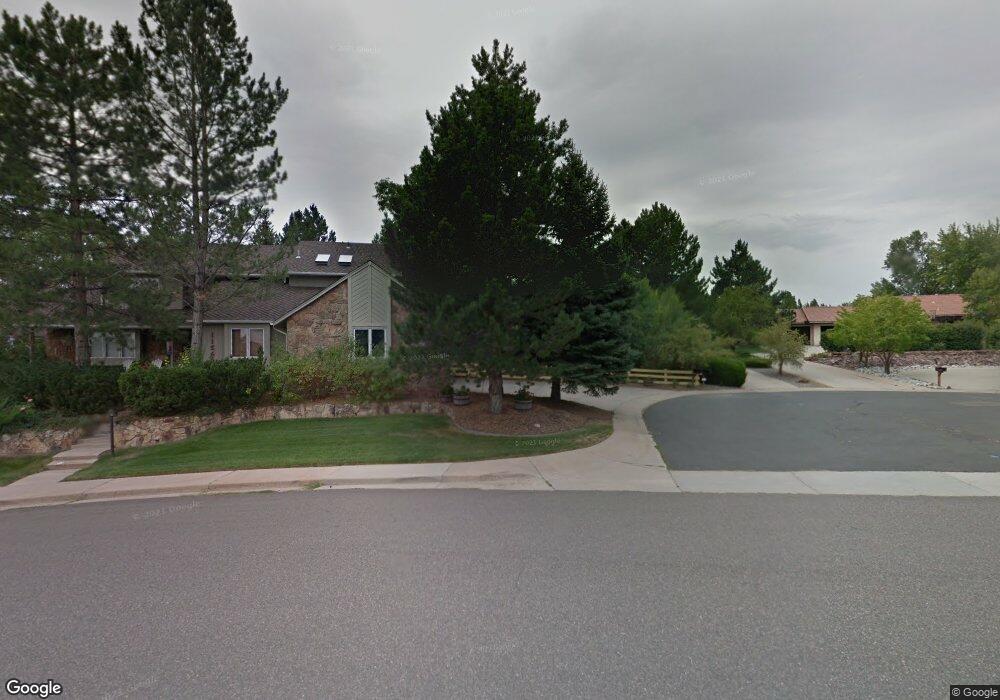
11570 W Park Range Rd Littleton, CO 80127
Estimated Value: $1,035,929 - $1,225,000
4
Beds
7
Baths
3,454
Sq Ft
$326/Sq Ft
Est. Value
About This Home
This home is located at 11570 W Park Range Rd, Littleton, CO 80127 and is currently estimated at $1,127,482, approximately $326 per square foot. 11570 W Park Range Rd is a home located in Jefferson County with nearby schools including Shaffer Elementary School, Falcon Bluffs Middle School, and Chatfield High School.
Ownership History
Date
Name
Owned For
Owner Type
Purchase Details
Closed on
Jul 25, 2003
Sold by
Keller Neil T
Bought by
Keller Neil T and Keller Kathryn M E
Current Estimated Value
Home Financials for this Owner
Home Financials are based on the most recent Mortgage that was taken out on this home.
Original Mortgage
$320,000
Outstanding Balance
$135,330
Interest Rate
5.19%
Mortgage Type
Purchase Money Mortgage
Estimated Equity
$992,152
Purchase Details
Closed on
Nov 27, 2002
Sold by
Tryba Lorraine R and Tryba John B
Bought by
Keller Neil T
Home Financials for this Owner
Home Financials are based on the most recent Mortgage that was taken out on this home.
Original Mortgage
$300,700
Interest Rate
6.28%
Create a Home Valuation Report for This Property
The Home Valuation Report is an in-depth analysis detailing your home's value as well as a comparison with similar homes in the area
Home Values in the Area
Average Home Value in this Area
Purchase History
| Date | Buyer | Sale Price | Title Company |
|---|---|---|---|
| Keller Neil T | -- | Colorado National Title | |
| Keller Neil T | $540,000 | Stewart Title |
Source: Public Records
Mortgage History
| Date | Status | Borrower | Loan Amount |
|---|---|---|---|
| Open | Keller Neil T | $320,000 | |
| Closed | Keller Neil T | $300,700 | |
| Closed | Keller Neil T | $166,000 |
Source: Public Records
Tax History Compared to Growth
Tax History
| Year | Tax Paid | Tax Assessment Tax Assessment Total Assessment is a certain percentage of the fair market value that is determined by local assessors to be the total taxable value of land and additions on the property. | Land | Improvement |
|---|---|---|---|---|
| 2024 | $6,877 | $64,234 | $25,873 | $38,361 |
| 2023 | $6,877 | $64,234 | $25,873 | $38,361 |
| 2022 | $5,580 | $50,979 | $21,053 | $29,926 |
| 2021 | $5,666 | $52,446 | $21,659 | $30,787 |
| 2020 | $5,668 | $52,632 | $22,427 | $30,205 |
| 2019 | $5,600 | $52,632 | $22,427 | $30,205 |
| 2018 | $5,582 | $50,666 | $17,536 | $33,130 |
| 2017 | $5,192 | $50,666 | $17,536 | $33,130 |
| 2016 | $5,144 | $47,514 | $15,833 | $31,681 |
| 2015 | $5,426 | $47,514 | $15,833 | $31,681 |
| 2014 | $5,426 | $47,223 | $14,149 | $33,074 |
Source: Public Records
Map
Nearby Homes
- 7646 S Bear Mountain
- 11673 Elk Head Range Rd
- 11703 Elk Head Range Rd
- 11710 Elk Head Range Rd
- 11235 San Joaquin Ridge
- 7462 S Quail Cir Unit 426
- 11872 Elk Head Range Rd
- 7433 S Quail Cir Unit 1924
- 8140 S Storm King Peak
- 7369 S Gore Range Rd Unit 208
- 7474 S Alkire St Unit 203
- 7413 S Quail Cir Unit 1422
- 7413 S Quail Cir Unit 1435
- 7339 S Gore Range Rd
- 7409 S Alkire St Unit 304
- 8196 S Spring Creek Pass
- 11851 Canyon Ave
- 7825 Sand Mountain
- 7355 S Alkire St Unit 203
- 11434 W Roxbury Dr
- 7647 S Bear Mountain
- 11580 W Park Range Rd
- 7627 S Bear Mountain
- 11590 W Park Range Rd
- 11475 San Joaquin Ridge
- 11465 San Joaquin Ridge
- 11455 San Joaquin Ridge
- 11539 W Park Range Rd
- 7636 S Bear Mountain
- 11445 San Joaquin Ridge
- 11485 San Joaquin Ridge
- 7616 S Bear Mountain
- 11529 W Park Range Rd
- 7626 S Bear Mountain
- 11435 San Joaquin Ridge
- 0 N Bear Claw Unit 827916
- 0 S Bear Claw
- 0 N Bear Claw Unit 963197
- 0 N Bear Claw
- 1 Bear Claw