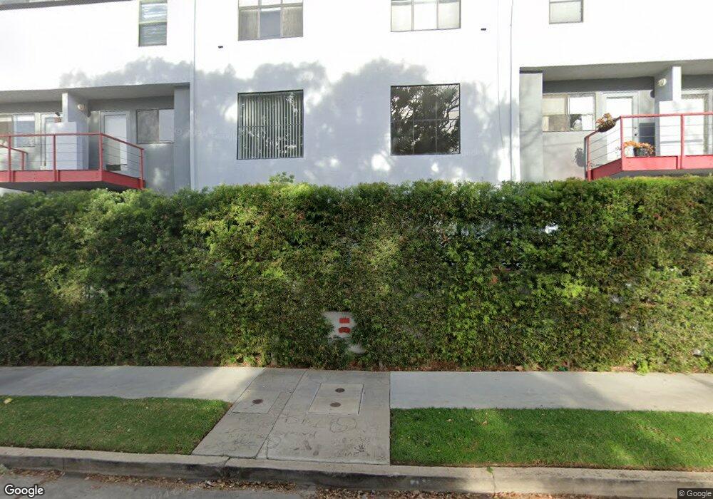
11575 Missouri Ave Unit 4 Los Angeles, CA 90025
Sawtelle NeighborhoodEstimated Value: $828,000 - $1,023,000
2
Beds
3
Baths
1,353
Sq Ft
$684/Sq Ft
Est. Value
About This Home
This home is located at 11575 Missouri Ave Unit 4, Los Angeles, CA 90025 and is currently estimated at $924,835, approximately $683 per square foot. 11575 Missouri Ave Unit 4 is a home located in Los Angeles County with nearby schools including Nora Sterry Elementary School, Daniel Webster Middle School, and New West Charter School.
Ownership History
Date
Name
Owned For
Owner Type
Purchase Details
Closed on
Mar 12, 1998
Sold by
Taslitt Craig
Bought by
Pack Michael J
Current Estimated Value
Home Financials for this Owner
Home Financials are based on the most recent Mortgage that was taken out on this home.
Original Mortgage
$236,250
Outstanding Balance
$43,372
Interest Rate
7.06%
Estimated Equity
$881,463
Create a Home Valuation Report for This Property
The Home Valuation Report is an in-depth analysis detailing your home's value as well as a comparison with similar homes in the area
Home Values in the Area
Average Home Value in this Area
Purchase History
| Date | Buyer | Sale Price | Title Company |
|---|---|---|---|
| Pack Michael J | $262,500 | First American Title Co |
Source: Public Records
Mortgage History
| Date | Status | Borrower | Loan Amount |
|---|---|---|---|
| Open | Pack Michael J | $236,250 |
Source: Public Records
Tax History Compared to Growth
Tax History
| Year | Tax Paid | Tax Assessment Tax Assessment Total Assessment is a certain percentage of the fair market value that is determined by local assessors to be the total taxable value of land and additions on the property. | Land | Improvement |
|---|---|---|---|---|
| 2025 | $5,072 | $419,122 | $148,486 | $270,636 |
| 2024 | $5,072 | $410,905 | $145,575 | $265,330 |
| 2023 | $4,978 | $402,849 | $142,721 | $260,128 |
| 2022 | $4,749 | $394,951 | $139,923 | $255,028 |
| 2021 | $4,683 | $387,208 | $137,180 | $250,028 |
| 2019 | $4,543 | $375,725 | $133,112 | $242,613 |
| 2018 | $4,525 | $368,358 | $130,502 | $237,856 |
| 2016 | $4,319 | $354,057 | $125,436 | $228,621 |
| 2015 | $4,256 | $348,739 | $123,552 | $225,187 |
| 2014 | $4,277 | $341,908 | $121,132 | $220,776 |
Source: Public Records
Map
Nearby Homes
- 1855 Barry Ave
- 1861 Barry Ave
- 1912 Barry Ave
- 1827 Barry Ave Unit 2
- 11656 Nebraska Ave Unit 6
- 1804 S Barrington Ave Unit D
- 1751 Barry Ave Unit 4
- 1731 Colby Ave Unit 202
- 1830 Stoner Ave Unit 4
- 1818 Butler Ave Unit 4
- 1800 Butler Ave Unit 104
- 1712 Colby Ave Unit 105
- 1729 S Barrington Ave Unit 2
- 1706 Colby Ave Unit 301
- 11565 Iowa Ave
- 2026 Federal Ave
- 1726 Stoner Ave Unit 102
- 2017 Butler Ave
- 1665 Federal Ave Unit 302
- 1710 Granville Ave Unit 3
- 11575 Missouri Ave
- 11575 Missouri Ave Unit 5
- 11575 Missouri Ave Unit 3
- 11575 Missouri Ave Unit 2
- 11575 Missouri Ave Unit 1
- 11575 Missouri Ave Unit 16
- 11575 Missouri Ave Unit 15
- 11575 Missouri Ave Unit 14
- 11575 Missouri Ave Unit 13
- 11575 Missouri Ave Unit 12
- 11575 Missouri Ave Unit 11
- 11575 Missouri Ave Unit 10
- 11575 Missouri Ave Unit 9
- 11575 Missouri Ave Unit 8
- 11575 Missouri Ave Unit 7
- 11575 Missouri Ave Unit 6
- 1846 Federal Ave Unit 1848 1/2
- 1846 Federal Ave Unit 1848
- 1846 Federal Ave Unit 1846 1/2
- 1846 Federal Ave