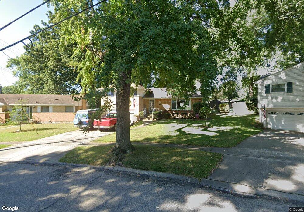
1159 Eastgate Dr Cincinnati, OH 45231
Finneytown NeighborhoodEstimated Value: $236,000 - $262,000
3
Beds
3
Baths
1,670
Sq Ft
$152/Sq Ft
Est. Value
About This Home
This home is located at 1159 Eastgate Dr, Cincinnati, OH 45231 and is currently estimated at $253,328, approximately $151 per square foot. 1159 Eastgate Dr is a home located in Hamilton County with nearby schools including Finneytown Elementary School, Finneytown Secondary Campus, and St. Vivian School.
Ownership History
Date
Name
Owned For
Owner Type
Purchase Details
Closed on
Aug 12, 1996
Sold by
Schuster Paul A and Schuster Rita L
Bought by
Mahan Jeff G and Mahan Karen S
Current Estimated Value
Home Financials for this Owner
Home Financials are based on the most recent Mortgage that was taken out on this home.
Original Mortgage
$70,000
Outstanding Balance
$5,578
Interest Rate
8.3%
Estimated Equity
$247,750
Purchase Details
Closed on
Apr 7, 1994
Sold by
Schuster Paul A and Schuster Rita L
Bought by
Schuster Paul A and Schuster Rita L
Create a Home Valuation Report for This Property
The Home Valuation Report is an in-depth analysis detailing your home's value as well as a comparison with similar homes in the area
Home Values in the Area
Average Home Value in this Area
Purchase History
| Date | Buyer | Sale Price | Title Company |
|---|---|---|---|
| Mahan Jeff G | $100,000 | -- | |
| Schuster Paul A | -- | -- |
Source: Public Records
Mortgage History
| Date | Status | Borrower | Loan Amount |
|---|---|---|---|
| Open | Mahan Jeff G | $70,000 |
Source: Public Records
Tax History Compared to Growth
Tax History
| Year | Tax Paid | Tax Assessment Tax Assessment Total Assessment is a certain percentage of the fair market value that is determined by local assessors to be the total taxable value of land and additions on the property. | Land | Improvement |
|---|---|---|---|---|
| 2024 | $4,829 | $70,770 | $15,834 | $54,936 |
| 2023 | $4,747 | $70,770 | $15,834 | $54,936 |
| 2022 | $4,022 | $43,474 | $12,439 | $31,035 |
| 2021 | $3,947 | $43,474 | $12,439 | $31,035 |
| 2020 | $4,009 | $43,474 | $12,439 | $31,035 |
| 2019 | $3,683 | $36,841 | $10,542 | $26,299 |
| 2018 | $3,401 | $36,841 | $10,542 | $26,299 |
| 2017 | $3,242 | $36,841 | $10,542 | $26,299 |
| 2016 | $3,345 | $37,409 | $10,595 | $26,814 |
| 2015 | $3,366 | $37,409 | $10,595 | $26,814 |
| 2014 | $3,368 | $37,409 | $10,595 | $26,814 |
| 2013 | $3,326 | $38,172 | $10,812 | $27,360 |
Source: Public Records
Map
Nearby Homes
- 1025 Eastgate Dr
- 8543 Foxcroft Dr
- 1006 Hearthstone Dr
- 7923 Bobolink Dr
- 8579 Daly Rd
- 1280 Brushwood Ave
- 6642 Plantation Way
- 1029 Bluejay Dr
- 984 W Galbraith Rd
- 8433 Jonfred Ct
- 7929 Cherrywood Ct
- 8584 Mockingbird Ln
- 8627 Mockingbird Ln
- 6596 S Oak Knoll Dr
- 6586 S Oak Knoll Dr
- 8622 Mockingbird Ln
- 8663 Mockingbird Ln
- 1116 Madeleine Cir
- 1052 Vacationland Dr
- 8681 Desoto Dr
- 1157 Eastgate Dr
- 1163 Eastgate Dr
- 1155 Eastgate Dr
- 8282 Daly Rd
- 8258 Daly Rd
- 8294 Daly Rd
- 1175 Eastgate Dr
- 1158 Eastgate Dr
- 1162 Eastgate Dr
- 1164 Eastgate Dr
- 8310 Daly Rd
- 1148 Eastgate Dr
- 1161 Hearthstone Dr
- 1149 Eastgate Dr
- 1174 Hearthstone Dr
- 1144 Eastgate Dr
- 1145 Eastgate Dr
- 8334 Daly Rd
- 8273 Daly Rd
- 8281 Daly Rd