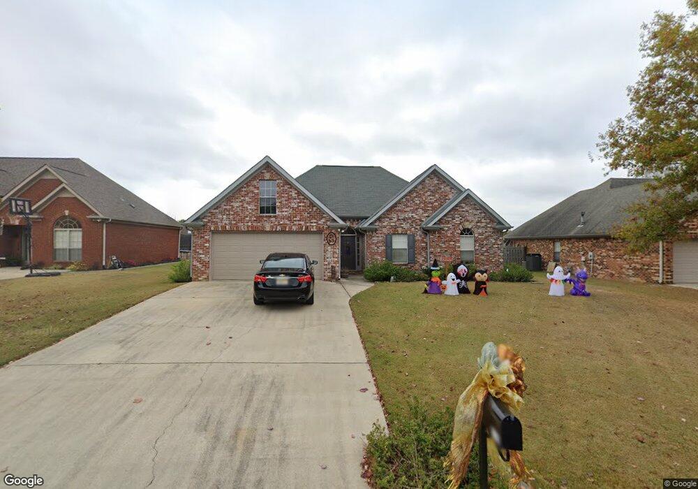
116 Hasting Ln Alabaster, AL 35114
Estimated Value: $264,000 - $317,000
Studio
2
Baths
1,552
Sq Ft
$186/Sq Ft
Est. Value
About This Home
This home is located at 116 Hasting Ln, Alabaster, AL 35114 and is currently estimated at $287,921, approximately $185 per square foot. 116 Hasting Ln is a home located in Shelby County with nearby schools including Thompson Intermediate School, Thompson Middle School, and Thompson High School.
Ownership History
Date
Name
Owned For
Owner Type
Purchase Details
Closed on
Sep 24, 2020
Sold by
Molish Kimberly B and Molish Keith
Bought by
Elward Angela and Elward Chris
Current Estimated Value
Purchase Details
Closed on
Nov 18, 2016
Sold by
Molsih Kimberly B and Molsih Keith
Bought by
Molsih Kimberly B
Purchase Details
Closed on
Oct 30, 2006
Sold by
Molish Kimberly B Barry
Bought by
Molish Keith and Molish Kimberly B
Home Financials for this Owner
Home Financials are based on the most recent Mortgage that was taken out on this home.
Original Mortgage
$163,000
Interest Rate
6.87%
Mortgage Type
New Conventional
Purchase Details
Closed on
Aug 23, 2004
Sold by
Not Provided
Bought by
Molish Keith and Molish Kimberly B
Create a Home Valuation Report for This Property
The Home Valuation Report is an in-depth analysis detailing your home's value as well as a comparison with similar homes in the area
Home Values in the Area
Average Home Value in this Area
Purchase History
| Date | Buyer | Sale Price | Title Company |
|---|---|---|---|
| Elward Angela | $195,000 | None Available | |
| Molsih Kimberly B | $146,300 | First American Title Inc Co | |
| Molish Keith | -- | Reli Inc | |
| Molish Keith | $5,000 | -- |
Source: Public Records
Mortgage History
| Date | Status | Borrower | Loan Amount |
|---|---|---|---|
| Previous Owner | Molish Keith | $163,000 |
Source: Public Records
Tax History
| Year | Tax Paid | Tax Assessment Tax Assessment Total Assessment is a certain percentage of the fair market value that is determined by local assessors to be the total taxable value of land and additions on the property. | Land | Improvement |
|---|---|---|---|---|
| 2024 | $1,399 | $25,900 | $0 | $0 |
| 2023 | $1,281 | $24,480 | $0 | $0 |
| 2022 | $1,183 | $22,660 | $0 | $0 |
| 2021 | $1,017 | $19,600 | $0 | $0 |
| 2020 | $968 | $17,920 | $0 | $0 |
| 2019 | $921 | $17,060 | $0 | $0 |
| 2017 | $833 | $15,420 | $0 | $0 |
| 2015 | $791 | $14,640 | $0 | $0 |
| 2014 | $791 | $14,640 | $0 | $0 |
Source: Public Records
Map
Nearby Homes
- 208 Queens Gate
- 501 Ramsgate Dr
- 120 Mayfair Park
- 236 Queens Gate
- 306 Mayfair Cir
- 312 Cornwall Dr
- 445 Ramsgate Dr
- 544 Ramsgate Dr
- 537 Ramsgate Dr
- 545 Ramsgate Dr
- 305 Cedar Grove Ct
- 549 Ramsgate Dr
- 309 Cedar Grove Ct
- 124 Kingsley Rd
- 280 Cedar Grove Pkwy
- 2001 1st Ave W
- 316 Sterling Manor Cir
- 1805 Mohawk Dr
- 217 Kensington Ln
- 120 Sterling Gate Dr
- 116 Hastings Ln
- 112 Hastings Ln
- 120 Hastings Ln
- 217 Queens Gate
- 213 Queens Gate
- 108 Hastings Ln
- 221 Queens Gate
- 124 Hastings Ln
- 117 Hastings Ln
- 209 Queens Gate
- 225 Queens Gate
- 121 Hastings Ln
- 113 Hastings Ln
- 104 Hastings Ln
- 125 Hastings Ln
- 128 Hastings Ln
- 109 Hastings Ln
- 205 Queens Gate
- 229 Queens Gate
- 129 Hastings Ln
Your Personal Tour Guide
Ask me questions while you tour the home.