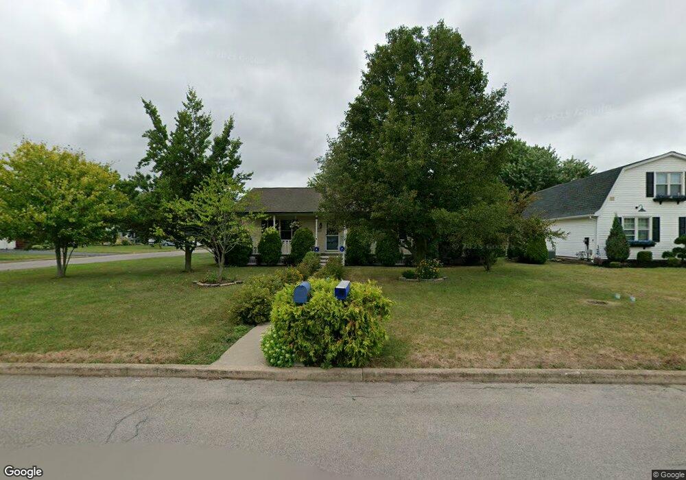
116 Lindhurst Dr Lockport, NY 14094
Estimated Value: $260,804 - $286,000
3
Beds
2
Baths
1,512
Sq Ft
$183/Sq Ft
Est. Value
About This Home
This home is located at 116 Lindhurst Dr, Lockport, NY 14094 and is currently estimated at $275,951, approximately $182 per square foot. 116 Lindhurst Dr is a home located in Niagara County with nearby schools including Aaron Mossell Junior High School, Lockport High School, and DeSales Catholic School.
Ownership History
Date
Name
Owned For
Owner Type
Purchase Details
Closed on
Apr 12, 2022
Sold by
Prohaska Thomas J
Bought by
Brennan Sean
Current Estimated Value
Purchase Details
Closed on
Dec 13, 2002
Sold by
Faecy Linus J
Bought by
Prohaska Thomas J
Purchase Details
Closed on
Aug 15, 2001
Sold by
Habitat For Humanity Lockport Inc
Bought by
Faery Linus J
Purchase Details
Closed on
Dec 18, 1997
Sold by
Bonner Norman E
Bought by
Habitat For Humanity Lock
Create a Home Valuation Report for This Property
The Home Valuation Report is an in-depth analysis detailing your home's value as well as a comparison with similar homes in the area
Home Values in the Area
Average Home Value in this Area
Purchase History
| Date | Buyer | Sale Price | Title Company |
|---|---|---|---|
| Brennan Sean | $25,000 | None Listed On Document | |
| Prohaska Thomas J | $99,000 | Gary M Billingsley | |
| Faery Linus J | $5,100 | Richard F May | |
| Habitat For Humanity Lock | -- | -- |
Source: Public Records
Tax History Compared to Growth
Tax History
| Year | Tax Paid | Tax Assessment Tax Assessment Total Assessment is a certain percentage of the fair market value that is determined by local assessors to be the total taxable value of land and additions on the property. | Land | Improvement |
|---|---|---|---|---|
| 2024 | $4,653 | $189,000 | $13,500 | $175,500 |
| 2023 | $4,451 | $177,000 | $13,500 | $163,500 |
| 2022 | $3,347 | $158,000 | $13,500 | $144,500 |
| 2021 | $3,696 | $109,600 | $10,400 | $99,200 |
| 2020 | $3,531 | $109,600 | $10,400 | $99,200 |
| 2019 | $948 | $109,600 | $10,400 | $99,200 |
| 2018 | $2,341 | $109,600 | $10,400 | $99,200 |
| 2017 | $2,308 | $109,600 | $10,400 | $99,200 |
| 2016 | $2,185 | $109,600 | $10,400 | $99,200 |
| 2015 | -- | $109,600 | $10,400 | $99,200 |
| 2014 | -- | $109,600 | $10,400 | $99,200 |
Source: Public Records
Map
Nearby Homes
- 178 Continental Dr
- 869 Lincoln Ave
- 206 Continental Dr
- 40 Georgia Ave
- 27 Independence Dr
- 105 Obrien Dr
- 151 Independence Dr
- 76 Elizabeth Dr
- 6685 Curtis Ct
- Patio A Plan at Lockhaven Estates
- Patio B Plan at Lockhaven Estates
- Patio D Plan at Lockhaven Estates
- 6673 Curtis Ct
- Patio C Plan at Lockhaven Estates
- 6667 Curtis Ct
- 44 Coolidge Ave
- 1100 Beattie Ave
- 6409 Buell Dr
- 76 Morrow Ave
- 544 Willow St
- 110 Lindhurst Dr
- 104 Lindhurst Dr
- 34 Hoover Pkwy
- 32 Hoover Pkwy
- 29 Hoover Pkwy
- 30 Hoover Pkwy
- 45 Alanview Dr
- 98 Lindhurst Dr
- 41 Alanview Dr
- 105 Lindhurst Dr
- 27 Hoover Pkwy
- 99 Lindhurst Dr
- 92 Lindhurst Dr
- 877 Lincoln Ave
- 861 Lincoln Ave
- 35 Alanview Dr
- 25 Hoover Pkwy
- 6 Nixon Place
- 93 Lindhurst Dr
- 86 Lindhurst Dr