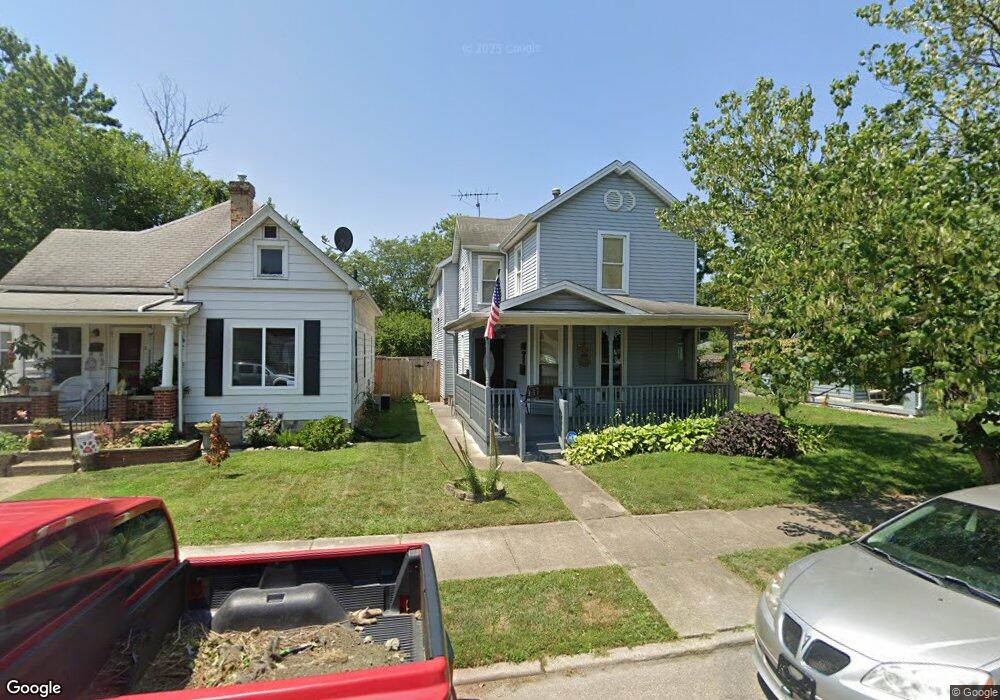
116 Shafor St Middletown, OH 45042
Sunset-Park Place NeighborhoodEstimated Value: $179,000 - $194,000
3
Beds
1
Bath
1,624
Sq Ft
$117/Sq Ft
Est. Value
About This Home
This home is located at 116 Shafor St, Middletown, OH 45042 and is currently estimated at $189,384, approximately $116 per square foot. 116 Shafor St is a home located in Butler County with nearby schools including Wildwood Elementary School, Highview 6th Grade Center, and Middletown Middle School.
Ownership History
Date
Name
Owned For
Owner Type
Purchase Details
Closed on
Mar 18, 2008
Sold by
James Travis Scott and James Stephanie
Bought by
Lawson Barry K
Current Estimated Value
Home Financials for this Owner
Home Financials are based on the most recent Mortgage that was taken out on this home.
Original Mortgage
$70,948
Outstanding Balance
$43,590
Interest Rate
5.74%
Mortgage Type
FHA
Estimated Equity
$145,794
Purchase Details
Closed on
May 26, 2004
Sold by
James Stephanie and James Travis Scott
Bought by
James Travis Scott and James Stephanie
Create a Home Valuation Report for This Property
The Home Valuation Report is an in-depth analysis detailing your home's value as well as a comparison with similar homes in the area
Home Values in the Area
Average Home Value in this Area
Purchase History
We collect this data history from publicly available records. To have your information removed, we recommend requesting removal directly through your county’s website.
| Date | Buyer | Sale Price | Title Company |
|---|---|---|---|
| Lawson Barry K | $84,900 | Attorney | |
| James Travis Scott | -- | -- |
Source: Public Records
Mortgage History
We collect this data history from publicly available records. To have your information removed, we recommend requesting removal directly through your county’s website.
| Date | Status | Borrower | Loan Amount |
|---|---|---|---|
| Open | Lawson Barry K | $70,948 |
Source: Public Records
Tax History
| Year | Tax Paid | Tax Assessment Tax Assessment Total Assessment is a certain percentage of the fair market value that is determined by local assessors to be the total taxable value of land and additions on the property. | Land | Improvement |
|---|---|---|---|---|
| 2025 | $2,637 | $51,050 | $6,340 | $44,710 |
| 2024 | $2,637 | $51,050 | $6,340 | $44,710 |
| 2023 | $2,621 | $52,230 | $6,340 | $45,890 |
| 2022 | $2,029 | $34,910 | $6,340 | $28,570 |
| 2021 | $1,951 | $34,910 | $6,340 | $28,570 |
| 2020 | $2,033 | $34,910 | $6,340 | $28,570 |
| 2019 | $1,710 | $23,590 | $6,520 | $17,070 |
| 2018 | $1,488 | $23,590 | $6,520 | $17,070 |
| 2017 | $1,491 | $23,590 | $6,520 | $17,070 |
| 2016 | $1,363 | $20,650 | $6,520 | $14,130 |
| 2015 | $1,343 | $20,650 | $6,520 | $14,130 |
| 2014 | $1,502 | $20,650 | $6,520 | $14,130 |
| 2013 | $1,502 | $25,150 | $6,520 | $18,630 |
Source: Public Records
Map
Nearby Homes
- 19 Mckinley St
- 102 Franklin St
- 215 Monroe St
- 2119 Central Ave
- 2208 Linden Ave
- 16 Harrison St
- 2304 Flemming Rd
- 315 Franklin St
- 6 Sunset Place
- 2619 Central Ave
- 2210 Arlington Ave
- 18 N Sutphin St
- 408 Franklin St
- 412 Mckinley St
- 2204 Superior Ave
- 21 Kenwood Dr
- 425 Mckinley St
- 2039 Howard Ave
- 427 Mckinley St
- 2409 Elmo Place
- 108 Shafor St
- 108 Shafor St Unit 108 Shafor Street
- 112 Shafor St
- 106 Shafor St
- 110 Shafor St
- 114 Shafor St
- 102 Shafor St
- 100 Shafor St
- 118 Shafor St
- 107 Mckinley St
- 109 Mckinley St
- 105 Mckinley St
- 111 Mckinley St
- 103 Mckinley St
- 109 Shafor St
- 120 Shafor St
- 111 Shafor St
- 107 Shafor St
- 113 Mckinley St
- 101 Mckinley St
Your Personal Tour Guide
Ask me questions while you tour the home.