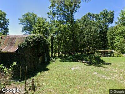
1160 Joe Branch Rd Allardt, TN 38504
Estimated Value: $254,000 - $304,000
--
Bed
1
Bath
1,728
Sq Ft
$160/Sq Ft
Est. Value
About This Home
This home is located at 1160 Joe Branch Rd, Allardt, TN 38504 and is currently estimated at $276,000, approximately $159 per square foot. 1160 Joe Branch Rd is a home located in Fentress County.
Ownership History
Date
Name
Owned For
Owner Type
Purchase Details
Closed on
Oct 2, 2024
Sold by
Lewallen Darrell
Bought by
Lewallen Glenn D
Current Estimated Value
Home Financials for this Owner
Home Financials are based on the most recent Mortgage that was taken out on this home.
Original Mortgage
$562,500
Outstanding Balance
$539,978
Interest Rate
6.32%
Mortgage Type
Reverse Mortgage Home Equity Conversion Mortgage
Estimated Equity
-$261,645
Create a Home Valuation Report for This Property
The Home Valuation Report is an in-depth analysis detailing your home's value as well as a comparison with similar homes in the area
Home Values in the Area
Average Home Value in this Area
Purchase History
| Date | Buyer | Sale Price | Title Company |
|---|---|---|---|
| Lewallen Glenn D | -- | None Listed On Document | |
| Lewallen Glenn D | -- | None Listed On Document |
Source: Public Records
Mortgage History
| Date | Status | Borrower | Loan Amount |
|---|---|---|---|
| Open | Lewallen Glenn D | $562,500 | |
| Closed | Lewallen Glenn D | $562,500 | |
| Previous Owner | Lewallen Glenn D | $562,500 | |
| Previous Owner | Lewallen Glenn | $13,600 | |
| Previous Owner | Lewallen Darrell | $66,000 |
Source: Public Records
Tax History Compared to Growth
Tax History
| Year | Tax Paid | Tax Assessment Tax Assessment Total Assessment is a certain percentage of the fair market value that is determined by local assessors to be the total taxable value of land and additions on the property. | Land | Improvement |
|---|---|---|---|---|
| 2024 | $669 | $49,525 | $11,175 | $38,350 |
| 2023 | $669 | $49,525 | $11,175 | $38,350 |
| 2022 | $532 | $27,875 | $8,425 | $19,450 |
| 2021 | $532 | $27,875 | $8,425 | $19,450 |
| 2020 | $532 | $27,875 | $8,425 | $19,450 |
| 2019 | $532 | $27,875 | $8,425 | $19,450 |
| 2018 | $532 | $27,875 | $8,425 | $19,450 |
| 2017 | $504 | $25,400 | $8,425 | $16,975 |
| 2016 | $504 | $25,400 | $8,425 | $16,975 |
| 2015 | $504 | $25,391 | $0 | $0 |
| 2014 | $504 | $25,391 | $0 | $0 |
Source: Public Records
Map
Nearby Homes
- 21.31 Cole Place Rd
- 0 72 Acres Cole Place Rd
- 50 acres Oloff Smith Rd
- 0 Laurel Dale Cemetary Rd
- lot 17 Long Ridge Way
- 5601 Central Ave
- Lot 24 Old Mount Helen Rd
- Lot 23 Old Mount Helen Rd
- Lot 19 Old Mount Helen Rd
- Lot 13 Old Mount Helen Rd
- 0 Old Mount Helen Rd
- 0 Scott-Fentress Co Line Unit 1292458
- Lot 1 Hwy 52 and Brewstertown Rd
- 0 Coyote Trail
- 239 Sewell Dr
- 1032 Range Cemetery Rd
- 0 Sam Smith Rd Unit RTC2865905
- 0 Sam Smith Rd Unit 236295
- 20 Bluff View Loop
- 109 004 White Oak Creek
