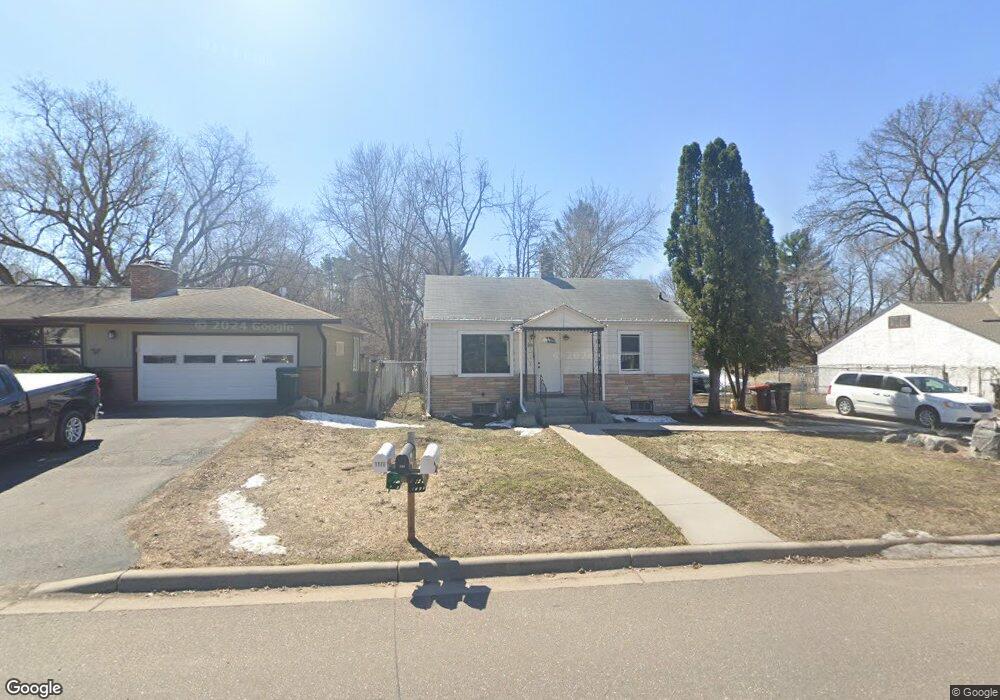
1160 Lealand Rd E Saint Paul, MN 55109
Sherwood Glen NeighborhoodEstimated Value: $254,000 - $281,068
3
Beds
2
Baths
312
Sq Ft
$867/Sq Ft
Est. Value
About This Home
This home is located at 1160 Lealand Rd E, Saint Paul, MN 55109 and is currently estimated at $270,517, approximately $867 per square foot. 1160 Lealand Rd E is a home located in Ramsey County with nearby schools including Weaver Elementary School, John Glenn Middle School, and St Jerome Elementary School.
Ownership History
Date
Name
Owned For
Owner Type
Purchase Details
Closed on
Jun 28, 2021
Sold by
Yang Lahoua
Bought by
Smith Kailey and Wiechmann Luke
Current Estimated Value
Home Financials for this Owner
Home Financials are based on the most recent Mortgage that was taken out on this home.
Original Mortgage
$213,400
Outstanding Balance
$193,627
Interest Rate
2.9%
Mortgage Type
New Conventional
Estimated Equity
$76,890
Purchase Details
Closed on
Oct 28, 2016
Sold by
Oien Jodi L
Bought by
Yang Lahoua
Home Financials for this Owner
Home Financials are based on the most recent Mortgage that was taken out on this home.
Original Mortgage
$110,000
Interest Rate
3%
Mortgage Type
Adjustable Rate Mortgage/ARM
Create a Home Valuation Report for This Property
The Home Valuation Report is an in-depth analysis detailing your home's value as well as a comparison with similar homes in the area
Home Values in the Area
Average Home Value in this Area
Purchase History
| Date | Buyer | Sale Price | Title Company |
|---|---|---|---|
| Smith Kailey | $220,000 | Knight Barry Ttl United Llc | |
| Yang Lahoua | $141,667 | Title Recording Svcs Inc | |
| Smith Kailey Kailey | $220,000 | -- |
Source: Public Records
Mortgage History
| Date | Status | Borrower | Loan Amount |
|---|---|---|---|
| Open | Smith Kailey | $213,400 | |
| Previous Owner | Yang Lahoua | $110,000 | |
| Closed | Smith Kailey Kailey | $213,400 |
Source: Public Records
Tax History Compared to Growth
Tax History
| Year | Tax Paid | Tax Assessment Tax Assessment Total Assessment is a certain percentage of the fair market value that is determined by local assessors to be the total taxable value of land and additions on the property. | Land | Improvement |
|---|---|---|---|---|
| 2025 | $3,146 | $261,500 | $53,600 | $207,900 |
| 2023 | $3,146 | $234,700 | $53,600 | $181,100 |
| 2022 | $2,666 | $216,200 | $53,600 | $162,600 |
| 2021 | $2,458 | $194,700 | $53,600 | $141,100 |
| 2020 | $2,562 | $185,200 | $53,600 | $131,600 |
| 2019 | $2,114 | $180,400 | $53,600 | $126,800 |
| 2018 | $1,862 | $156,000 | $53,600 | $102,400 |
| 2017 | $1,750 | $137,800 | $53,600 | $84,200 |
| 2016 | $2,362 | $0 | $0 | $0 |
| 2015 | $2,172 | $124,700 | $49,100 | $75,600 |
| 2014 | $2,128 | $0 | $0 | $0 |
Source: Public Records
Map
Nearby Homes
- 1201 Frost Ave
- 1018 Sextant Ave
- 1467 County Road B E
- 2020 Arcade St
- 1509 Sandhurst Ave E
- 955 Brooks Ct
- 1875 E Shore Dr Unit 302
- 1869 Birmingham St
- 1940 Barclay St
- 1779 Frank St
- 771 County Road B2 E
- 727 Laurie Ct
- 2420 Hazelwood St
- 1730 Atlantic St
- 1854 Barclay St
- 1740 English St
- 1984 Prosperity Rd
- 2295 Gervais Hills Dr
- 668 Viking Dr E
- 822 Palm Ct
- 1160 Lealand Rd E
- 1170 Lealand Rd E
- 1152 Lealand Rd E
- 1161 Lealand Rd
- 1172 Lealand Rd E
- 1172 Lealand Rd E
- xxxx Leland Rd E
- 1171 Lealand Rd E
- 1140 Lealand Rd E
- 1190 Lealand Rd
- 1160 County Road B E
- 1190 Lealand Rd E
- 1134 Lealand Rd
- 1174 County Road B E
- 1187 Junction Ave
- 2160 Day Rd
- 1152 County Road B E
- 1187 Lealand Rd
- 1135 Lealand Rd
- 1194 Lealand Rd