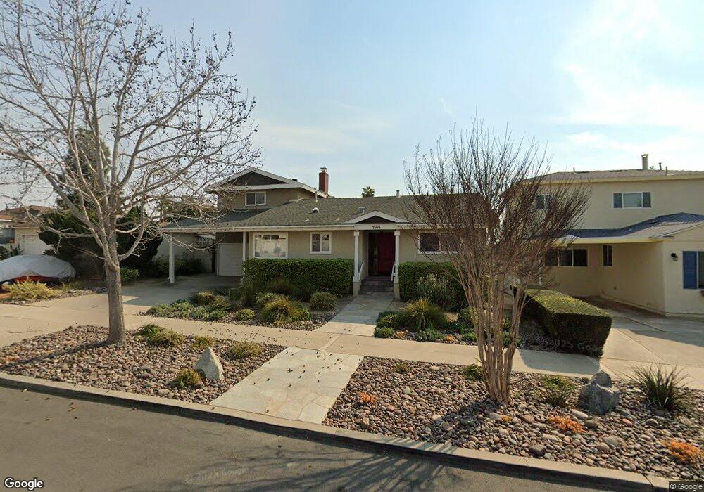
1161 Beryl St San Diego, CA 92109
Pacific Beach NeighborhoodEstimated Value: $2,181,000 - $2,370,000
4
Beds
3
Baths
2,242
Sq Ft
$1,004/Sq Ft
Est. Value
About This Home
This home is located at 1161 Beryl St, San Diego, CA 92109 and is currently estimated at $2,251,604, approximately $1,004 per square foot. 1161 Beryl St is a home located in San Diego County with nearby schools including Pacific Beach Elementary School, Pacific Beach Middle, and Mission Bay High School.
Ownership History
Date
Name
Owned For
Owner Type
Purchase Details
Closed on
Mar 24, 1999
Sold by
Lord Thomas T and Whitehead Family Trust
Bought by
Wasson Donald Bruce and Wasson Sandra Susan
Current Estimated Value
Home Financials for this Owner
Home Financials are based on the most recent Mortgage that was taken out on this home.
Original Mortgage
$372,000
Outstanding Balance
$91,263
Interest Rate
6.91%
Estimated Equity
$2,160,341
Purchase Details
Closed on
Jan 4, 1999
Sold by
Whitehead Gerald L
Bought by
Lord Thomas Tierney and Lord Margaret Loree
Purchase Details
Closed on
Nov 30, 1998
Sold by
Whitehead Gerald L
Bought by
Lord Thomas Tierney and Lord Margaret Loree
Purchase Details
Closed on
Sep 11, 1998
Sold by
Whitehead Gerald L
Bought by
Whitehead Gerald Lesh and Whitehead Bette O
Home Financials for this Owner
Home Financials are based on the most recent Mortgage that was taken out on this home.
Original Mortgage
$227,150
Interest Rate
6.3%
Mortgage Type
Purchase Money Mortgage
Purchase Details
Closed on
May 15, 1997
Sold by
Whitehead Gerald Lesh and Whitehead Bette O
Bought by
Lord Thomas Tierney and Lord Margaret Loree
Purchase Details
Closed on
Jan 13, 1997
Sold by
Lord Thomas T and Lord Margaret L
Bought by
Lord Thomas Tierney and Lord Margaret Loree
Home Financials for this Owner
Home Financials are based on the most recent Mortgage that was taken out on this home.
Original Mortgage
$220,000
Interest Rate
7.28%
Purchase Details
Closed on
Dec 6, 1996
Sold by
Lord Thomas T and Whitehead Family Trust #1
Bought by
Lord Thomas Tierney and Lord Margaret Loree
Home Financials for this Owner
Home Financials are based on the most recent Mortgage that was taken out on this home.
Original Mortgage
$220,000
Interest Rate
7.28%
Purchase Details
Closed on
Sep 25, 1996
Sold by
Whitehead Gerald Lesh and Whitehead Bette O
Bought by
Lord Thomas Tierney and Lord Margaret Loree
Purchase Details
Closed on
Jan 12, 1995
Sold by
Whitehead Gerald Lesh and Whitehead Bette O
Bought by
Lord Thomas Tierney and Lord Margaret Loree
Purchase Details
Closed on
Mar 23, 1990
Create a Home Valuation Report for This Property
The Home Valuation Report is an in-depth analysis detailing your home's value as well as a comparison with similar homes in the area
Home Values in the Area
Average Home Value in this Area
Purchase History
| Date | Buyer | Sale Price | Title Company |
|---|---|---|---|
| Wasson Donald Bruce | $465,000 | Chicago Title Co | |
| Lord Thomas Tierney | -- | -- | |
| Lord Thomas Tierney | -- | -- | |
| Whitehead Gerald L | -- | -- | |
| Whitehead Gerald Lesh | -- | Stewart Title | |
| Lord Thomas Tierney | -- | -- | |
| Whitehead Gerald Lesh | -- | -- | |
| Lord Thomas Tierney | -- | -- | |
| Lord Thomas Tierney | -- | Southland Title | |
| Lord Thomas Tierney | -- | -- | |
| Whitehead Gerald Lesh | -- | -- | |
| Lord Thomas Tierney | -- | -- | |
| Whitehead Gerald Lesh | -- | -- | |
| -- | $330,000 | -- |
Source: Public Records
Mortgage History
| Date | Status | Borrower | Loan Amount |
|---|---|---|---|
| Open | Wasson Donald Bruce | $372,000 | |
| Previous Owner | Whitehead Gerald Lesh | $227,150 | |
| Previous Owner | Lord Thomas Tierney | $220,000 |
Source: Public Records
Tax History Compared to Growth
Tax History
| Year | Tax Paid | Tax Assessment Tax Assessment Total Assessment is a certain percentage of the fair market value that is determined by local assessors to be the total taxable value of land and additions on the property. | Land | Improvement |
|---|---|---|---|---|
| 2025 | $9,765 | $815,310 | $509,497 | $305,813 |
| 2024 | $9,765 | $799,324 | $499,507 | $299,817 |
| 2023 | $9,548 | $783,652 | $489,713 | $293,939 |
| 2022 | $9,293 | $768,287 | $480,111 | $288,176 |
| 2021 | $9,228 | $753,224 | $470,698 | $282,526 |
| 2020 | $9,115 | $745,502 | $465,872 | $279,630 |
| 2019 | $8,951 | $730,886 | $456,738 | $274,148 |
| 2018 | $8,367 | $716,556 | $447,783 | $268,773 |
| 2017 | $8,167 | $702,506 | $439,003 | $263,503 |
| 2016 | $8,035 | $688,733 | $430,396 | $258,337 |
| 2015 | $7,306 | $626,489 | $423,932 | $202,557 |
| 2014 | $7,190 | $614,218 | $415,628 | $198,590 |
Source: Public Records
Map
Nearby Homes
- 1025 Wilbur Ave
- 4944 Cass St Unit 604
- 4944 Cass St Unit 407
- 1220 Emerald St
- 1270 Emerald St
- 938 Opal St
- 1154 Sapphire St
- 972 Sapphire St Unit LA1
- 974 Sapphire St Unit LA2
- 976 Sapphire St Unit LA3
- 1361 Felspar St Unit 7
- 1148 Turquoise St
- 1505 Loring St
- 835 Felspar St Week 6
- 5209 Foothill Blvd
- 4767 Ocean Blvd
- 4767 Ocean Blvd Unit 411
- 1059 Agate St Unit A
- 4667 Ocean Blvd Unit 106
- 4733 Ingraham St