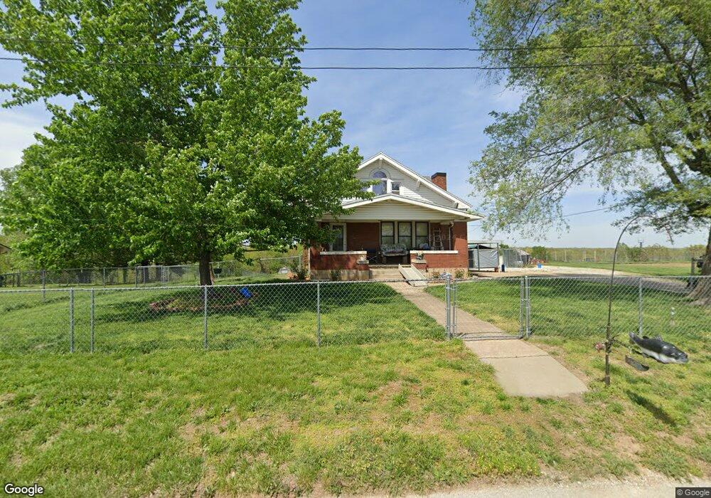
11618 E Railroad Rd Centertown, MO 65023
Estimated Value: $296,441 - $338,000
3
Beds
2
Baths
1,026
Sq Ft
$307/Sq Ft
Est. Value
About This Home
This home is located at 11618 E Railroad Rd, Centertown, MO 65023 and is currently estimated at $315,147, approximately $307 per square foot. 11618 E Railroad Rd is a home located in Cole County with nearby schools including Pioneer Trail Elementary School, Thomas Jefferson Middle School, and Capital City High School.
Ownership History
Date
Name
Owned For
Owner Type
Purchase Details
Closed on
May 9, 2022
Sold by
Toebben Diane L and Toebben Gerald
Bought by
Gilliam Thomas and Gilliam Suzianne
Current Estimated Value
Home Financials for this Owner
Home Financials are based on the most recent Mortgage that was taken out on this home.
Original Mortgage
$210,000
Outstanding Balance
$75,324
Interest Rate
4.52%
Mortgage Type
New Conventional
Estimated Equity
$239,823
Create a Home Valuation Report for This Property
The Home Valuation Report is an in-depth analysis detailing your home's value as well as a comparison with similar homes in the area
Purchase History
| Date | Buyer | Sale Price | Title Company |
|---|---|---|---|
| Gilliam Thomas | -- | None Listed On Document |
Source: Public Records
Mortgage History
| Date | Status | Borrower | Loan Amount |
|---|---|---|---|
| Open | Gilliam Thomas | $210,000 |
Source: Public Records
Tax History
| Year | Tax Paid | Tax Assessment Tax Assessment Total Assessment is a certain percentage of the fair market value that is determined by local assessors to be the total taxable value of land and additions on the property. | Land | Improvement |
|---|---|---|---|---|
| 2025 | $1,138 | $17,690 | $2,910 | $14,780 |
| 2024 | $11 | $17,690 | $2,910 | $14,780 |
| 2023 | $1,138 | $17,690 | $2,910 | $14,780 |
| 2022 | $1,087 | $16,860 | $0 | $16,860 |
| 2021 | $1,097 | $16,860 | $0 | $16,860 |
| 2020 | $1,109 | $22,167 | $2,912 | $19,255 |
| 2019 | $1,080 | $21,483 | $2,912 | $18,571 |
| 2018 | $1,080 | $16,883 | $2,936 | $13,947 |
| 2017 | $1,057 | $16,883 | $2,936 | $13,947 |
| 2016 | -- | $16,883 | $2,936 | $13,947 |
| 2015 | $913 | $0 | $0 | $0 |
| 2014 | $913 | $17,062 | $3,059 | $14,003 |
Source: Public Records
Map
Nearby Homes
- 11814 Main St
- 318 Murphy Ford Road (Land Only) Rd
- 0 Murphy Ford Rd
- 29658 Leonard Rd
- 31602 Mockingbird Rd
- 202 Carel Rd
- 201 Poelker Place
- 141 Poelker Place
- 205 Poelker Place
- 32730 Henley Lake Dr
- 0 Dynamite Ridge Rd
- 6919 Stonebridge Park Dr
- 333 W Forest Ln
- 317 W Forest Ct
- 731 Biltmore Dr
- 56836 String Creek Rd
- 732 Biltmore Dr
- 728 Biltmore Dr
- 6115 Napa Ridge Rd
- 35492 Blank Rd
- 11706 E Railroad Rd
- 11710 E Railroad Rd
- 11610 E Railroad Rd
- 11712 E Railroad Rd
- 11602 Lookout Trail
- 11608 E Railroad Rd
- 11609 Main St
- 11603 Main St
- 11714 E Mill St
- 11703 Main St
- 11707 Main St
- 11714 E
- 11720 E Railroad Rd
- 1205 Madison St
- 11518 E Railroad Rd
- 11717 Pine St
- 12001 Main St
- 1318 Monroe St
- 1316 Monroe St
- 1320 Monroe St
Your Personal Tour Guide
Ask me questions while you tour the home.