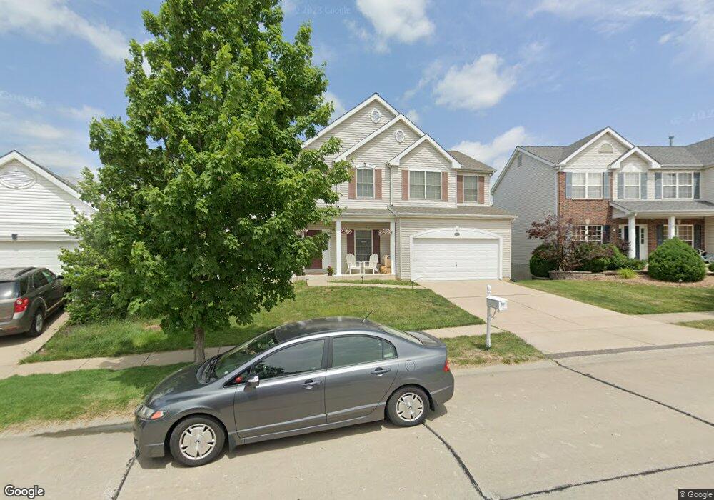
1163 Spring Orchard Dr O Fallon, MO 63368
Estimated Value: $426,373 - $454,000
4
Beds
3
Baths
2,510
Sq Ft
$175/Sq Ft
Est. Value
About This Home
This home is located at 1163 Spring Orchard Dr, O Fallon, MO 63368 and is currently estimated at $438,843, approximately $174 per square foot. 1163 Spring Orchard Dr is a home located in St. Charles County with nearby schools including Pheasant Point Elementary School, Fort Zumwalt South Middle School, and Fort Zumwalt South High School.
Ownership History
Date
Name
Owned For
Owner Type
Purchase Details
Closed on
Apr 25, 2003
Sold by
Taylor Morley Inc
Bought by
Powers Terence P and Powers Robin L
Current Estimated Value
Home Financials for this Owner
Home Financials are based on the most recent Mortgage that was taken out on this home.
Original Mortgage
$160,000
Outstanding Balance
$69,340
Interest Rate
5.87%
Mortgage Type
Purchase Money Mortgage
Estimated Equity
$369,503
Create a Home Valuation Report for This Property
The Home Valuation Report is an in-depth analysis detailing your home's value as well as a comparison with similar homes in the area
Home Values in the Area
Average Home Value in this Area
Purchase History
| Date | Buyer | Sale Price | Title Company |
|---|---|---|---|
| Powers Terence P | $222,023 | -- |
Source: Public Records
Mortgage History
| Date | Status | Borrower | Loan Amount |
|---|---|---|---|
| Open | Powers Terence P | $160,000 |
Source: Public Records
Tax History Compared to Growth
Tax History
| Year | Tax Paid | Tax Assessment Tax Assessment Total Assessment is a certain percentage of the fair market value that is determined by local assessors to be the total taxable value of land and additions on the property. | Land | Improvement |
|---|---|---|---|---|
| 2025 | $4,638 | $73,770 | -- | -- |
| 2023 | $4,640 | $70,233 | $0 | $0 |
| 2022 | $4,131 | $58,145 | $0 | $0 |
| 2021 | $4,134 | $58,145 | $0 | $0 |
| 2020 | $3,743 | $50,948 | $0 | $0 |
| 2019 | $3,751 | $50,948 | $0 | $0 |
| 2018 | $3,720 | $48,248 | $0 | $0 |
| 2017 | $3,677 | $48,248 | $0 | $0 |
| 2016 | $3,550 | $46,395 | $0 | $0 |
| 2015 | $3,300 | $46,395 | $0 | $0 |
| 2014 | $2,618 | $36,173 | $0 | $0 |
Source: Public Records
Map
Nearby Homes
- 25 Broad Brook Ct
- 179 Christina Marie Dr
- 178 Christina Marie Dr
- 6420 Long Timber Dr
- 1803 Jacobs Cir
- 1 Pauley Cir
- 661 Clifton Hill Dr
- 136 Jacobs Way
- 2737 Red Cedar Parc Dr S
- 219 Braddock Way
- 93 Arapahoe Basin Ct
- 367 Shamrock St
- 361 Shamrock St
- 86 Myrtle Wood Ct
- 211 Butternut Stage Dr
- 2136 Farnsworth Dr Unit D
- 41 Pheasant Ring Dr
- 2 the Durango at the Grove
- 5 Arborgate Dr Unit 69A
- 516 Sunward Dr
- 1165 Spring Orchard Dr
- 1161 Spring Orchard Dr
- 1246 Cold Spring Dr
- 1248 Cold Spring Dr
- 1159 Spring Orchard Dr
- 1244 Cold Spring Dr
- 1306 Avondale Spring Dr
- 1167 Spring Orchard Dr
- 1250 Cold Spring Dr
- 1162 Spring Orchard Dr
- 1242 Cold Spring Dr
- 1157 Spring Orchard Dr
- 1252 Cold Spring Dr
- 1166 Spring Orchard Dr
- 1158 Spring Orchard Dr
- 1240 Cold Spring Dr
- 1155 Spring Orchard Dr
- 1156 Spring Orchard Dr
- 1238 Cold Spring Dr
- 1249 Cold Spring Dr