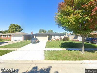
11639 Skylark Ct Sterling Heights, MI 48312
Estimated Value: $291,000 - $325,000
4
Beds
2
Baths
1,353
Sq Ft
$223/Sq Ft
Est. Value
About This Home
This home is located at 11639 Skylark Ct, Sterling Heights, MI 48312 and is currently estimated at $301,505, approximately $222 per square foot. 11639 Skylark Ct is a home located in Macomb County with nearby schools including Willow Woods Elementary School, Carleton Middle School, and Sterling Heights Senior H.S..
Ownership History
Date
Name
Owned For
Owner Type
Purchase Details
Closed on
Mar 21, 2016
Sold by
Lingo C John and Lingo Diana L
Bought by
The C John Lingo & Diana L Lingo Revocab
Current Estimated Value
Home Financials for this Owner
Home Financials are based on the most recent Mortgage that was taken out on this home.
Original Mortgage
$255,000
Interest Rate
4.1%
Mortgage Type
Reverse Mortgage Home Equity Conversion Mortgage
Create a Home Valuation Report for This Property
The Home Valuation Report is an in-depth analysis detailing your home's value as well as a comparison with similar homes in the area
Home Values in the Area
Average Home Value in this Area
Purchase History
| Date | Buyer | Sale Price | Title Company |
|---|---|---|---|
| The C John Lingo & Diana L Lingo Revocab | -- | Attorney |
Source: Public Records
Mortgage History
| Date | Status | Borrower | Loan Amount |
|---|---|---|---|
| Closed | The C John Lingo & Diana L Lingo Revocab | $255,000 | |
| Closed | Lingo C John | $45,300 | |
| Closed | Lingo C John | $37,000 |
Source: Public Records
Tax History Compared to Growth
Tax History
| Year | Tax Paid | Tax Assessment Tax Assessment Total Assessment is a certain percentage of the fair market value that is determined by local assessors to be the total taxable value of land and additions on the property. | Land | Improvement |
|---|---|---|---|---|
| 2024 | $2,835 | $120,700 | $0 | $0 |
| 2023 | $2,691 | $108,100 | $0 | $0 |
| 2022 | $2,610 | $95,700 | $0 | $0 |
| 2021 | $2,698 | $89,100 | $0 | $0 |
| 2020 | $2,564 | $86,000 | $0 | $0 |
| 2019 | $2,407 | $78,100 | $0 | $0 |
| 2018 | $2,549 | $71,400 | $0 | $0 |
| 2017 | $2,459 | $68,800 | $15,000 | $53,800 |
| 2016 | $2,407 | $68,800 | $0 | $0 |
| 2015 | -- | $63,400 | $0 | $0 |
| 2014 | -- | $53,900 | $0 | $0 |
Source: Public Records
Map
Nearby Homes
- 11641 Brougham Dr
- 35464 Evanston Ave
- 11864 Eldorado Dr
- 11928 Canterbury Dr
- 35457 Wellston Ave
- 36310 Bagdad Dr
- 12136 Brougham Dr
- 12157 Chevelle Dr
- 36460 Tarpon Dr
- 12219 Corvair Dr
- 35407 Mustang Dr
- 36515 Bagdad Dr
- 12286 Eldorado Dr
- 11151 Brougham Dr
- 36602 Wayne Dr
- 11856 Tahiti Dr
- 12018 15 Mile Rd Unit 25B
- 11098 Canterbury Dr
- 36592 Ridgecroft Dr
- 35533 Turner Dr
- 11639 Skylark Ct
- 11651 Skylark Ct
- 11627 Skylark Ct
- 11663 Skylark Ct
- 11640 Brougham Dr
- 11628 Brougham Dr
- 11615 Skylark Ct
- 11664 Brougham Dr
- 11616 Brougham Dr
- 11638 Skylark Ct
- 11650 Skylark Ct
- 11626 Skylark Ct
- 35833 Electra Dr
- 35845 Electra Dr
- 11662 Skylark Ct
- 11614 Skylark Ct
- 35869 Electra Dr
- 35687 Electra Dr
- 11633 Fury Ct
- 11645 Fury Ct