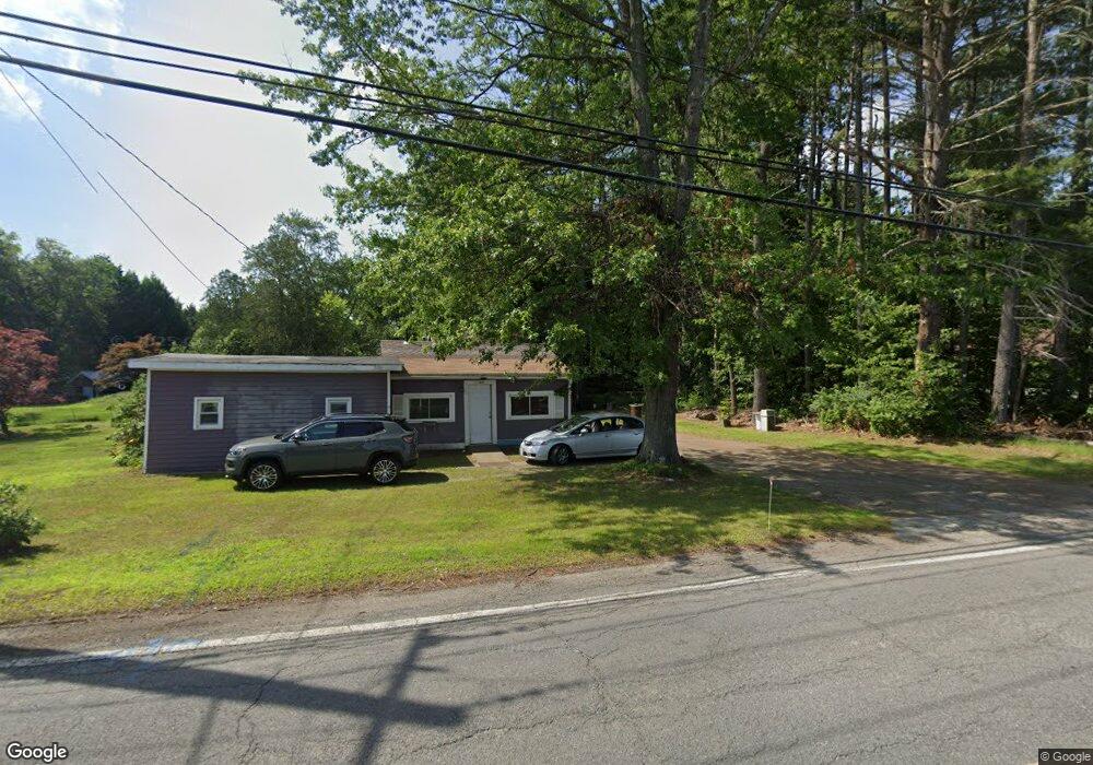
1164 Bernardston Rd Greenfield, MA 01301
Estimated Value: $253,000 - $311,000
3
Beds
1
Bath
1,160
Sq Ft
$242/Sq Ft
Est. Value
About This Home
This home is located at 1164 Bernardston Rd, Greenfield, MA 01301 and is currently estimated at $281,033, approximately $242 per square foot. 1164 Bernardston Rd is a home located in Franklin County with nearby schools including Greenfield Center School, Cornerstone Christian School, and Stoneleigh-Burnham School.
Ownership History
Date
Name
Owned For
Owner Type
Purchase Details
Closed on
Oct 1, 2015
Sold by
Hill Timothy S and Tetreault Shirley
Bought by
Hill Timothy S and Hill Craig
Current Estimated Value
Create a Home Valuation Report for This Property
The Home Valuation Report is an in-depth analysis detailing your home's value as well as a comparison with similar homes in the area
Home Values in the Area
Average Home Value in this Area
Purchase History
| Date | Buyer | Sale Price | Title Company |
|---|---|---|---|
| Hill Timothy S | -- | -- | |
| Hill Timothy S | -- | -- |
Source: Public Records
Tax History Compared to Growth
Tax History
| Year | Tax Paid | Tax Assessment Tax Assessment Total Assessment is a certain percentage of the fair market value that is determined by local assessors to be the total taxable value of land and additions on the property. | Land | Improvement |
|---|---|---|---|---|
| 2025 | $3,194 | $163,300 | $76,200 | $87,100 |
| 2024 | $3,087 | $151,400 | $64,900 | $86,500 |
| 2023 | $2,794 | $142,200 | $64,900 | $77,300 |
| 2022 | $3,047 | $136,500 | $65,000 | $71,500 |
| 2021 | $3,156 | $135,900 | $68,700 | $67,200 |
| 2020 | $2,965 | $129,300 | $68,700 | $60,600 |
| 2019 | $2,692 | $120,400 | $59,800 | $60,600 |
| 2018 | $2,651 | $118,200 | $58,700 | $59,500 |
| 2017 | $2,534 | $116,600 | $58,700 | $57,900 |
| 2016 | $2,486 | $114,000 | $58,700 | $55,300 |
| 2015 | $2,553 | $113,400 | $60,200 | $53,200 |
| 2014 | $2,328 | $113,400 | $60,200 | $53,200 |
Source: Public Records
Map
Nearby Homes
- 31 Lovers Ln
- 001 Adams Rd
- 83 Eden Trail Branch
- 34 Brookside Ave
- 47 Cross St
- 72 Meadowood Dr
- 696 Bernardston Rd
- 75 South St Unit 3
- 59 River St
- 23 Industrial Dr
- 79 Burnham Rd
- 1 Northfield Rd
- 539 Fox Hill Rd
- 182 Main Rd
- 218 Greenfield Rd
- 21 Hillside Ave
- 544 Fox Hill Rd (Vacant Land)
- 137 French King Hwy
- 4 Pickett Ln
- 335 Federal St
- 225 Log Plain Rd
- 221 Log Plain Rd
- 1148 Bernardston Rd
- 1173 Bernardston Rd
- 1182 Bernardston Rd
- 252 Log Plain Rd
- 1144 Bernardston Rd
- 218 Log Plain Rd
- 0 Fargo St
- 260 Log Plain Rd
- 1138 Bernardston Rd
- 1175 Bernardston Rd
- 259 Log Plain Rd
- 8 Fargo St
- 1196 Bernardston Rd
- 1134 Bernardston Rd
- 29 Fargo St
- 267 Log Plain Rd
- 1130 Bernardston Rd
- 271 Log Plain Rd