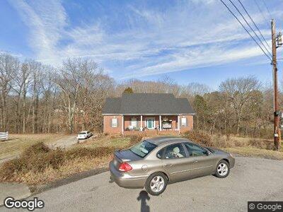
1165 Adam Dr Cottontown, TN 37048
Estimated Value: $392,649 - $470,000
--
Bed
2
Baths
2,185
Sq Ft
$199/Sq Ft
Est. Value
About This Home
This home is located at 1165 Adam Dr, Cottontown, TN 37048 and is currently estimated at $435,412, approximately $199 per square foot. 1165 Adam Dr is a home located in Robertson County with nearby schools including Robert F. Woodall Elementary School, White House Heritage Elementary School, and White House Heritage High School.
Ownership History
Date
Name
Owned For
Owner Type
Purchase Details
Closed on
Aug 20, 1999
Sold by
Stephen Vanhoozer
Bought by
Alverson James H
Current Estimated Value
Home Financials for this Owner
Home Financials are based on the most recent Mortgage that was taken out on this home.
Original Mortgage
$95,000
Interest Rate
7.58%
Purchase Details
Closed on
Dec 1, 1993
Sold by
Frasure Jesse E
Bought by
Stephen Vanhoozer
Purchase Details
Closed on
Nov 29, 1993
Bought by
Vanhoozer Stephen and Vanhoozer Van Hoozer
Purchase Details
Closed on
Feb 28, 1992
Bought by
Frasure Jesse E and Frasure Sandy L
Purchase Details
Closed on
Aug 13, 1990
Purchase Details
Closed on
Sep 12, 1975
Bought by
Tate Tony O
Create a Home Valuation Report for This Property
The Home Valuation Report is an in-depth analysis detailing your home's value as well as a comparison with similar homes in the area
Home Values in the Area
Average Home Value in this Area
Purchase History
| Date | Buyer | Sale Price | Title Company |
|---|---|---|---|
| Alverson James H | $162,500 | -- | |
| Stephen Vanhoozer | $116,450 | -- | |
| Vanhoozer Stephen | $116,500 | -- | |
| Frasure Jesse E | $99,900 | -- | |
| -- | $95,000 | -- | |
| Wellborn Tracy A & First Republic Mortg | -- | -- | |
| Tate Tony O | -- | -- |
Source: Public Records
Mortgage History
| Date | Status | Borrower | Loan Amount |
|---|---|---|---|
| Open | Alverson James H | $122,000 | |
| Closed | Alverson James H | $90,322 | |
| Closed | Alverson James H | $25,000 | |
| Closed | Alverson James H | $106,000 | |
| Closed | Tate Tony O | $95,000 |
Source: Public Records
Tax History Compared to Growth
Tax History
| Year | Tax Paid | Tax Assessment Tax Assessment Total Assessment is a certain percentage of the fair market value that is determined by local assessors to be the total taxable value of land and additions on the property. | Land | Improvement |
|---|---|---|---|---|
| 2024 | $1,653 | $91,850 | $22,500 | $69,350 |
| 2023 | $1,653 | $91,850 | $22,500 | $69,350 |
| 2022 | $1,562 | $60,650 | $6,475 | $54,175 |
| 2021 | $1,562 | $60,650 | $6,475 | $54,175 |
| 2020 | $1,562 | $60,650 | $6,475 | $54,175 |
| 2019 | $1,562 | $60,650 | $6,475 | $54,175 |
| 2018 | $1,562 | $60,650 | $6,475 | $54,175 |
| 2017 | $1,364 | $44,225 | $5,525 | $38,700 |
| 2016 | $1,364 | $44,225 | $5,525 | $38,700 |
| 2015 | $1,309 | $44,225 | $5,525 | $38,700 |
| 2014 | $1,309 | $44,225 | $5,525 | $38,700 |
Source: Public Records
Map
Nearby Homes
- 1129 Adam Dr
- 533 Lee Rd
- 111 Renee Ct
- 3042 Killarney Park
- 4060 Highway 31 W
- 2344 Brokeshire Dr
- 4146 Burton Dr
- 4150 Burton Dr
- 4188 Burton Dr
- 2170 Meredith Dr
- 2166 Meredith Dr
- 2088 Meredith Dr
- 2130 Brokeshire Dr
- 2076 Meredith Dr
- 1274 Tisdale Dr
- 1270 Tisdale Dr
- 2066 Meredith Dr
- 1267 Tisdale Dr
- 1263 Tisdale Dr
- 2048 Meredith Dr
- 1165 Adam Dr
- 1161 Adam Dr
- 1160 Adam Dr
- 1150 Adam Dr
- 1157 Adam Dr
- 1146 Adam Dr
- 225 Quail Ridge Dr
- 1142 Adam Dr
- 221 Quail Ridge Dr
- 3823 Highway 31 W
- 1138 Adam Dr
- 217 Quail Ridge Dr
- 1153 Adam Dr
- 137 Baldridge Dr
- 133 Baldridge Dr
- 3839 Highway 31 W
- 3839 U S 31w
- 229 Quail Ridge Dr
- 804 Overview Dr
- 213 Quail Ridge Dr