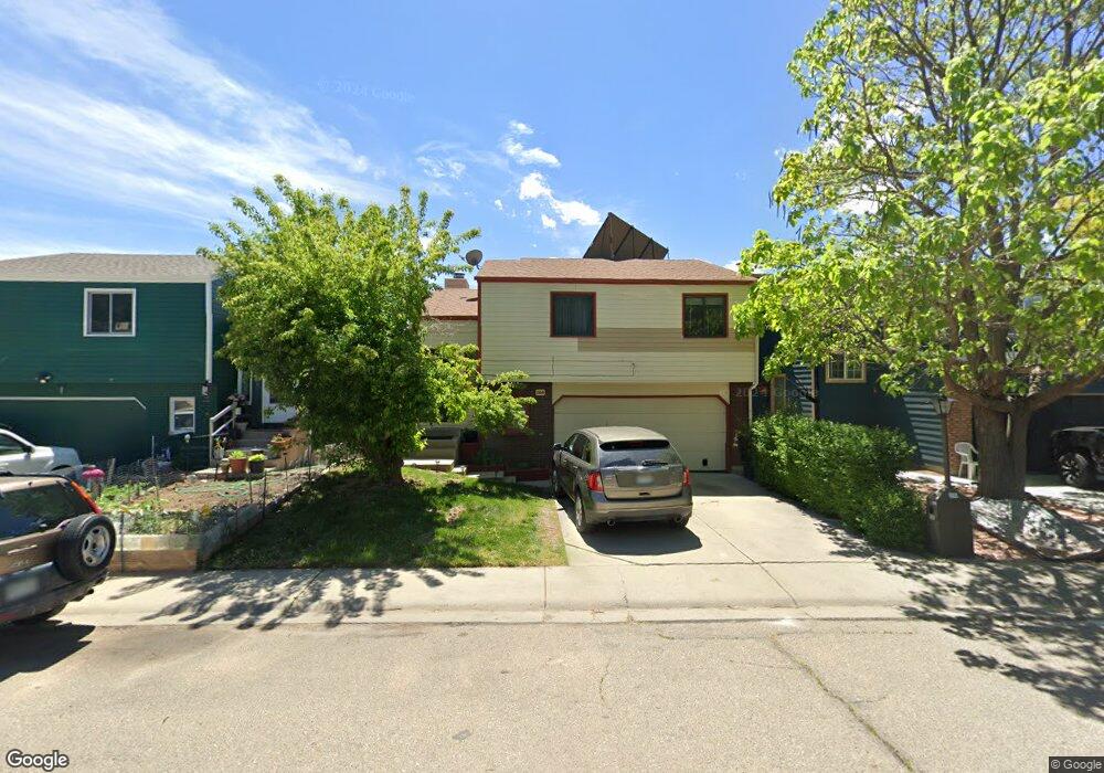
1165 Longdon St Longmont, CO 80501
Clark Centennial NeighborhoodEstimated Value: $405,630 - $445,000
3
Beds
2
Baths
1,455
Sq Ft
$292/Sq Ft
Est. Value
About This Home
This home is located at 1165 Longdon St, Longmont, CO 80501 and is currently estimated at $425,408, approximately $292 per square foot. 1165 Longdon St is a home located in Boulder County with nearby schools including Columbine Elementary School, Trail Ridge Middle School, and Skyline High School.
Ownership History
Date
Name
Owned For
Owner Type
Purchase Details
Closed on
Feb 23, 1996
Sold by
Gamble Brian G and Gamble Gaylene
Bought by
Quinones Cesar Rafael
Current Estimated Value
Home Financials for this Owner
Home Financials are based on the most recent Mortgage that was taken out on this home.
Original Mortgage
$107,100
Outstanding Balance
$3,532
Interest Rate
7.09%
Mortgage Type
FHA
Estimated Equity
$421,876
Purchase Details
Closed on
Dec 6, 1984
Bought by
Quinones Cesar Rafael and Quinones Elva Armeda
Purchase Details
Closed on
Jun 7, 1984
Bought by
Quinones Cesar Rafael and Quinones Elva Armeda
Purchase Details
Closed on
Jun 19, 1979
Bought by
Quinones Cesar Rafael and Quinones Elva Armeda
Create a Home Valuation Report for This Property
The Home Valuation Report is an in-depth analysis detailing your home's value as well as a comparison with similar homes in the area
Home Values in the Area
Average Home Value in this Area
Purchase History
| Date | Buyer | Sale Price | Title Company |
|---|---|---|---|
| Quinones Cesar Rafael | $108,000 | Commonwealth Land Title | |
| Quinones Cesar Rafael | $76,900 | -- | |
| Quinones Cesar Rafael | -- | -- | |
| Quinones Cesar Rafael | $300,000 | -- |
Source: Public Records
Mortgage History
| Date | Status | Borrower | Loan Amount |
|---|---|---|---|
| Open | Quinones Cesar Rafael | $107,100 |
Source: Public Records
Tax History Compared to Growth
Tax History
| Year | Tax Paid | Tax Assessment Tax Assessment Total Assessment is a certain percentage of the fair market value that is determined by local assessors to be the total taxable value of land and additions on the property. | Land | Improvement |
|---|---|---|---|---|
| 2025 | $1,811 | $21,550 | $4,850 | $16,700 |
| 2024 | $1,811 | $21,550 | $4,850 | $16,700 |
| 2023 | $1,786 | $18,928 | $5,313 | $17,299 |
| 2022 | $2,019 | $20,398 | $3,843 | $16,555 |
| 2021 | $2,045 | $20,985 | $3,954 | $17,031 |
| 2020 | $1,782 | $18,340 | $3,861 | $14,479 |
| 2019 | $1,753 | $18,340 | $3,861 | $14,479 |
| 2018 | $1,439 | $15,149 | $3,816 | $11,333 |
| 2017 | $1,419 | $16,748 | $4,219 | $12,529 |
| 2016 | $1,249 | $13,062 | $3,582 | $9,480 |
| 2015 | $1,190 | $10,515 | $3,343 | $7,172 |
| 2014 | $982 | $10,515 | $3,343 | $7,172 |
Source: Public Records
Map
Nearby Homes
- 1211 Meadow St
- 1226 Atwood St
- 1147 Emery St
- 845 Martin St
- 342 9th Ave
- 936 Kimbark St Unit 4
- 10 Juneau Place
- 836 Emery St
- 823 Collyer St
- 830 Emery St
- 147 Dawson Place
- 1430 Lashley St
- 1514 Collyer St
- 117 Valentine Ln
- 727 Baker St
- 820 Kimbark St Unit D
- 736 Kimbark St
- 641 Martin St
- 1310 Hilltop Dr
- 50 Forsyth Dr