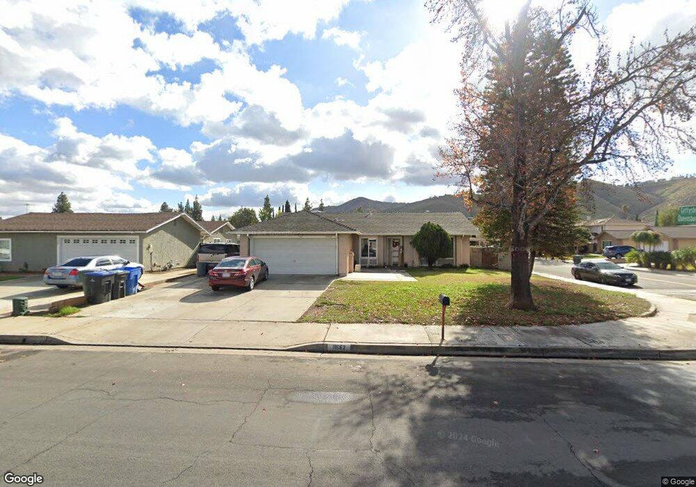
11662 Queensborough St Riverside, CA 92503
La Sierra South NeighborhoodEstimated Value: $644,000 - $660,495
3
Beds
2
Baths
1,620
Sq Ft
$401/Sq Ft
Est. Value
About This Home
This home is located at 11662 Queensborough St, Riverside, CA 92503 and is currently estimated at $649,124, approximately $400 per square foot. 11662 Queensborough St is a home located in Riverside County with nearby schools including Alan Orrenmaa Elementary School, Arizona Middle School, and Hillcrest High School.
Ownership History
Date
Name
Owned For
Owner Type
Purchase Details
Closed on
Oct 25, 2007
Sold by
Pons Miguel
Bought by
Murillo Mariel
Current Estimated Value
Purchase Details
Closed on
Jul 28, 1999
Sold by
Kaus Douglas E and Kaus Jo Karen
Bought by
Pons Miguel and Murillo Mariel
Home Financials for this Owner
Home Financials are based on the most recent Mortgage that was taken out on this home.
Original Mortgage
$148,009
Outstanding Balance
$42,234
Interest Rate
7.56%
Mortgage Type
FHA
Estimated Equity
$606,890
Create a Home Valuation Report for This Property
The Home Valuation Report is an in-depth analysis detailing your home's value as well as a comparison with similar homes in the area
Home Values in the Area
Average Home Value in this Area
Purchase History
| Date | Buyer | Sale Price | Title Company |
|---|---|---|---|
| Murillo Mariel | -- | None Available | |
| Pons Miguel | $149,000 | American Title |
Source: Public Records
Mortgage History
| Date | Status | Borrower | Loan Amount |
|---|---|---|---|
| Open | Pons Miguel | $148,009 |
Source: Public Records
Tax History Compared to Growth
Tax History
| Year | Tax Paid | Tax Assessment Tax Assessment Total Assessment is a certain percentage of the fair market value that is determined by local assessors to be the total taxable value of land and additions on the property. | Land | Improvement |
|---|---|---|---|---|
| 2025 | $2,698 | $228,976 | $61,463 | $167,513 |
| 2023 | $2,698 | $220,086 | $59,077 | $161,009 |
| 2022 | $2,495 | $215,771 | $57,919 | $157,852 |
| 2021 | $2,462 | $211,541 | $56,784 | $154,757 |
| 2020 | $2,422 | $209,373 | $56,202 | $153,171 |
| 2019 | $2,390 | $205,268 | $55,100 | $150,168 |
| 2018 | $2,355 | $201,244 | $54,020 | $147,224 |
| 2017 | $2,311 | $197,299 | $52,961 | $144,338 |
| 2016 | $2,272 | $193,431 | $51,923 | $141,508 |
| 2015 | $2,237 | $190,528 | $51,144 | $139,384 |
| 2014 | $2,228 | $186,798 | $50,144 | $136,654 |
Source: Public Records
Map
Nearby Homes
- 3570 Gettysburg Dr
- 3526 Fillmore St
- 11868 National Dr
- 11485 Queensborough St
- 3567 Ganador Ct
- 3370 Fanwood Ct
- 3701 Fillmore St Unit 71
- 3400 Glasgow Cir
- 0 Rancho Corto Dr
- 12149 Indiana Ave Unit 18
- 12149 Indiana Ave Unit 95
- 3663 Buchanan St Unit 110
- 3663 Buchanan St Unit 90
- 3663 Buchanan St Unit 106
- 3663 Buchanan St Unit 15
- 3663 Buchanan St Unit 154
- 11499 Bridgeway Dr
- 3886 New Haven Dr
- 11140 Montlake Dr
- 3883 Buchanan St Unit 133
- 11652 Queensborough St
- 3579 Gettysburg Dr
- 11642 Queensborough St
- 3590 Gettysburg Dr
- 3569 Gettysburg Dr
- 3598 Gettysburg Dr
- 3580 Gettysburg Dr
- 3568 Philadelphia Ct
- 11667 Queensborough St
- 3578 Philadelphia Ct
- 3559 Gettysburg Dr
- 11677 Queensborough St
- 11687 Queensborough St
- 11647 Queensborough St
- 3596 Philadelphia Ct
- 3588 Philadelphia Ct
- 3591 Gwinnett Dr
- 3599 Gwinnett Dr
- 3558 Philadelphia Ct
- 11637 Queensborough St