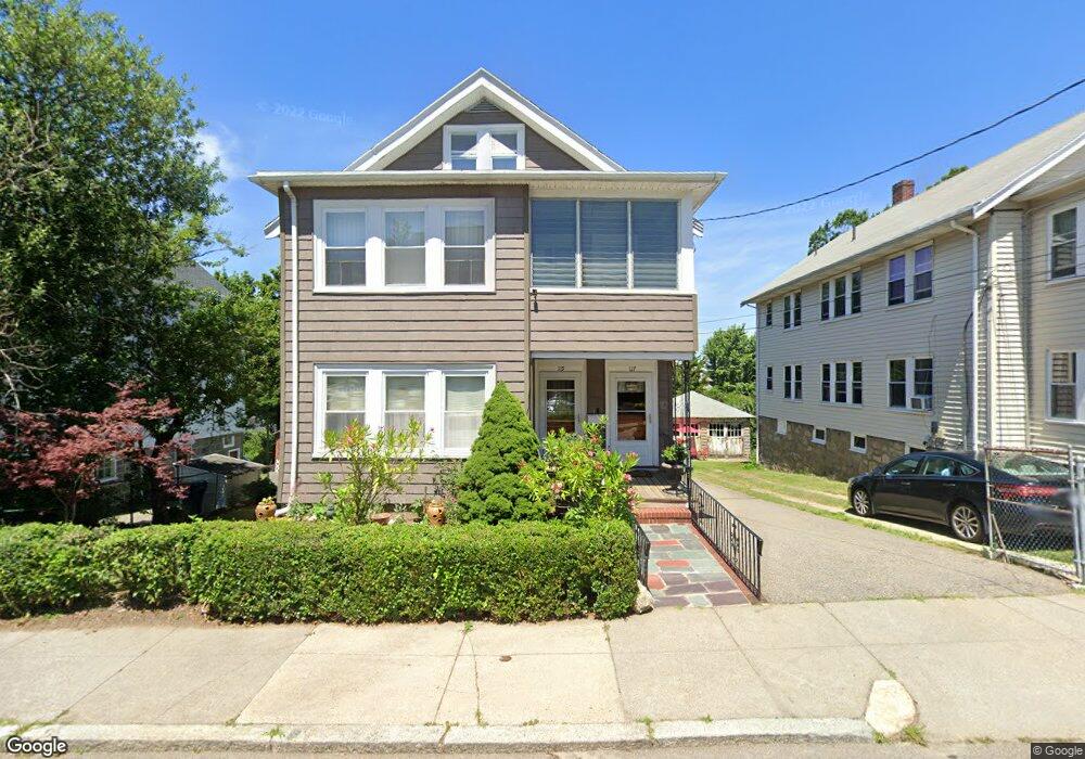
117 Augustus Ave Unit 119 Roslindale, MA 02131
Roslindale NeighborhoodEstimated Value: $693,000 - $1,020,000
5
Beds
2
Baths
1,840
Sq Ft
$456/Sq Ft
Est. Value
About This Home
This home is located at 117 Augustus Ave Unit 119, Roslindale, MA 02131 and is currently estimated at $839,242, approximately $456 per square foot. 117 Augustus Ave Unit 119 is a home located in Suffolk County with nearby schools including Brooke Charter School Roslindale, Sacred Heart STEM School, and St. Clare High School.
Ownership History
Date
Name
Owned For
Owner Type
Purchase Details
Closed on
May 30, 2012
Sold by
Siconolifi Santina
Bought by
Siconolifi Nadia and Siconolifi Pasqualino
Current Estimated Value
Home Financials for this Owner
Home Financials are based on the most recent Mortgage that was taken out on this home.
Original Mortgage
$200,000
Outstanding Balance
$99,566
Interest Rate
4.01%
Estimated Equity
$739,676
Create a Home Valuation Report for This Property
The Home Valuation Report is an in-depth analysis detailing your home's value as well as a comparison with similar homes in the area
Home Values in the Area
Average Home Value in this Area
Purchase History
| Date | Buyer | Sale Price | Title Company |
|---|---|---|---|
| Siconolifi Nadia | -- | -- |
Source: Public Records
Mortgage History
| Date | Status | Borrower | Loan Amount |
|---|---|---|---|
| Open | Siconolifi Nadia | $200,000 |
Source: Public Records
Tax History Compared to Growth
Tax History
| Year | Tax Paid | Tax Assessment Tax Assessment Total Assessment is a certain percentage of the fair market value that is determined by local assessors to be the total taxable value of land and additions on the property. | Land | Improvement |
|---|---|---|---|---|
| 2025 | $8,303 | $717,000 | $270,100 | $446,900 |
| 2024 | $7,464 | $684,800 | $261,500 | $423,300 |
| 2023 | $7,071 | $658,400 | $251,400 | $407,000 |
| 2022 | $6,513 | $598,600 | $228,600 | $370,000 |
| 2021 | $6,261 | $586,800 | $224,100 | $362,700 |
| 2020 | $5,547 | $525,300 | $201,900 | $323,400 |
| 2019 | $5,235 | $496,700 | $177,400 | $319,300 |
| 2018 | $4,911 | $468,600 | $177,400 | $291,200 |
| 2017 | $4,864 | $459,300 | $177,400 | $281,900 |
| 2016 | $4,677 | $425,200 | $177,400 | $247,800 |
| 2015 | $4,380 | $361,700 | $160,800 | $200,900 |
| 2014 | $4,062 | $322,900 | $160,800 | $162,100 |
Source: Public Records
Map
Nearby Homes
- 69 Metropolitan Ave
- 5 7 Hemman St
- 55 Metropolitan Ave
- 142 Metropolitan Ave Unit A
- 295 Kittredge St
- 124 Glendower Rd Unit 2
- 89 Glendower Rd
- 34 Averton St
- 0 Averton St
- 75 Glendower Rd
- 25 Crandall St
- 142 Birch St
- 142 Birch St Unit 1
- 142 Birch St Unit 2
- 276 Cornell St
- 67 Hautevale St
- 112 Roslindale Ave Unit 2
- 250 Poplar St Unit 1
- 80 Roslindale Ave Unit 3
- 415 Poplar St
- 119 Augustus Ave
- 121 Augustus Ave Unit 123
- 121-123 Augustus Ave Unit 3
- 111 Augustus Ave Unit 115
- 123 Augustus Ave Unit 2
- 123 Augustus Ave
- 123 Augustus Ave Unit A
- 6 Kittredge Ct
- 2 Ethel St
- 2 Ethel St Unit 1
- 188 Kittredge St
- 180 Kittredge St
- 1 Ethel St
- 107 Augustus Ave
- 182 Kittedge Unit B
- 182 Kittredge St Unit B
- 182 Kittredge St Unit 1
- 182 Kittredge St Unit 2
- 3 Ethel St
- 192 Kittredge St