Estimated Value: $263,000 - $320,000
4
Beds
2
Baths
1,210
Sq Ft
$239/Sq Ft
Est. Value
About This Home
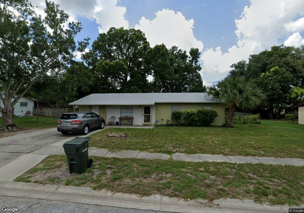
This home is located at 117 Burnt Tree Ct, Ocoee, FL 34761 and is currently estimated at $289,403, approximately $239 per square foot. 117 Burnt Tree Ct is a home located in Orange County with nearby schools including Ocoee Elementary School, Ocoee Middle School, and Ocoee High School.
Ownership History
Date
Name
Owned For
Owner Type
Purchase Details
Closed on
Aug 1, 2017
Bought by
Kountz Frederick
Current Estimated Value
Purchase Details
Closed on
Jun 7, 2004
Sold by
Linzey Pamela
Bought by
Kountz Frederick
Purchase Details
Closed on
Aug 4, 1995
Sold by
Durrance Sonia W and Barrett Sonia W
Bought by
Kountz Fredrick A and Kountz Pamela S
Home Financials for this Owner
Home Financials are based on the most recent Mortgage that was taken out on this home.
Original Mortgage
$64,668
Interest Rate
7.42%
Mortgage Type
VA
Create a Home Valuation Report for This Property
The Home Valuation Report is an in-depth analysis detailing your home's value as well as a comparison with similar homes in the area
Home Values in the Area
Average Home Value in this Area
Purchase History
| Date | Buyer | Sale Price | Title Company |
|---|---|---|---|
| Kountz Frederick | $100 | -- | |
| Kountz Frederick | -- | -- | |
| Kountz Fredrick A | $63,400 | -- |
Source: Public Records
Mortgage History
| Date | Status | Borrower | Loan Amount |
|---|---|---|---|
| Previous Owner | Kountz Fredrick A | $64,668 |
Source: Public Records
Tax History
| Year | Tax Paid | Tax Assessment Tax Assessment Total Assessment is a certain percentage of the fair market value that is determined by local assessors to be the total taxable value of land and additions on the property. | Land | Improvement |
|---|---|---|---|---|
| 2025 | $1,140 | $64,411 | -- | -- |
| 2024 | $962 | $62,596 | -- | -- |
| 2023 | $962 | $59,060 | $0 | $0 |
| 2022 | $933 | $57,340 | $0 | $0 |
| 2021 | $930 | $55,670 | $0 | $0 |
| 2020 | $891 | $54,901 | $0 | $0 |
| 2019 | $926 | $53,667 | $0 | $0 |
| 2018 | $918 | $52,666 | $0 | $0 |
| 2017 | $919 | $77,173 | $18,000 | $59,173 |
| 2016 | $925 | $64,469 | $7,000 | $57,469 |
| 2015 | $935 | $62,539 | $7,000 | $55,539 |
| 2014 | $929 | $51,305 | $7,000 | $44,305 |
Source: Public Records
Map
Nearby Homes
- 28 Rewis St
- 600 Hill Ave
- 1079 N Lakewood Ave
- 20 Rewis St
- 632 Cardinal St
- 1102 Bellini Ln
- 12 Lee St
- 1236 Russell Dr
- 314 15th Ave
- 314 Wurst Rd
- 702 Carmen Dr
- 319 W Silver Star Rd
- 1500 Adair St
- 503 Apricot Dr
- 601 Catwood Dr
- 905 Spring Creek Dr
- 1301 Pinewood Ln
- 1311 Olympia Park Cir
- 1100 Malcom Rd
- 0 E Silver Star Rd
- 115 Burnt Tree Ct
- 119 Burnt Tree Ct
- 156 Mobile Ln
- 140 Mobile Ln
- 138 Mobile Ln
- 142 Mobile Ln
- 144 Mobile Ln
- 112 Burnt Tree Ct
- 134 Mobile Ln
- 146 Mobile Ln
- 110 Burnt Tree Ct
- 114 Burnt Tree Ct
- 113 Burnt Tree Ct
- 121 Burnt Tree Ct
- 148 Mobile Ln
- 130 Mobile Ln
- 108 Burnt Tree Ct
- 116 Burnt Tree Ct
- 141 Mobile Ln
- 150 Mobile Ln
Your Personal Tour Guide
Ask me questions while you tour the home.