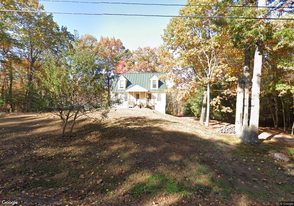
117 Lindsey Way Goffstown, NH 03045
Estimated Value: $493,914 - $540,000
3
Beds
2
Baths
1,685
Sq Ft
$309/Sq Ft
Est. Value
About This Home
This home is located at 117 Lindsey Way, Goffstown, NH 03045 and is currently estimated at $521,479, approximately $309 per square foot. 117 Lindsey Way is a home located in Hillsborough County with nearby schools including Mountain View Middle School and Goffstown High School.
Ownership History
Date
Name
Owned For
Owner Type
Purchase Details
Closed on
Sep 9, 2008
Sold by
Sirva Relocation Cred
Bought by
Dresser Bradlee F and Dresser Renee M
Current Estimated Value
Home Financials for this Owner
Home Financials are based on the most recent Mortgage that was taken out on this home.
Original Mortgage
$240,563
Interest Rate
6.69%
Mortgage Type
Purchase Money Mortgage
Purchase Details
Closed on
Apr 3, 2000
Sold by
Scarlett Homes Inc
Bought by
Simmonds Edward P and Simmonds Michelle A
Home Financials for this Owner
Home Financials are based on the most recent Mortgage that was taken out on this home.
Original Mortgage
$139,935
Interest Rate
8.4%
Create a Home Valuation Report for This Property
The Home Valuation Report is an in-depth analysis detailing your home's value as well as a comparison with similar homes in the area
Home Values in the Area
Average Home Value in this Area
Purchase History
| Date | Buyer | Sale Price | Title Company |
|---|---|---|---|
| Dresser Bradlee F | $235,500 | -- | |
| Simmonds Edward P | $147,300 | -- |
Source: Public Records
Mortgage History
| Date | Status | Borrower | Loan Amount |
|---|---|---|---|
| Open | Simmonds Edward P | $232,592 | |
| Closed | Simmonds Edward P | $240,563 | |
| Previous Owner | Simmonds Edward P | $139,935 |
Source: Public Records
Tax History Compared to Growth
Tax History
| Year | Tax Paid | Tax Assessment Tax Assessment Total Assessment is a certain percentage of the fair market value that is determined by local assessors to be the total taxable value of land and additions on the property. | Land | Improvement |
|---|---|---|---|---|
| 2024 | $8,364 | $409,200 | $186,700 | $222,500 |
| 2023 | $7,718 | $409,200 | $186,700 | $222,500 |
| 2022 | $7,127 | $270,900 | $122,700 | $148,200 |
| 2021 | $6,724 | $270,900 | $122,700 | $148,200 |
| 2020 | $6,724 | $270,900 | $122,700 | $148,200 |
| 2019 | $6,659 | $270,900 | $122,700 | $148,200 |
| 2018 | $5,039 | $270,900 | $122,700 | $148,200 |
| 2017 | $6,392 | $233,100 | $102,200 | $130,900 |
| 2016 | $6,161 | $233,100 | $102,200 | $130,900 |
| 2015 | $6,232 | $221,300 | $96,100 | $125,200 |
| 2014 | $5,975 | $221,300 | $96,100 | $125,200 |
Source: Public Records
Map
Nearby Homes
- 115 Forestedge Way
- 22 Peppermint St
- 53 Rachael Cir
- 61 Woodview Way
- 163 Woodview Way Unit 2
- 16 Roger Rd
- 243 Donald Dr
- 76 Donald Dr
- 328 E Dunbarton Rd
- 11-1 Chatel Rd
- 39 Old Hackett Hill Rd Unit 3F
- 19 Country Club Dr Unit 38
- 23 Country Club Dr Unit 1023
- 1306 Goffstown Rd Unit 9
- 4 Chip St
- 4 Arabian Ct Unit B
- 5 Mustang Ct
- 75 Hackett Hill Rd Unit 15
- 1021 Goffstown Rd
- 4B Dearborn Cir
- 111 Lindsey Way
- 118 Lindsey Way
- 125 Lindsey Way
- 109 Lindsey Way
- 131 Lindsey Way
- 3 Monarch Ave
- 132 Lindsey Way
- 97 Lindsey Way
- 134 Lindsey Way
- 144 Lindsey Way
- 150 Lindsey Way
- 15 Monarch Ave
- 17 Monarch Ave
- 89 Lindsey Way
- 96 Lindsey Way
- 10 Monarch Ave
- 41 Black Brook Rd
- 00 Lindsey Way Unit M:9 B:4 L:38-1
- 00 Lindsey Way Unit Lot 4-38-2
- 83 Lindsey Way