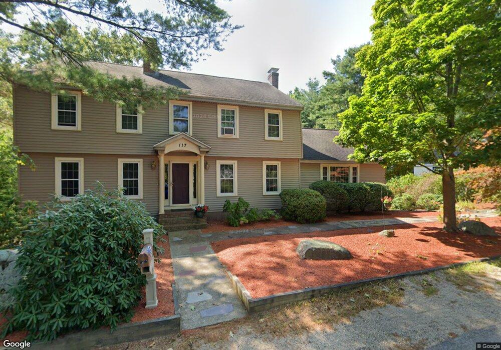
117 Little River Rd Hampton, NH 03842
Estimated Value: $899,000 - $1,062,000
3
Beds
3
Baths
3,190
Sq Ft
$314/Sq Ft
Est. Value
About This Home
This home is located at 117 Little River Rd, Hampton, NH 03842 and is currently estimated at $1,001,607, approximately $313 per square foot. 117 Little River Rd is a home located in Rockingham County with nearby schools including Hampton Centre School, Adeline C. Marston Elementary School, and Hampton Academy.
Ownership History
Date
Name
Owned For
Owner Type
Purchase Details
Closed on
Jul 12, 2018
Sold by
Bruno Barbara A and Bruno Louis F
Bought by
Louis Louis F and Louis B F
Current Estimated Value
Purchase Details
Closed on
May 15, 2002
Sold by
Trowbridge Emery H
Bought by
Buell Barbara A
Home Financials for this Owner
Home Financials are based on the most recent Mortgage that was taken out on this home.
Original Mortgage
$260,000
Interest Rate
7.15%
Purchase Details
Closed on
Aug 23, 1996
Sold by
Fields Harry L and Fields Carol A
Bought by
Trowbridge Emery H and Trowbridge Nancy L
Create a Home Valuation Report for This Property
The Home Valuation Report is an in-depth analysis detailing your home's value as well as a comparison with similar homes in the area
Home Values in the Area
Average Home Value in this Area
Purchase History
| Date | Buyer | Sale Price | Title Company |
|---|---|---|---|
| Louis Louis F | -- | -- | |
| Buell Barbara A | $360,000 | -- | |
| Trowbridge Emery H | $196,500 | -- |
Source: Public Records
Mortgage History
| Date | Status | Borrower | Loan Amount |
|---|---|---|---|
| Previous Owner | Trowbridge Emery H | $218,000 | |
| Previous Owner | Trowbridge Emery H | $240,000 | |
| Previous Owner | Trowbridge Emery H | $255,000 | |
| Previous Owner | Trowbridge Emery H | $260,000 |
Source: Public Records
Tax History Compared to Growth
Tax History
| Year | Tax Paid | Tax Assessment Tax Assessment Total Assessment is a certain percentage of the fair market value that is determined by local assessors to be the total taxable value of land and additions on the property. | Land | Improvement |
|---|---|---|---|---|
| 2024 | $9,935 | $806,400 | $254,000 | $552,400 |
| 2023 | $8,826 | $526,900 | $153,900 | $373,000 |
| 2022 | $8,346 | $526,900 | $153,900 | $373,000 |
| 2021 | $8,346 | $526,900 | $153,900 | $373,000 |
| 2020 | $8,387 | $526,500 | $153,900 | $372,600 |
| 2019 | $8,429 | $526,500 | $153,900 | $372,600 |
| 2018 | $9,118 | $535,700 | $139,900 | $395,800 |
| 2017 | $8,352 | $510,200 | $139,900 | $370,300 |
| 2016 | $8,204 | $510,200 | $139,900 | $370,300 |
Source: Public Records
Map
Nearby Homes
- 7 Hunter Dr
- 330 High St
- 22 Mace Rd
- 24 Milbern Ave
- 403 High St
- 430 High St
- 467 High St Unit 22
- 11 Carlson Rd
- 10 Mcdermott Rd
- 78 Dearborn Ave
- 223 Mill Rd
- 7 Anns Ln Unit s 1 & 2
- 3 Playhouse Cir
- 7 Moulton Rd
- 19 Rockrimmon Rd
- 182 Kings Hwy
- 10 Hemlock St Unit 3
- 190 Kings Hwy Unit A1
- 19 Juniper Ln
- 16 Briar Rd
- 119 Little River Rd
- 121 Little River Rd
- 115 Little River Rd
- 87 Little River Rd
- 114 Little River Rd
- 123 Little River Rd
- 84 Little River Rd
- 81 Woodland Rd
- 118 Little River Rd
- 93 Little River Rd
- 2 Bear Path
- 131 Little River Rd
- 5 Bear Path
- 85 Woodland Rd
- 133 Little River Rd
- 4 Dalton Rd
- 4 Dalton Ln
- 122 Little River Rd
- 126 Little River Rd
- 6 Dalton Ln