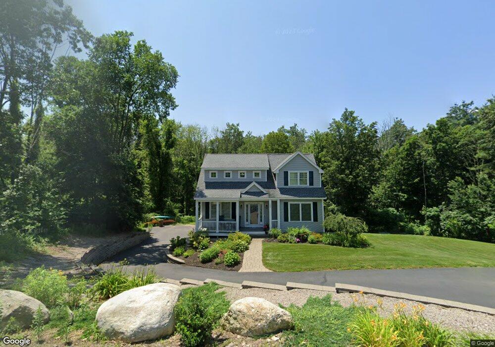
117 Main St Atkinson, NH 03811
Estimated Value: $566,000 - $814,000
3
Beds
3
Baths
2,260
Sq Ft
$303/Sq Ft
Est. Value
About This Home
This home is located at 117 Main St, Atkinson, NH 03811 and is currently estimated at $685,630, approximately $303 per square foot. 117 Main St is a home located in Rockingham County with nearby schools including Atkinson Academy, Timberlane Regional Middle School, and Timberlane Regional High School.
Ownership History
Date
Name
Owned For
Owner Type
Purchase Details
Closed on
Jun 17, 2021
Sold by
Rumfelt Paula G and Rumfelt Lori A
Bought by
Rumfelt Ft
Current Estimated Value
Purchase Details
Closed on
Jun 28, 2005
Sold by
Herbert Gary L and Herbert Linda E
Bought by
Lincmark Rt
Home Financials for this Owner
Home Financials are based on the most recent Mortgage that was taken out on this home.
Original Mortgage
$200,000
Interest Rate
5.82%
Mortgage Type
Purchase Money Mortgage
Create a Home Valuation Report for This Property
The Home Valuation Report is an in-depth analysis detailing your home's value as well as a comparison with similar homes in the area
Home Values in the Area
Average Home Value in this Area
Purchase History
| Date | Buyer | Sale Price | Title Company |
|---|---|---|---|
| Rumfelt Ft | -- | None Available | |
| Lincmark Rt | $285,100 | -- |
Source: Public Records
Mortgage History
| Date | Status | Borrower | Loan Amount |
|---|---|---|---|
| Previous Owner | Lincmark Rt | $200,000 |
Source: Public Records
Tax History Compared to Growth
Tax History
| Year | Tax Paid | Tax Assessment Tax Assessment Total Assessment is a certain percentage of the fair market value that is determined by local assessors to be the total taxable value of land and additions on the property. | Land | Improvement |
|---|---|---|---|---|
| 2024 | $5,845 | $452,400 | $135,500 | $316,900 |
| 2023 | $6,560 | $452,400 | $135,500 | $316,900 |
| 2022 | $5,551 | $452,400 | $135,500 | $316,900 |
| 2021 | $5,587 | $452,000 | $135,500 | $316,500 |
| 2020 | $6,428 | $350,500 | $120,300 | $230,200 |
| 2019 | $6,193 | $350,500 | $120,300 | $230,200 |
| 2018 | $6,284 | $350,500 | $120,300 | $230,200 |
| 2017 | $6,215 | $339,600 | $120,300 | $219,300 |
| 2016 | $6,072 | $339,600 | $120,300 | $219,300 |
| 2015 | $1,486 | $77,800 | $77,800 | $0 |
| 2014 | $2,374 | $124,300 | $124,300 | $0 |
| 2013 | $2,362 | $124,300 | $124,300 | $0 |
Source: Public Records
Map
Nearby Homes
- 9 Hickory Pond Ln Unit 9
- 15 Marilyn Dr
- 22 Knightland Rd
- 132 Maple Ave
- 27 Village Dr
- 3 Knightland Rd
- 4 Huckleberry Ln
- 7 Stevens Ct Unit 7
- 7 Stevens Ct
- 127 Cowbell Crossing
- 52 Academy Ave
- 11 Sleepy Hollow Rd
- 10 Old Coach Rd
- 63 Main St
- 41 Westside Dr
- 7 Oak Ridge Dr
- Lot 11 Crown Hill Rd
- 2 Devonshire Rd
- 19 Crown Hill Rd
- 2 N Broadway
- 119 Main St
- 119 Main St
- 115 Main St
- 9 Wright Farm Rd
- 11 Wright Farm Rd
- Lot 9 Page Farm
- 3 Pages Ln
- 121 Main St
- 5 Hickory Pond Ln
- Lot 54 Page Farm
- 121 Main Street Route 121
- Lot 5 Page Farm Unit 87-5
- 7 Hickory Pond Ln
- Lot 6 Page Farm
- Lot 6 Page Farm Unit 6
- 7 Pages Ln
- 9 Hickory Pond Ln
- 20 Edmund Cir
- 18 Edmund Cir
- 18 Edmund Cir Unit 61