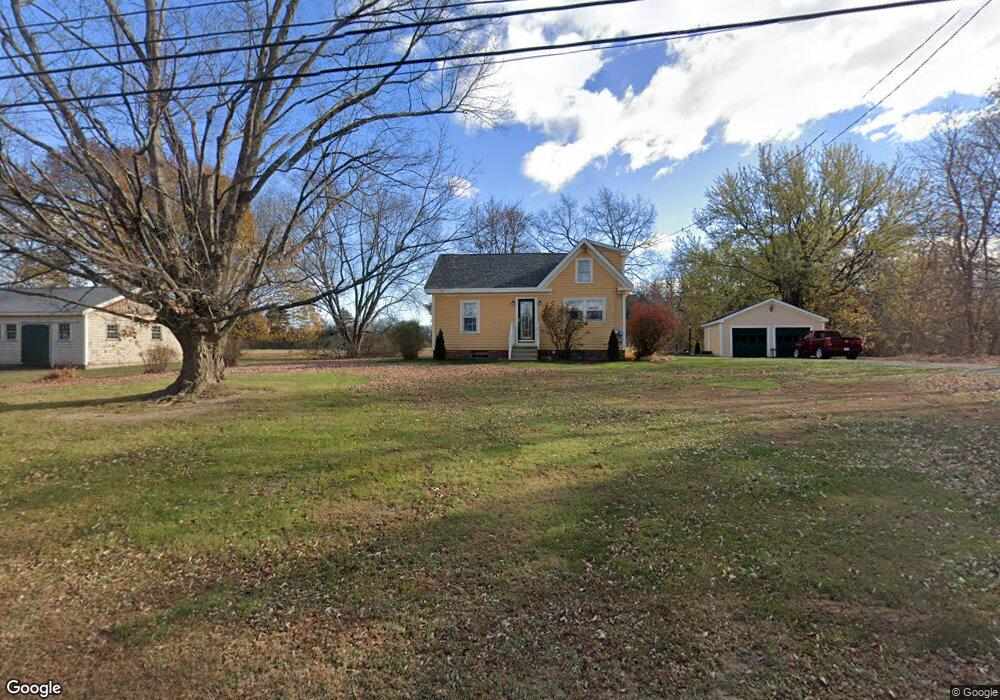
117 Main St Salisbury, MA 01952
Estimated Value: $420,446 - $614,000
2
Beds
1
Bath
1,075
Sq Ft
$496/Sq Ft
Est. Value
About This Home
This home is located at 117 Main St, Salisbury, MA 01952 and is currently estimated at $533,112, approximately $495 per square foot. 117 Main St is a home located in Essex County with nearby schools including Triton Regional High School and Amesbury Seventh-Day Adventist School.
Ownership History
Date
Name
Owned For
Owner Type
Purchase Details
Closed on
Oct 17, 1997
Sold by
Est Chaples Catherine and Sweenie June
Bought by
Tindle Rt and Tindle Robert F
Current Estimated Value
Purchase Details
Closed on
Jun 28, 1991
Sold by
Bourdreau William L
Bought by
Phillips James R
Create a Home Valuation Report for This Property
The Home Valuation Report is an in-depth analysis detailing your home's value as well as a comparison with similar homes in the area
Home Values in the Area
Average Home Value in this Area
Purchase History
| Date | Buyer | Sale Price | Title Company |
|---|---|---|---|
| Tindle Rt | $120,000 | -- | |
| Phillips James R | $119,000 | -- |
Source: Public Records
Mortgage History
| Date | Status | Borrower | Loan Amount |
|---|---|---|---|
| Open | Phillips James R | $83,200 | |
| Closed | Phillips James R | $25,000 | |
| Closed | Phillips James R | $114,000 |
Source: Public Records
Tax History Compared to Growth
Tax History
| Year | Tax Paid | Tax Assessment Tax Assessment Total Assessment is a certain percentage of the fair market value that is determined by local assessors to be the total taxable value of land and additions on the property. | Land | Improvement |
|---|---|---|---|---|
| 2025 | $3,639 | $361,000 | $159,900 | $201,100 |
| 2024 | $3,687 | $352,800 | $159,900 | $192,900 |
| 2023 | $3,688 | $341,500 | $159,900 | $181,600 |
| 2022 | $3,459 | $310,500 | $145,300 | $165,200 |
| 2021 | $3,408 | $302,700 | $145,300 | $157,400 |
| 2020 | $3,401 | $296,800 | $147,700 | $149,100 |
| 2019 | $3,388 | $285,700 | $147,700 | $138,000 |
| 2018 | $3,300 | $280,100 | $147,700 | $132,400 |
| 2017 | $2,967 | $248,900 | $126,600 | $122,300 |
| 2016 | $2,831 | $242,600 | $120,300 | $122,300 |
| 2015 | $2,828 | $240,700 | $120,300 | $120,400 |
Source: Public Records
Map
Nearby Homes
- 53 Rabbit Rd
- 10 High St
- 7 Toll Rd
- 25 Bayberry Ln
- 22 Huntington Ave
- 270 Elm St
- 204 Elm St
- 161 Elm St Unit A
- 61 Folly Mill Rd
- 188 Lafayette Rd
- 118 Elm St
- 1 Stacey Ln
- 154 Lafayette Rd
- 106 Folly Mill Rd
- 97 Elm St
- 5 Richs Ct Unit 3
- 25 Cedar St Unit 4
- 25 Cedar St Unit 14
- 25 Cedar St Unit 7
- 25 Cedar St Unit 3