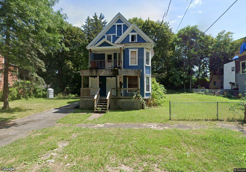
117 Malcolm St Unit 19 Syracuse, NY 13204
Near Westside NeighborhoodEstimated Value: $56,000 - $161,365
6
Beds
2
Baths
2,686
Sq Ft
$38/Sq Ft
Est. Value
About This Home
This home is located at 117 Malcolm St Unit 19, Syracuse, NY 13204 and is currently estimated at $101,455, approximately $37 per square foot. 117 Malcolm St Unit 19 is a home located in Onondaga County with nearby schools including Bellevue Elementary School, Corcoran High School, and Henninger High School.
Ownership History
Date
Name
Owned For
Owner Type
Purchase Details
Closed on
Aug 1, 2017
Sold by
Greater Syracuse Property
Bought by
Palmer Daniel
Current Estimated Value
Home Financials for this Owner
Home Financials are based on the most recent Mortgage that was taken out on this home.
Original Mortgage
$35,000
Outstanding Balance
$29,205
Interest Rate
3.96%
Mortgage Type
Purchase Money Mortgage
Estimated Equity
$72,250
Purchase Details
Closed on
Oct 3, 2016
Sold by
Hough Mary
Bought by
City Of Syracuse
Create a Home Valuation Report for This Property
The Home Valuation Report is an in-depth analysis detailing your home's value as well as a comparison with similar homes in the area
Home Values in the Area
Average Home Value in this Area
Purchase History
| Date | Buyer | Sale Price | Title Company |
|---|---|---|---|
| Palmer Daniel | $4,000 | Richard Reilly | |
| City Of Syracuse | $1,500 | Meghan E. Ryan |
Source: Public Records
Mortgage History
| Date | Status | Borrower | Loan Amount |
|---|---|---|---|
| Open | Palmer Daniel | $35,000 |
Source: Public Records
Tax History
| Year | Tax Paid | Tax Assessment Tax Assessment Total Assessment is a certain percentage of the fair market value that is determined by local assessors to be the total taxable value of land and additions on the property. | Land | Improvement |
|---|---|---|---|---|
| 2024 | $1,370 | $64,000 | $4,500 | $59,500 |
| 2023 | $1,386 | $64,000 | $4,500 | $59,500 |
| 2022 | $926 | $64,000 | $4,500 | $59,500 |
| 2021 | $926 | $20,000 | $4,500 | $15,500 |
| 2020 | $925 | $20,000 | $4,500 | $15,500 |
| 2019 | $1,471 | $20,000 | $4,500 | $15,500 |
| 2018 | $913 | $20,000 | $4,500 | $15,500 |
| 2017 | $1,060 | $20,000 | $4,500 | $15,500 |
| 2016 | $624 | $36,000 | $4,500 | $31,500 |
| 2015 | -- | $36,000 | $4,500 | $31,500 |
| 2014 | -- | $36,000 | $4,500 | $31,500 |
Source: Public Records
Map
Nearby Homes
- 944 Bellevue Ave Unit 46
- 1075 Onondaga W St
- 122 Putnam St
- 147 Coolidge Ave
- 305 Onondaga Ave
- 1000 Bellevue Ave
- 330 Holland St Unit 32
- 243 Palmer Ave
- 321 Rich St
- 325 Rich St
- 412 Rich St
- 231 Kellogg St
- 419 Rich St
- 509 Delaware St Unit 511
- 226 Sabine St
- 806 Tallman St
- 320 Hubbell Ave
- 600 South Ave
- 113 White St
- 455 Rich St
- 123 Malcolm St
- 113 Malcolm St
- 111 Malcolm St
- 810 Bellevue Ave
- 810 Bellevue Ave Unit A
- 810 Bellevue Ave Unit 2
- 116 Malcolm St
- 118 Malcolm St
- 109 Malcolm St
- 909 W Onondaga St
- 903 W Onondaga St
- 114 Malcolm St
- 112 Malcolm St
- 105 Malcolm St
- 915 W Onondaga St
- 921 W Onondaga St
- 910 Bellevue Ave
- 100 Summit Ave
- 925 W Onondaga St
- 120 Onondaga Ave
Your Personal Tour Guide
Ask me questions while you tour the home.