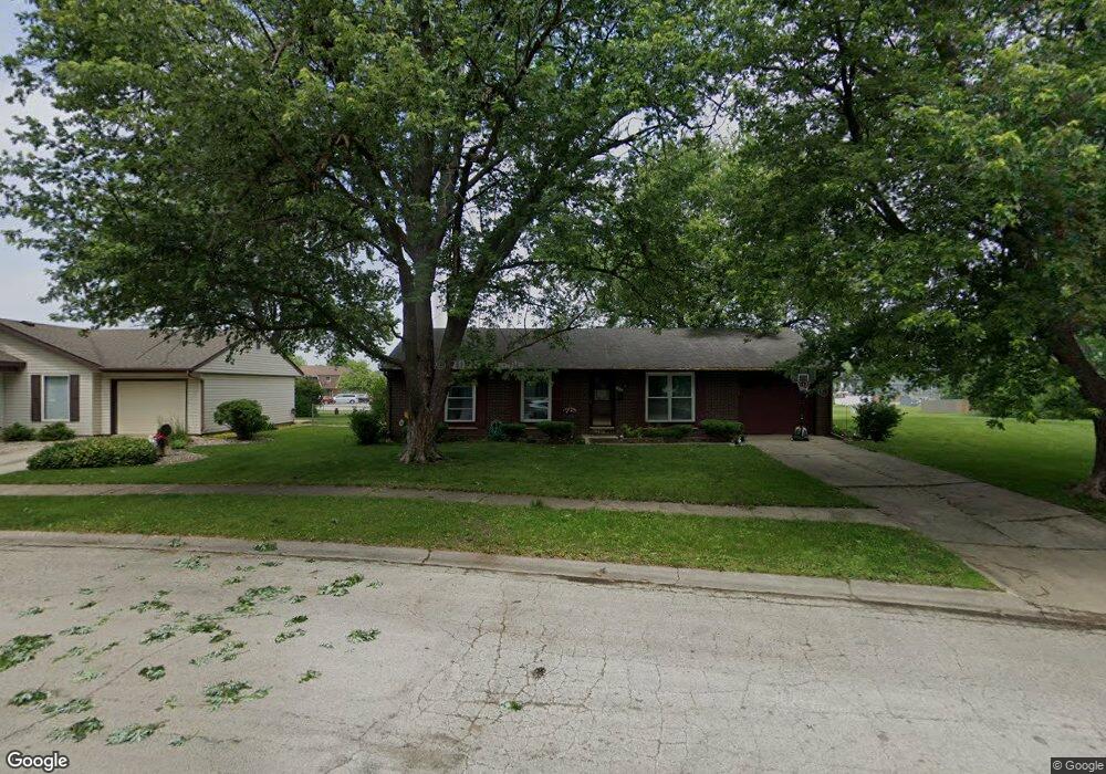
117 Meadows Ct Bourbonnais, IL 60914
Estimated Value: $194,135 - $222,000
3
Beds
1
Bath
1,025
Sq Ft
$207/Sq Ft
Est. Value
About This Home
This home is located at 117 Meadows Ct, Bourbonnais, IL 60914 and is currently estimated at $212,284, approximately $207 per square foot. 117 Meadows Ct is a home located in Kankakee County with nearby schools including Shabbona Elementary School, Liberty Intermediate School, and Bourbonnais Upper Grade Center.
Ownership History
Date
Name
Owned For
Owner Type
Purchase Details
Closed on
Jun 19, 2009
Sold by
Colvin Gary L and Colvin Barbara A
Bought by
Basile Angela
Current Estimated Value
Home Financials for this Owner
Home Financials are based on the most recent Mortgage that was taken out on this home.
Original Mortgage
$122,100
Outstanding Balance
$80,132
Interest Rate
5.5%
Mortgage Type
FHA
Estimated Equity
$132,152
Create a Home Valuation Report for This Property
The Home Valuation Report is an in-depth analysis detailing your home's value as well as a comparison with similar homes in the area
Home Values in the Area
Average Home Value in this Area
Purchase History
| Date | Buyer | Sale Price | Title Company |
|---|---|---|---|
| Basile Angela | $127,000 | Homestar Title |
Source: Public Records
Mortgage History
| Date | Status | Borrower | Loan Amount |
|---|---|---|---|
| Open | Basile Angela | $122,100 |
Source: Public Records
Tax History
| Year | Tax Paid | Tax Assessment Tax Assessment Total Assessment is a certain percentage of the fair market value that is determined by local assessors to be the total taxable value of land and additions on the property. | Land | Improvement |
|---|---|---|---|---|
| 2024 | $3,839 | $52,351 | $6,562 | $45,789 |
| 2023 | $3,494 | $48,473 | $6,076 | $42,397 |
| 2022 | $3,324 | $44,775 | $5,856 | $38,919 |
| 2021 | $3,133 | $42,326 | $5,727 | $36,599 |
| 2020 | $3,046 | $40,636 | $5,574 | $35,062 |
| 2019 | $2,914 | $38,786 | $5,412 | $33,374 |
| 2018 | $2,815 | $37,568 | $5,332 | $32,236 |
| 2017 | $2,751 | $36,652 | $5,202 | $31,450 |
| 2016 | $2,670 | $35,803 | $5,125 | $30,678 |
| 2015 | $2,644 | $35,147 | $5,074 | $30,073 |
| 2014 | $2,539 | $35,147 | $5,074 | $30,073 |
| 2013 | -- | $36,250 | $5,074 | $31,176 |
Source: Public Records
Map
Nearby Homes
- 206 Meadows Rd S
- 1063 Yale Ave
- 273 Harvard Ave
- 15 Hanson Dr
- 9 Hilltop Dr
- 261 Mohawk Dr
- 530 Meadows Rd S
- 22 Emery Dr
- 16 Kim Dr
- 54 Bonds Dr
- Lot 5 Larry Power Rd
- 1565 Stefanie Ln
- 899 Armour Rd
- 172 Anita Dr
- 675 Washington Ave
- 703 Heritage Dr
- 1356 Eagle Bluff Dr
- 292 Ashley Ave
- 817 Stonewall Dr
- 250 N Levasseur Ave
- 113 Meadows Ct
- 121 Meadows Ct
- 109 Meadows Ct
- 110 Meadows Ct
- 217 Harvard Ave
- 125 Meadows Ct
- 213 Harvard Ave
- 114 Meadows Ct
- 221 Harvard Ave
- 124 Meadows Ct
- 101 Meadows Rd S
- 122 Meadows Ct
- 119 Meadows Rd S
- 205 Harvard Ave
- 209 Harvard Ave
- 123 Meadows Rd S
- 127 Meadows Rd S
- 206 Meadows Rd N
- 131 Meadows Rd S
- 225 Harvard Ave
Your Personal Tour Guide
Ask me questions while you tour the home.