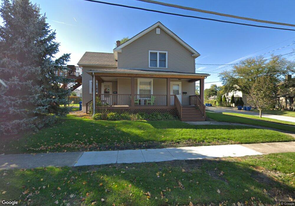
117 N 6th Ave Saint Charles, IL 60174
Southeast Saint Charles NeighborhoodEstimated Value: $343,000 - $399,000
--
Bed
--
Bath
1,667
Sq Ft
$225/Sq Ft
Est. Value
About This Home
This home is located at 117 N 6th Ave, Saint Charles, IL 60174 and is currently estimated at $375,249, approximately $225 per square foot. 117 N 6th Ave is a home located in Kane County with nearby schools including Lincoln Elementary School, Thompson Middle School, and St Charles East High School.
Ownership History
Date
Name
Owned For
Owner Type
Purchase Details
Closed on
Mar 2, 1998
Sold by
Siblik Jeff C
Bought by
Siblik Jeff C and Siblik Lisa C
Current Estimated Value
Home Financials for this Owner
Home Financials are based on the most recent Mortgage that was taken out on this home.
Original Mortgage
$123,700
Interest Rate
7.23%
Create a Home Valuation Report for This Property
The Home Valuation Report is an in-depth analysis detailing your home's value as well as a comparison with similar homes in the area
Home Values in the Area
Average Home Value in this Area
Purchase History
| Date | Buyer | Sale Price | Title Company |
|---|---|---|---|
| Siblik Jeff C | -- | First American Title Ins Co |
Source: Public Records
Mortgage History
| Date | Status | Borrower | Loan Amount |
|---|---|---|---|
| Closed | Siblik Jeff C | $123,700 |
Source: Public Records
Tax History Compared to Growth
Tax History
| Year | Tax Paid | Tax Assessment Tax Assessment Total Assessment is a certain percentage of the fair market value that is determined by local assessors to be the total taxable value of land and additions on the property. | Land | Improvement |
|---|---|---|---|---|
| 2024 | $6,624 | $89,235 | $26,068 | $63,167 |
| 2023 | $6,392 | $79,866 | $23,331 | $56,535 |
| 2022 | $6,463 | $80,042 | $25,825 | $54,217 |
| 2021 | $5,936 | $72,779 | $21,099 | $51,680 |
| 2020 | $5,878 | $71,422 | $20,706 | $50,716 |
| 2019 | $5,778 | $70,008 | $20,296 | $49,712 |
| 2018 | $5,381 | $64,879 | $19,525 | $45,354 |
| 2017 | $5,093 | $60,780 | $18,856 | $41,924 |
| 2016 | $5,258 | $57,558 | $18,194 | $39,364 |
| 2015 | -- | $51,900 | $17,998 | $33,902 |
| 2014 | -- | $55,442 | $17,998 | $37,444 |
| 2013 | -- | $54,130 | $18,178 | $35,952 |
Source: Public Records
Map
Nearby Homes
- 907 Illinois Ave
- 530 Ohio Ave
- 10 Illinois St Unit 5A
- 50 S 1st St Unit 5D
- 308 S 12th Ave
- 402 Brownstone Dr
- 723 S 6th Ave
- 314 W Main St
- 708 S 10th Ave
- 11 Hunt Club Dr Unit 108S
- 113 S 4th St
- 1348 Adams Ct
- 301 S 4th St
- 503 Cora Ln
- 1501 Dempsey Dr
- 1034 N 5th Ave
- 1517 Dempsey Dr
- 232 Benham Ct Unit 12FL
- 615 Marion Ave
- 885 Geneva Rd
- 117 N 6th Ave Unit Upper
- 513 State Ave
- 513 State Ave
- 518 Cedar Ave
- 516 Cedar Ave
- 112 N 5th Ave
- 120 N 6th Ave
- 604 Cedar Ave
- 520 State Ave
- 614 Cedar Ave
- 608 State Ave Unit 612
- 514 State Ave
- 508 State Ave
- 15 N 6th Ave
- 116 N 7th Ave
- 117 N 5th Ave
- 111 N 5th Ave
- 111 N 5th Ave Unit F
- 20 N 5th Ave
- 414 Cedar Ave