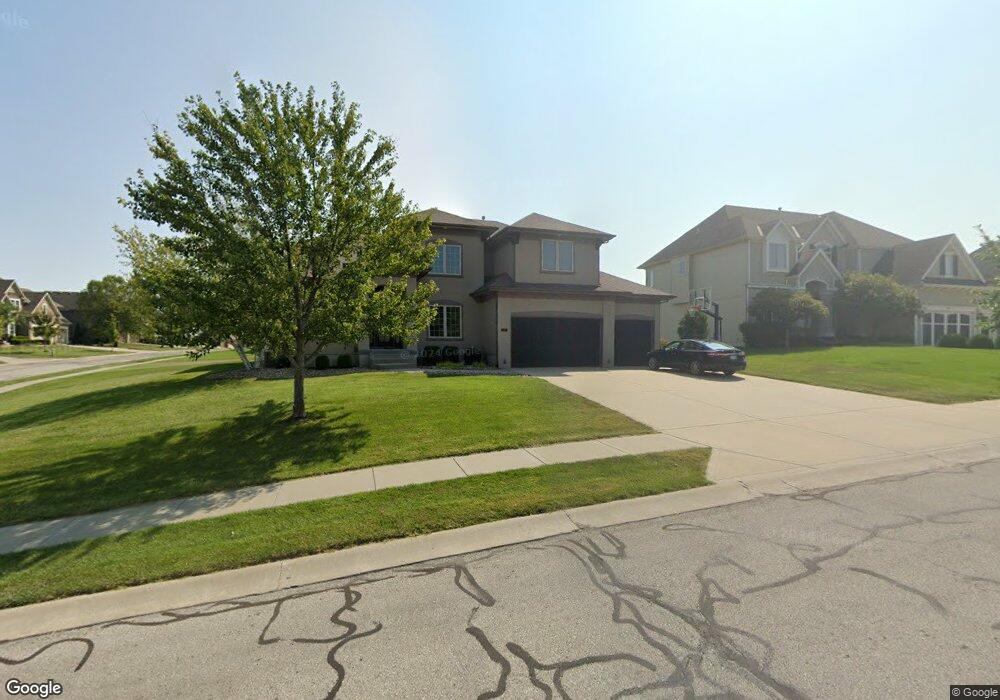
117 NW Lewis Dr Lees Summit, MO 64081
Estimated Value: $630,000 - $918,000
4
Beds
4
Baths
2,982
Sq Ft
$250/Sq Ft
Est. Value
About This Home
This home is located at 117 NW Lewis Dr, Lees Summit, MO 64081 and is currently estimated at $745,807, approximately $250 per square foot. 117 NW Lewis Dr is a home located in Jackson County with nearby schools including Cedar Creek Elementary School, Pleasant Lea Middle School, and Lee's Summit Senior High School.
Ownership History
Date
Name
Owned For
Owner Type
Purchase Details
Closed on
Jul 6, 2017
Sold by
Heenan Patrick T and Heenan Bonnie L
Bought by
Heenan Patrick T and Heenan Bonnie L
Current Estimated Value
Purchase Details
Closed on
Feb 11, 2011
Sold by
C & M Builders Inc
Bought by
Heenan Patrick T and Heenan Bonnie L
Home Financials for this Owner
Home Financials are based on the most recent Mortgage that was taken out on this home.
Original Mortgage
$150,000
Outstanding Balance
$103,031
Interest Rate
4.86%
Mortgage Type
New Conventional
Estimated Equity
$642,777
Purchase Details
Closed on
Aug 17, 2010
Sold by
Gale Communities Inc
Bought by
C & M Builders Inc
Home Financials for this Owner
Home Financials are based on the most recent Mortgage that was taken out on this home.
Original Mortgage
$371,900
Interest Rate
4.6%
Mortgage Type
Construction
Create a Home Valuation Report for This Property
The Home Valuation Report is an in-depth analysis detailing your home's value as well as a comparison with similar homes in the area
Home Values in the Area
Average Home Value in this Area
Purchase History
| Date | Buyer | Sale Price | Title Company |
|---|---|---|---|
| Heenan Patrick T | -- | None Available | |
| Heenan Patrick T | -- | Kansas City Title | |
| C & M Builders Inc | -- | Chicago |
Source: Public Records
Mortgage History
| Date | Status | Borrower | Loan Amount |
|---|---|---|---|
| Open | Heenan Patrick T | $150,000 | |
| Previous Owner | C & M Builders Inc | $371,900 |
Source: Public Records
Tax History Compared to Growth
Tax History
| Year | Tax Paid | Tax Assessment Tax Assessment Total Assessment is a certain percentage of the fair market value that is determined by local assessors to be the total taxable value of land and additions on the property. | Land | Improvement |
|---|---|---|---|---|
| 2025 | $8,359 | $121,114 | $18,721 | $102,393 |
| 2024 | $8,298 | $115,767 | $17,005 | $98,762 |
| 2023 | $8,298 | $115,767 | $18,559 | $97,208 |
| 2022 | $7,393 | $91,580 | $14,013 | $77,567 |
| 2021 | $7,546 | $91,580 | $14,013 | $77,567 |
| 2020 | $7,252 | $87,162 | $14,013 | $73,149 |
| 2019 | $7,054 | $87,162 | $14,013 | $73,149 |
| 2018 | $1,755,935 | $85,768 | $13,379 | $72,389 |
| 2017 | $7,480 | $85,768 | $13,379 | $72,389 |
| 2016 | $7,368 | $83,619 | $13,015 | $70,604 |
| 2014 | $7,343 | $81,700 | $12,160 | $69,540 |
Source: Public Records
Map
Nearby Homes
- 2704 SW Gray Ln
- Mariah Plan at Winterset Valley
- Ashland Plan at Winterset Valley
- Oakleigh Plan at Winterset Valley
- Forrester 2824 Plan at Winterset Valley
- Regency Plan at Winterset Valley
- Bentley Plan at Winterset Valley
- Forrester II Plan at Winterset Valley
- Oakshire Plan at Winterset Valley
- Windsong Plan at Winterset Valley
- Mariner II Plan at Winterset Valley
- Carolina Plan at Winterset Valley
- Mariner Plan at Winterset Valley
- Monticello Plan at Winterset Valley
- Monterey Plan at Winterset Valley
- Monterey 2655 Plan at Winterset Valley
- Oasis Plan at Winterset Valley
- Destiny Plan at Winterset Valley
- Cypress Plan at Winterset Valley
- Monticello Reverse Plan at Winterset Valley
- 113 NW Lewis Dr
- 2717 NW Olmstead Dr
- 2720 NW Olmstead Dr
- 109 NW Lewis Dr
- 116 NW Lewis Dr
- 2713 NW Olmstead Dr
- 112 NW Lewis Dr
- 120 NW Morton Ct
- 2725 NW Thoreau Dr
- 2716 NW Olmstead Dr
- 124 NW Morton Ct
- 120 NW Lewis Dr
- 105 NW Lewis Dr
- 108 NW Lewis Dr
- 2709 NW Olmstead Dr
- 2712 NW Olmstead Dr
- 2721 NW Thoreau Dr
- 2717 NW Thoreau Dr
- 117 NW Burroughs Dr
- 104 NW Lewis Dr