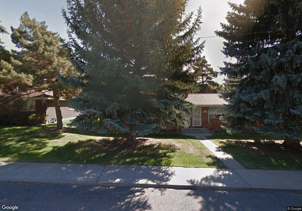
117 Pattee Creek Dr Missoula, MT 59801
Lewis and Clark NeighborhoodEstimated Value: $416,000 - $573,000
8
Beds
4
Baths
1,608
Sq Ft
$299/Sq Ft
Est. Value
About This Home
This home is located at 117 Pattee Creek Dr, Missoula, MT 59801 and is currently estimated at $480,462, approximately $298 per square foot. 117 Pattee Creek Dr is a home located in Missoula County with nearby schools including Lewis & Clark School, Washington Middle School, and Sentinel High School.
Ownership History
Date
Name
Owned For
Owner Type
Purchase Details
Closed on
Dec 16, 2022
Sold by
Schrumpf Philip K
Bought by
Knucklehead Land Company Inc
Current Estimated Value
Purchase Details
Closed on
Nov 6, 2003
Sold by
Schrumpf Clarice E
Bought by
Schrumpf Philip K
Home Financials for this Owner
Home Financials are based on the most recent Mortgage that was taken out on this home.
Original Mortgage
$131,250
Interest Rate
3.9%
Mortgage Type
New Conventional
Create a Home Valuation Report for This Property
The Home Valuation Report is an in-depth analysis detailing your home's value as well as a comparison with similar homes in the area
Home Values in the Area
Average Home Value in this Area
Purchase History
| Date | Buyer | Sale Price | Title Company |
|---|---|---|---|
| Knucklehead Land Company Inc | -- | -- | |
| Schrumpf Philip K | -- | Western Title & Escrow |
Source: Public Records
Mortgage History
| Date | Status | Borrower | Loan Amount |
|---|---|---|---|
| Previous Owner | Schrumpf Philip K | $131,250 |
Source: Public Records
Tax History Compared to Growth
Tax History
| Year | Tax Paid | Tax Assessment Tax Assessment Total Assessment is a certain percentage of the fair market value that is determined by local assessors to be the total taxable value of land and additions on the property. | Land | Improvement |
|---|---|---|---|---|
| 2025 | $4,071 | $457,100 | $215,175 | $241,925 |
| 2024 | $3,844 | $315,800 | $164,565 | $151,235 |
| 2023 | $3,765 | $315,800 | $164,565 | $151,235 |
| 2022 | $4,744 | $244,800 | $0 | $0 |
| 2021 | $2,974 | $244,800 | $0 | $0 |
| 2020 | $3,568 | $235,975 | $0 | $0 |
| 2019 | $3,602 | $235,975 | $0 | $0 |
| 2018 | $2,965 | $206,400 | $0 | $0 |
| 2017 | $2,474 | $206,400 | $0 | $0 |
| 2016 | $2,965 | $195,900 | $0 | $0 |
| 2015 | $2,780 | $195,900 | $0 | $0 |
| 2014 | $2,620 | $102,502 | $0 | $0 |
Source: Public Records
Map
Nearby Homes
- 200 Northview Dr
- 217 Dixon Ave
- 100 Pattee Canyon Dr
- 3008 Park St
- 217 Benton Ave
- 110 Hillcrest Loop
- 2711 S Higgins Ave
- 3208 Queen St
- 301 Livingston Ave
- Lot 26a South Ave W
- 116 South Ave E
- 500 Westview Dr
- 101 E Central Ave
- 109 E Central Ave
- 802 Normans Ln
- 806 Crestmont Way Unit A
- 140 Fairway Dr
- 100 Simons Dr
- 675 E Central Ave
- 612 High Park Way
- 135 Pattee Creek Dr
- 101 Pattee Creek Dr
- 101 & 105 Pattee Creek
- 136 SW Higgins Ave
- 160 Pattee Creek Dr
- 145 Pattee Creek Dr
- 148 SW Higgins Ave
- 108 Pattee Creek Dr
- 112 Pattee Creek Dr
- 104 Pattee Creek Dr
- 111 Pattee Canyon Dr
- 116 Pattee Creek Dr
- 111 Pattee Canyon #17
- 100 Pattee Creek Dr
- 111 Pattee Caynon Rd
- 153 Pattee Creek Dr
- 120 Pattee Creek Dr
- 105 SW Higgins Ave
- 158/160 S West Higgins Ave
- 158 SW Higgins Ave