Estimated Value: $256,000 - $265,000
Studio
2
Baths
1,845
Sq Ft
$140/Sq Ft
Est. Value
About This Home
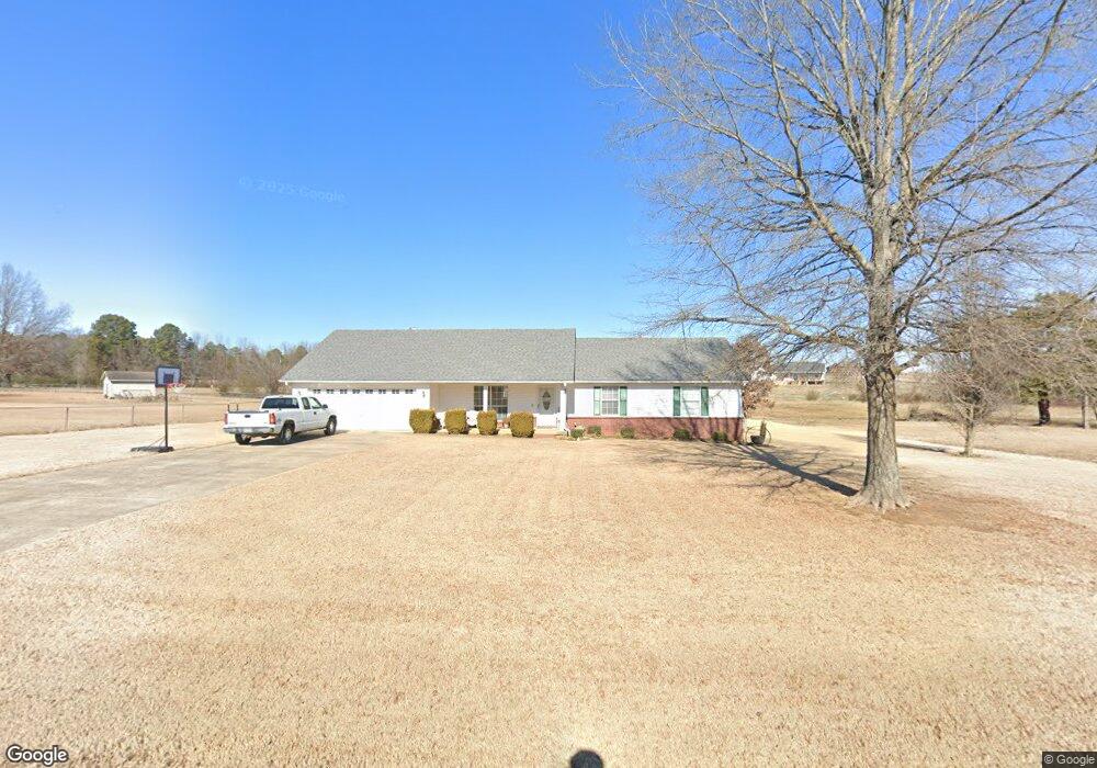
This home is located at 117 Ryan Ave, Beebe, AR 72012 and is currently estimated at $258,956, approximately $140 per square foot. 117 Ryan Ave is a home located in White County with nearby schools including Beebe Elementary School, Beebe Junior High School, and Beebe Middle School.
Ownership History
Date
Name
Owned For
Owner Type
Purchase Details
Closed on
Mar 26, 2021
Sold by
Ashley Matt and Ashley Matthew D
Bought by
Todd David and Todd Shannon
Current Estimated Value
Home Financials for this Owner
Home Financials are based on the most recent Mortgage that was taken out on this home.
Original Mortgage
$156,750
Outstanding Balance
$140,268
Interest Rate
2.73%
Mortgage Type
New Conventional
Estimated Equity
$118,688
Purchase Details
Closed on
Mar 25, 2021
Sold by
Ashley Matthew D and Ashley Anita
Bought by
Todd David and Todd Shannon
Home Financials for this Owner
Home Financials are based on the most recent Mortgage that was taken out on this home.
Original Mortgage
$156,750
Outstanding Balance
$140,268
Interest Rate
2.73%
Mortgage Type
New Conventional
Estimated Equity
$118,688
Purchase Details
Closed on
Sep 2, 2004
Bought by
Ashley
Purchase Details
Closed on
Sep 24, 2001
Bought by
Goff
Purchase Details
Closed on
Oct 4, 1996
Bought by
Allen Forrest R and Allen Ann
Create a Home Valuation Report for This Property
The Home Valuation Report is an in-depth analysis detailing your home's value as well as a comparison with similar homes in the area
Purchase History
| Date | Buyer | Sale Price | Title Company |
|---|---|---|---|
| Todd David | $165,000 | None Listed On Document | |
| Todd David | $165,000 | None Listed On Document | |
| Todd David | $165,000 | None Available | |
| Ashley | $129,000 | -- | |
| Goff | $9,000 | -- | |
| Allen Forrest R | -- | -- |
Source: Public Records
Mortgage History
| Date | Status | Borrower | Loan Amount |
|---|---|---|---|
| Open | Todd David | $156,750 | |
| Closed | Todd David | $156,750 | |
| Closed | Todd David | $156,750 |
Source: Public Records
Tax History
| Year | Tax Paid | Tax Assessment Tax Assessment Total Assessment is a certain percentage of the fair market value that is determined by local assessors to be the total taxable value of land and additions on the property. | Land | Improvement |
|---|---|---|---|---|
| 2025 | $1,405 | $34,510 | $6,750 | $27,760 |
| 2024 | $1,405 | $34,510 | $6,750 | $27,760 |
| 2023 | $980 | $34,510 | $6,750 | $27,760 |
| 2022 | $1,030 | $34,510 | $6,750 | $27,760 |
| 2021 | $870 | $34,510 | $6,750 | $27,760 |
| 2020 | $1,186 | $29,140 | $4,500 | $24,640 |
| 2019 | $811 | $29,140 | $4,500 | $24,640 |
| 2018 | $836 | $29,140 | $4,500 | $24,640 |
| 2017 | $1,179 | $29,140 | $4,500 | $24,640 |
| 2016 | $1,179 | $28,970 | $4,500 | $24,470 |
| 2015 | $1,123 | $27,590 | $4,000 | $23,590 |
| 2014 | $1,123 | $27,590 | $4,000 | $23,590 |
Source: Public Records
Map
Nearby Homes
- 311 Dugger Rd
- 271 Dugger Rd
- 729 Swinging Bridge Rd
- 235 Dugger Rd
- 101 W Lake Cove
- Tract 4 Artesia Ln
- Tract 11 Artesia Ln
- Tract 9 Artesia Ln
- 127 Dugger Rd
- 106 Prairie Dr
- Lot 16 & 17 Autumn Ln
- 102 Wildflower Dr
- 298 U S 64
- 115 James Dr
- 556 Davidson Rd
- 00 Duane Dr
- 152 Pine View Dr
- 233 Michelle Dr
- 000 Offspring Pineview
- 231 Michelle Dr
Your Personal Tour Guide
Ask me questions while you tour the home.