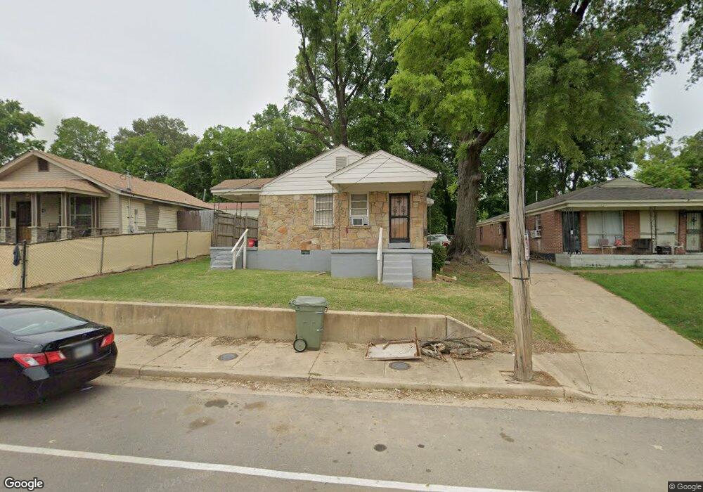
1170 Norris Rd Memphis, TN 38106
Southeast Memphis NeighborhoodEstimated Value: $51,000 - $161,000
2
Beds
2
Baths
1,408
Sq Ft
$64/Sq Ft
Est. Value
About This Home
This home is located at 1170 Norris Rd, Memphis, TN 38106 and is currently estimated at $90,120, approximately $64 per square foot. 1170 Norris Rd is a home located in Shelby County with nearby schools including Hamilton High School, Memphis College Preparatory, and Veritas College Preparatory.
Ownership History
Date
Name
Owned For
Owner Type
Purchase Details
Closed on
Dec 21, 2004
Sold by
C & R Investments Inc
Bought by
Watkins Leroy and Watkins Rosie
Current Estimated Value
Home Financials for this Owner
Home Financials are based on the most recent Mortgage that was taken out on this home.
Original Mortgage
$31,500
Outstanding Balance
$15,702
Interest Rate
5.66%
Mortgage Type
Purchase Money Mortgage
Estimated Equity
$74,418
Purchase Details
Closed on
Oct 23, 2002
Sold by
Malone Osnell
Bought by
C & R Investments Inc
Create a Home Valuation Report for This Property
The Home Valuation Report is an in-depth analysis detailing your home's value as well as a comparison with similar homes in the area
Home Values in the Area
Average Home Value in this Area
Purchase History
| Date | Buyer | Sale Price | Title Company |
|---|---|---|---|
| Watkins Leroy | $35,000 | -- | |
| C & R Investments Inc | $25,100 | Equity Title & Escrow Co Of |
Source: Public Records
Mortgage History
| Date | Status | Borrower | Loan Amount |
|---|---|---|---|
| Open | Watkins Leroy | $31,500 |
Source: Public Records
Tax History Compared to Growth
Tax History
| Year | Tax Paid | Tax Assessment Tax Assessment Total Assessment is a certain percentage of the fair market value that is determined by local assessors to be the total taxable value of land and additions on the property. | Land | Improvement |
|---|---|---|---|---|
| 2025 | $292 | $20,160 | $2,800 | $17,360 |
| 2024 | $292 | $8,600 | $1,240 | $7,360 |
| 2023 | $524 | $8,600 | $1,240 | $7,360 |
| 2022 | $524 | $8,600 | $1,240 | $7,360 |
| 2021 | $530 | $8,600 | $1,240 | $7,360 |
| 2020 | $1,067 | $14,720 | $1,240 | $13,480 |
| 2019 | $1,067 | $14,720 | $1,240 | $13,480 |
| 2018 | $1,067 | $14,720 | $1,240 | $13,480 |
| 2017 | $605 | $14,720 | $1,240 | $13,480 |
| 2016 | $864 | $19,760 | $0 | $0 |
| 2014 | $864 | $19,760 | $0 | $0 |
Source: Public Records
Map
Nearby Homes
- 1078 N Ball Rd
- 2180 Elvis Presley Blvd
- 1385 Eloise Rd
- 1408 Eloise Rd
- 2377 Warren St
- 2067 Corry Rd
- 1495 Compton Ave
- 0 Carlton Rd
- 1490 Lockhaven Ave
- 2436 Sparks St
- 1473 Carlton Rd
- 2048 Benton St
- 1560 Cane Rd
- 944 Alice Ave
- 2601 Darlene St
- 1431 Ledger Rd
- 760 E Mckellar Ave
- 2001 Benton St
- 2112 Blakewood Place
- 1202 Middle Dr Unit 101
- 1172 Norris Rd
- 1162 Norris Rd
- 1178 Norris Rd
- 1171 E Dempster Ave
- 1163 E Dempster Ave
- 1177 E Dempster Ave
- 1190 Norris Rd
- 1187 E Dempster Ave
- 1195 E Dempster Ave
- 1201 Norris Rd
- 1206 Norris Rd
- 1172 E Dempster Ave
- 1162 E Dempster Ave
- 1154 E Dempster Ave
- 1205 E Dempster Ave
- 1207 Norris Rd
- 1182 E Dempster Ave
- 2282 Rollins St
- 1211 Norris Rd
- 1214 Norris Rd