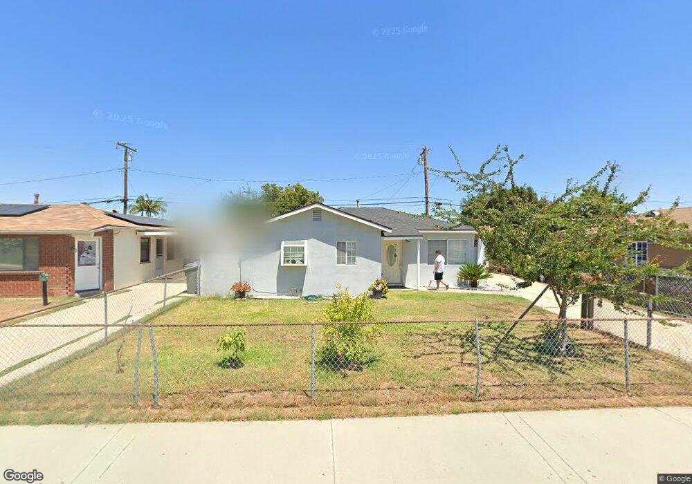
11722 Leland Ave Whittier, CA 90605
South Whittier NeighborhoodEstimated Value: $720,000 - $824,000
3
Beds
2
Baths
1,173
Sq Ft
$653/Sq Ft
Est. Value
About This Home
This home is located at 11722 Leland Ave, Whittier, CA 90605 and is currently estimated at $765,710, approximately $652 per square foot. 11722 Leland Ave is a home located in Los Angeles County with nearby schools including California High School, St. Gregory The Great, and St. Paul Of The Cross Elementary School.
Ownership History
Date
Name
Owned For
Owner Type
Purchase Details
Closed on
Aug 25, 2023
Sold by
Corona Mariano and Corona Lilia
Bought by
Corona Mariano
Current Estimated Value
Purchase Details
Closed on
Jan 27, 1995
Sold by
Conklin Susumu and Conklin Keiko M
Bought by
Corona Mariano
Home Financials for this Owner
Home Financials are based on the most recent Mortgage that was taken out on this home.
Original Mortgage
$121,933
Interest Rate
8.9%
Mortgage Type
FHA
Create a Home Valuation Report for This Property
The Home Valuation Report is an in-depth analysis detailing your home's value as well as a comparison with similar homes in the area
Home Values in the Area
Average Home Value in this Area
Purchase History
| Date | Buyer | Sale Price | Title Company |
|---|---|---|---|
| Corona Mariano | -- | None Listed On Document | |
| Corona Mariano | $125,000 | Gateway Title |
Source: Public Records
Mortgage History
| Date | Status | Borrower | Loan Amount |
|---|---|---|---|
| Previous Owner | Corona Mariano | $121,933 |
Source: Public Records
Tax History Compared to Growth
Tax History
| Year | Tax Paid | Tax Assessment Tax Assessment Total Assessment is a certain percentage of the fair market value that is determined by local assessors to be the total taxable value of land and additions on the property. | Land | Improvement |
|---|---|---|---|---|
| 2025 | $3,432 | $257,375 | $141,079 | $116,296 |
| 2024 | $3,432 | $252,329 | $138,313 | $114,016 |
| 2023 | $3,330 | $247,382 | $135,601 | $111,781 |
| 2022 | $3,345 | $242,533 | $132,943 | $109,590 |
| 2021 | $3,274 | $237,779 | $130,337 | $107,442 |
| 2019 | $3,180 | $230,728 | $126,472 | $104,256 |
| 2018 | $3,020 | $226,205 | $123,993 | $102,212 |
| 2016 | $2,865 | $217,423 | $119,179 | $98,244 |
| 2015 | $2,794 | $214,158 | $117,389 | $96,769 |
| 2014 | $2,769 | $209,964 | $115,090 | $94,874 |
Source: Public Records
Map
Nearby Homes
- 13531 Utica St
- 13538 Lukay St
- 13481 Meyer Rd
- 11828 Louis Ave
- 13513 Leffingwell Rd
- 11116 Leland Ave
- 13857 Leffingwell Rd
- 13272 Beaty Ave
- 13703 Placid Dr
- 12309 Ramsey Dr
- 11531 Sunnybrook Ln
- 11525 Sunnybrook Ln
- 11518 Fidel Ave
- 14034 Coteau Dr Unit 1103
- 11624 Starlight Ave
- 11118 Bunker Ln
- 10849 Inez St
- 11102 Eagle Ln
- 13213 Leffingwell Rd
- 11820 Painter Ave
- 11802 Leland Ave
- 11718 Leland Ave
- 11803 Alclad Ave
- 11806 Leland Ave
- 11712 Leland Ave
- 11809 Alclad Ave
- 11719 Alclad Ave
- 11812 Leland Ave
- 11713 Alclad Ave
- 11706 Leland Ave
- 11813 Alclad Ave
- 11709 Alclad Ave
- 11818 Leland Ave
- 11702 Leland Ave
- 11817 Alclad Ave
- 11813 Leland Ave
- 11703 Alclad Ave
- 13613 Utica St
- 11802 Alclad Ave
- 11824 Leland Ave