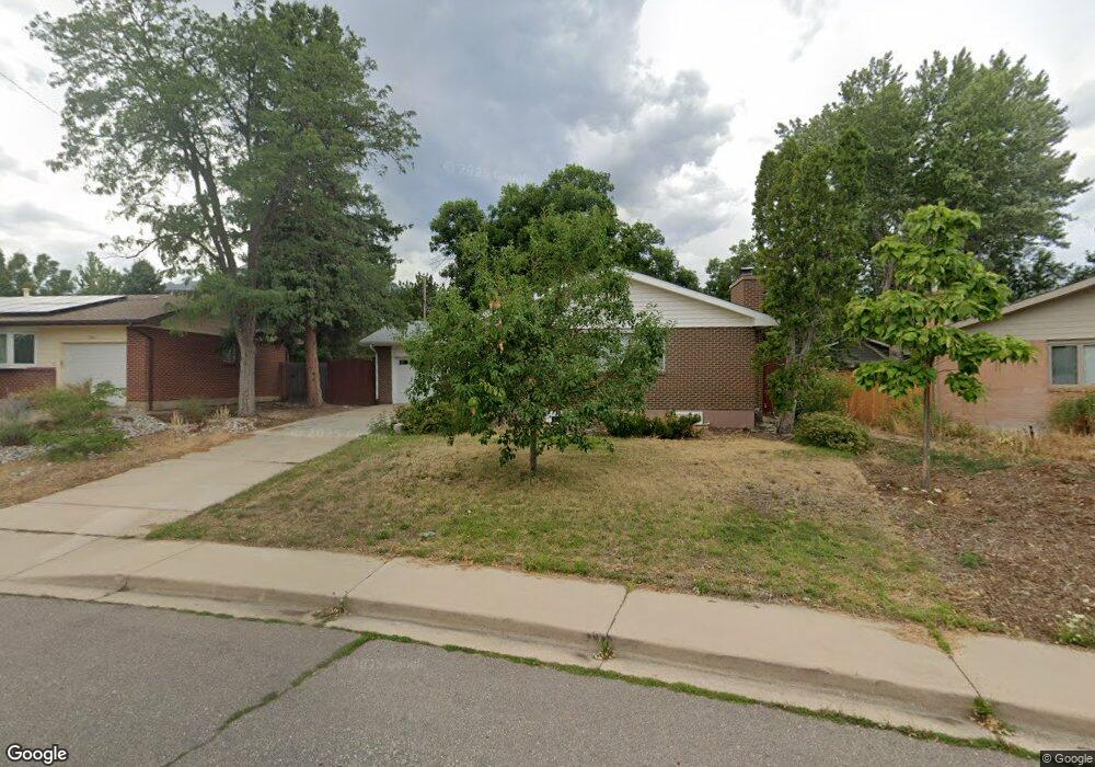
1175 Albion Rd Boulder, CO 80305
Table Mesa NeighborhoodEstimated Value: $1,032,000 - $1,210,000
3
Beds
2
Baths
1,392
Sq Ft
$779/Sq Ft
Est. Value
About This Home
This home is located at 1175 Albion Rd, Boulder, CO 80305 and is currently estimated at $1,083,841, approximately $778 per square foot. 1175 Albion Rd is a home located in Boulder County with nearby schools including Mesa Elementary School, Bear Creek Elementary School, and Southern Hills Middle School.
Ownership History
Date
Name
Owned For
Owner Type
Purchase Details
Closed on
Nov 3, 2008
Sold by
Hunnes Robert B and Will Of Henry E Stirn
Bought by
Hunnes Eric Alan
Current Estimated Value
Purchase Details
Closed on
Apr 26, 2006
Sold by
Hunnes Robert B and Will Of Henry E Stirn
Bought by
Hunnes Eric Alan
Purchase Details
Closed on
Oct 23, 1990
Bought by
Hunnes Eric Alan
Purchase Details
Closed on
Oct 15, 1975
Bought by
Hunnes Eric Alan
Create a Home Valuation Report for This Property
The Home Valuation Report is an in-depth analysis detailing your home's value as well as a comparison with similar homes in the area
Home Values in the Area
Average Home Value in this Area
Purchase History
| Date | Buyer | Sale Price | Title Company |
|---|---|---|---|
| Hunnes Eric Alan | -- | None Available | |
| Hunnes Eric Alan | -- | None Available | |
| Hunnes Robert B | -- | None Available | |
| Hunnes Eric Alan | -- | -- | |
| Hunnes Eric Alan | $43,900 | -- |
Source: Public Records
Tax History
| Year | Tax Paid | Tax Assessment Tax Assessment Total Assessment is a certain percentage of the fair market value that is determined by local assessors to be the total taxable value of land and additions on the property. | Land | Improvement |
|---|---|---|---|---|
| 2025 | $6,323 | $65,557 | $56,194 | $9,363 |
| 2024 | $6,323 | $65,557 | $56,194 | $9,363 |
| 2023 | $6,211 | $71,054 | $64,488 | $10,251 |
| 2022 | $5,506 | $58,485 | $47,434 | $11,051 |
| 2021 | $5,254 | $60,168 | $48,799 | $11,369 |
| 2020 | $4,668 | $53,632 | $42,900 | $10,732 |
| 2019 | $4,597 | $53,632 | $42,900 | $10,732 |
| 2018 | $4,426 | $51,055 | $31,680 | $19,375 |
| 2017 | $4,288 | $56,444 | $35,024 | $21,420 |
| 2016 | $3,753 | $43,359 | $25,552 | $17,807 |
| 2015 | $3,554 | $37,658 | $17,034 | $20,624 |
| 2014 | $3,166 | $37,658 | $17,034 | $20,624 |
Source: Public Records
Map
Nearby Homes
- 3490 Emerson Ave
- 3450 Emerson Ave
- 3210 Emerson Ave
- 4445 Grinnell Ave
- 4380 Ludlow St
- 4445 Squires Cir
- 2860 Table Mesa Dr
- 4204 Greenbriar Blvd Unit 45
- 4286 Greenbriar Blvd
- 725 S 45th St
- 3970 Longwood Ave
- 1516 Chambers Dr
- 4630 MacKy Way
- 3755 Silver Plume Ln
- 450 S 41st St
- 2665 Juilliard St
- 800 W Moorhead Cir Unit E
- 860 W Moorhead Cir Unit 2K
- 860 W Moorhead Cir Unit 1I
- 860 W Moorhead Cir Unit 2H
Your Personal Tour Guide
Ask me questions while you tour the home.