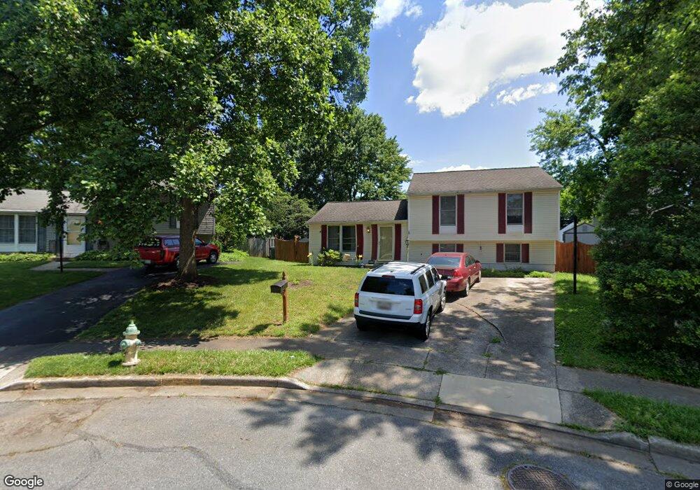
1178 Avondale Ct Frederick, MD 21702
Taskers Chance NeighborhoodEstimated Value: $357,000 - $452,000
--
Bed
3
Baths
1,728
Sq Ft
$239/Sq Ft
Est. Value
About This Home
This home is located at 1178 Avondale Ct, Frederick, MD 21702 and is currently estimated at $412,366, approximately $238 per square foot. 1178 Avondale Ct is a home located in Frederick County with nearby schools including Butterfly Ridge Elementary School, Monocacy Middle School, and Gov. Thomas Johnson High School.
Ownership History
Date
Name
Owned For
Owner Type
Purchase Details
Closed on
Nov 3, 1988
Sold by
Pilatsky Robert L and Pilatsky Cheryl L
Bought by
Moore William M and Moore Bonnie L
Current Estimated Value
Home Financials for this Owner
Home Financials are based on the most recent Mortgage that was taken out on this home.
Original Mortgage
$105,097
Interest Rate
10.22%
Purchase Details
Closed on
Oct 23, 1986
Sold by
Rylea Homes Inc.
Bought by
Pilatsky Robert L and Pilatsky Cheryl L
Create a Home Valuation Report for This Property
The Home Valuation Report is an in-depth analysis detailing your home's value as well as a comparison with similar homes in the area
Home Values in the Area
Average Home Value in this Area
Purchase History
| Date | Buyer | Sale Price | Title Company |
|---|---|---|---|
| Moore William M | $104,500 | -- | |
| Pilatsky Robert L | $91,100 | -- |
Source: Public Records
Mortgage History
| Date | Status | Borrower | Loan Amount |
|---|---|---|---|
| Closed | Moore William M | $105,097 |
Source: Public Records
Tax History Compared to Growth
Tax History
| Year | Tax Paid | Tax Assessment Tax Assessment Total Assessment is a certain percentage of the fair market value that is determined by local assessors to be the total taxable value of land and additions on the property. | Land | Improvement |
|---|---|---|---|---|
| 2025 | $4,795 | $336,300 | $119,100 | $217,200 |
| 2024 | $4,795 | $309,800 | $0 | $0 |
| 2023 | $4,432 | $283,300 | $0 | $0 |
| 2022 | $4,196 | $256,800 | $83,200 | $173,600 |
| 2021 | $3,800 | $243,367 | $0 | $0 |
| 2020 | $3,800 | $229,933 | $0 | $0 |
| 2019 | $3,618 | $216,500 | $70,300 | $146,200 |
| 2018 | $3,475 | $201,500 | $0 | $0 |
| 2017 | $3,275 | $216,500 | $0 | $0 |
| 2016 | $3,123 | $171,500 | $0 | $0 |
| 2015 | $3,123 | $170,267 | $0 | $0 |
| 2014 | $3,123 | $169,033 | $0 | $0 |
Source: Public Records
Map
Nearby Homes
- 163 Heathfield Dr
- 1204 Conewago Dr
- 120 Burgess Hill Way Unit 207
- 227 Savage Rd
- 111 Cavenrock Ct
- 1003 Lavenport Way
- 1899 Shookstown Rd
- 1897 Shookstown Rd
- 1895 Shookstown Rd
- 1893 Shookstown Rd
- 1891 Shookstown Rd
- 1889 Shookstown Rd
- 1887 Shookstown Rd
- 1885 Shookstown Rd
- 1883 Shookstown Rd
- 1881 Shookstown Rd
- 315 Schaffer Dr
- 1879 Shookstown Rd
- 1877 Shookstown Rd
- 1223 Palladian Way
- 1177 Avondale Ct
- 1180 Avondale Ct
- 209 Thames Dr
- 1179 Avondale Ct
- 211 Thames Dr
- 207 Thames Dr
- 1178 Codorus St
- 1176 Codorus St
- 1182 Avondale Ct
- 1180 Codorus St
- 205 Thames Dr
- 1174 Codorus St
- 1181 Avondale Ct
- 1184 Avondale Ct
- 1182 Codorus St
- 203 Thames Dr
- 1186 Avondale Ct
- 1183 Avondale Ct
- 210 Thames Dr
- 206 Thames Dr