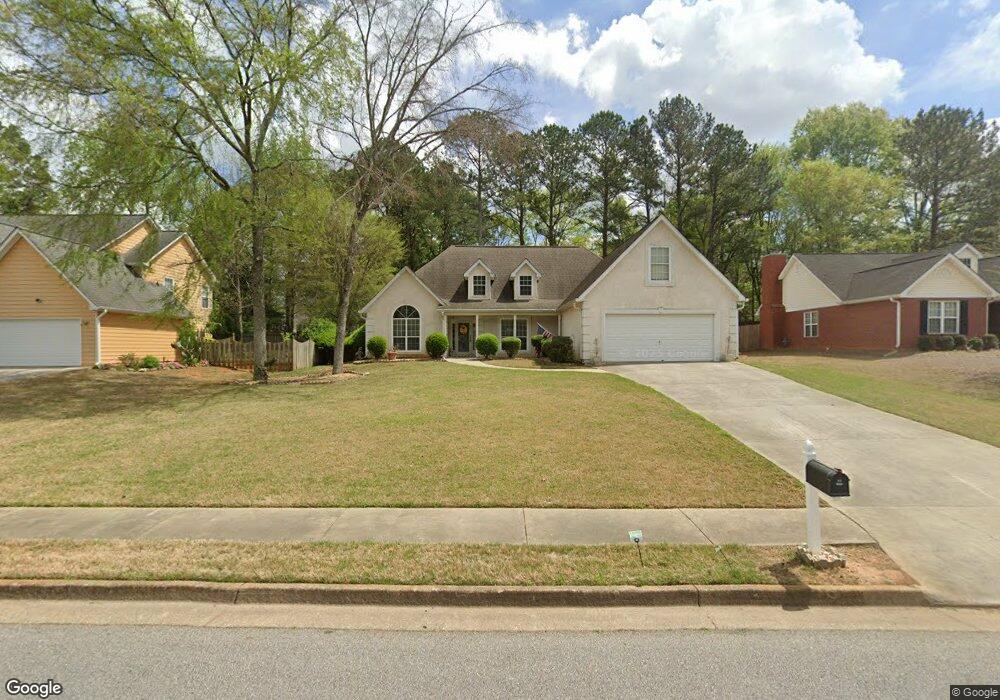
118 Parkside Dr Stockbridge, GA 30281
Estimated Value: $301,303 - $324,000
3
Beds
2
Baths
2,087
Sq Ft
$148/Sq Ft
Est. Value
About This Home
This home is located at 118 Parkside Dr, Stockbridge, GA 30281 and is currently estimated at $308,826, approximately $147 per square foot. 118 Parkside Dr is a home located in Henry County with nearby schools including Flippen Elementary School, Eagle's Landing Middle School, and Eagle's Landing High School.
Ownership History
Date
Name
Owned For
Owner Type
Purchase Details
Closed on
Mar 27, 2003
Sold by
Cendant Mobility Finl Corp
Bought by
Hall Mark B and Hall Beth
Current Estimated Value
Home Financials for this Owner
Home Financials are based on the most recent Mortgage that was taken out on this home.
Original Mortgage
$160,370
Outstanding Balance
$68,641
Interest Rate
5.82%
Mortgage Type
FHA
Estimated Equity
$240,185
Purchase Details
Closed on
Jan 31, 1995
Sold by
K Johnson Homes Inc
Bought by
Perry Robert Jamie
Home Financials for this Owner
Home Financials are based on the most recent Mortgage that was taken out on this home.
Original Mortgage
$132,800
Interest Rate
9.14%
Create a Home Valuation Report for This Property
The Home Valuation Report is an in-depth analysis detailing your home's value as well as a comparison with similar homes in the area
Home Values in the Area
Average Home Value in this Area
Purchase History
| Date | Buyer | Sale Price | Title Company |
|---|---|---|---|
| Hall Mark B | $163,000 | -- | |
| Cendant Mobility Finl Corp | $37,400 | -- | |
| Perry Robert Jamie | $139,900 | -- |
Source: Public Records
Mortgage History
| Date | Status | Borrower | Loan Amount |
|---|---|---|---|
| Open | Cendant Mobility Finl Corp | $160,370 | |
| Previous Owner | Perry Robert Jamie | $132,800 |
Source: Public Records
Tax History Compared to Growth
Tax History
| Year | Tax Paid | Tax Assessment Tax Assessment Total Assessment is a certain percentage of the fair market value that is determined by local assessors to be the total taxable value of land and additions on the property. | Land | Improvement |
|---|---|---|---|---|
| 2025 | $3,894 | $116,560 | $16,000 | $100,560 |
| 2024 | $3,894 | $120,680 | $16,000 | $104,680 |
| 2023 | $3,666 | $124,160 | $18,000 | $106,160 |
| 2022 | $3,105 | $94,440 | $14,000 | $80,440 |
| 2021 | $2,765 | $80,080 | $14,000 | $66,080 |
| 2020 | $2,592 | $72,760 | $12,000 | $60,760 |
| 2019 | $2,382 | $67,320 | $10,000 | $57,320 |
| 2018 | $2,245 | $61,520 | $10,000 | $51,520 |
| 2016 | $1,946 | $53,120 | $8,000 | $45,120 |
| 2015 | $1,886 | $50,440 | $8,000 | $42,440 |
| 2014 | $1,745 | $46,480 | $8,000 | $38,480 |
Source: Public Records
Map
Nearby Homes
- 209 Kensington Trace
- 214 Kensington Trace
- 200 Kensington Trace
- 228 Kensington Trace
- 104 Riverside Close
- 169 Parkside Dr
- 241 Legends Trace
- 129 Breton Highlands
- 941 Arbor Way
- 805 Cog Hill
- 601 Sawgrass Walk
- 205 Legends Trace
- 129 Talon Place
- 418 Abbey Springs Way
- 834 Chalet Hills
- 1016 Collingtree Ct
- 153 Rockport Dr
- 900 Ellesmere Point
- 120 Parkside Dr
- 116 Parkside Dr
- 122 Parkside Dr Unit 1
- 114 Parkside Dr
- 207 Kensington Trace
- 211 Kensington Trace
- 121 Parkside Dr
- 215 Kensington Trace
- 205 Kensington Trace
- 123 Parkside Dr
- 119 Parkside Dr
- 217 Kensington Trace Unit II
- 117 Parkside Dr
- 125 Parkside Dr
- 124 Parkside Dr
- 112 Parkside Dr
- 103 Heritage Walk
- 0 Kensington Trace
- 0 Heritage
- 115 Parkside Dr Unit I