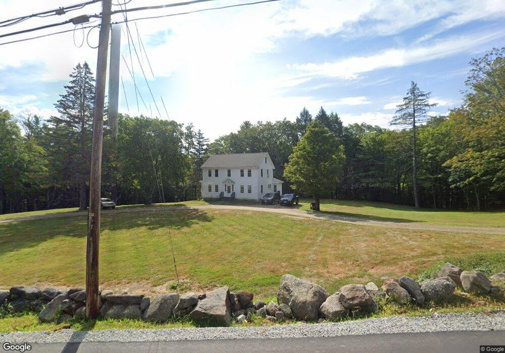
1180 Deering Center Rd Deering, NH 03244
Estimated Value: $240,000 - $481,000
3
Beds
2
Baths
2,226
Sq Ft
$181/Sq Ft
Est. Value
About This Home
This home is located at 1180 Deering Center Rd, Deering, NH 03244 and is currently estimated at $403,524, approximately $181 per square foot. 1180 Deering Center Rd is a home located in Hillsborough County with nearby schools including Hillsboro-Deering Elementary School and Hillsboro-Deering High School.
Ownership History
Date
Name
Owned For
Owner Type
Purchase Details
Closed on
Aug 27, 2009
Sold by
Silver Michael and Silver Deborah
Bought by
Wilds Christian Assoc
Current Estimated Value
Purchase Details
Closed on
Jul 22, 2002
Sold by
Local Church Ministrie
Bought by
Silver Michael and Silver Deborah
Home Financials for this Owner
Home Financials are based on the most recent Mortgage that was taken out on this home.
Original Mortgage
$71,650
Interest Rate
6.73%
Create a Home Valuation Report for This Property
The Home Valuation Report is an in-depth analysis detailing your home's value as well as a comparison with similar homes in the area
Home Values in the Area
Average Home Value in this Area
Purchase History
| Date | Buyer | Sale Price | Title Company |
|---|---|---|---|
| Wilds Christian Assoc | $215,000 | -- | |
| Silver Michael | $75,500 | -- |
Source: Public Records
Mortgage History
| Date | Status | Borrower | Loan Amount |
|---|---|---|---|
| Previous Owner | Silver Michael | $100,000 | |
| Previous Owner | Silver Michael | $71,650 |
Source: Public Records
Tax History Compared to Growth
Tax History
| Year | Tax Paid | Tax Assessment Tax Assessment Total Assessment is a certain percentage of the fair market value that is determined by local assessors to be the total taxable value of land and additions on the property. | Land | Improvement |
|---|---|---|---|---|
| 2024 | $7,598 | $270,400 | $81,700 | $188,700 |
| 2023 | $7,025 | $270,400 | $81,700 | $188,700 |
| 2022 | $6,152 | $270,400 | $81,700 | $188,700 |
| 2021 | $6,100 | $270,400 | $81,700 | $188,700 |
| 2020 | $6,709 | $270,400 | $81,700 | $188,700 |
| 2019 | $6,299 | $205,700 | $64,600 | $141,100 |
| 2018 | $6,181 | $205,700 | $64,600 | $141,100 |
| 2017 | $6,165 | $205,700 | $64,600 | $141,100 |
| 2016 | $5,873 | $205,700 | $64,600 | $141,100 |
| 2015 | $6,083 | $205,700 | $64,600 | $141,100 |
| 2014 | $5,181 | $210,000 | $69,300 | $140,700 |
| 2013 | $5,450 | $210,000 | $69,300 | $140,700 |
Source: Public Records
Map
Nearby Homes
- Lot 13 E Deering Rd
- 9 Reservoir Rd
- 126 Fisher Rd
- 107 Branch Rd
- 30 Dels Way
- 194 Buckley Rd Unit 2
- 194 Buckley Rd Unit 44
- 475 Old County Rd
- 281 Hodgdon Rd
- 62 Collins Landing Rd Unit 46
- 108 E Shore Dr
- 200 Mountain Rd
- 101-125 Winslow Rd
- 008-043-001 School House Rd
- 008-043-000 School House Rd
- 2426 2nd Nh Turnpike
- 133 Hay Hill Rd
- 196 Deering Center Rd
- 69 Birch Glen Dr Unit 2
- Lot 7-13 Mountain Rd
- 10 Cross Rd
- 6 Camp Rd
- 15 Cross Rd
- 1218 Deering Center Rd
- 1223 Deering Center Rd
- 60 Cross Rd
- 1138 Deering Center Rd
- 1097 Deering Center Rd
- 1116 Deering Center Rd
- 162 Camp Rd
- 1115 Deering Center Rd
- 1081 Deering Center Rd
- 1279 Deering Center Rd
- 1084 Deering Center Rd
- 87 Cross Rd
- 175 Camp Rd
- 182 Camp Rd
- 1055 Deering Center Rd
- 1055 Deering Center Rd
- 106 Cross Rd