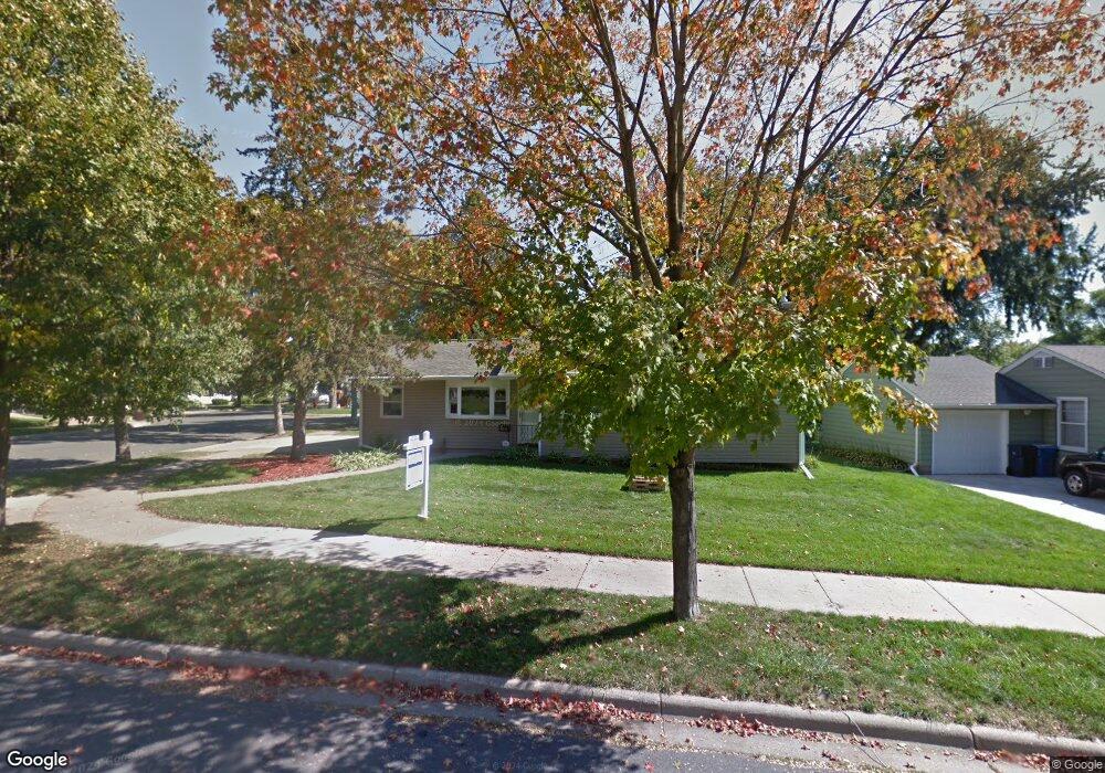
1180 Macarthur Ave Saint Paul, MN 55118
Estimated Value: $293,000 - $306,000
2
Beds
1
Bath
1,718
Sq Ft
$174/Sq Ft
Est. Value
About This Home
This home is located at 1180 Macarthur Ave, Saint Paul, MN 55118 and is currently estimated at $298,846, approximately $173 per square foot. 1180 Macarthur Ave is a home located in Dakota County with nearby schools including Garlough Environmental Magnet, Heritage E-STEM Magnet School, and Two Rivers High School.
Ownership History
Date
Name
Owned For
Owner Type
Purchase Details
Closed on
Jan 27, 2016
Sold by
Ballou Collin R
Bought by
Parranto Christopher and Parranto Cassandra
Current Estimated Value
Home Financials for this Owner
Home Financials are based on the most recent Mortgage that was taken out on this home.
Original Mortgage
$165,750
Outstanding Balance
$131,789
Interest Rate
3.87%
Mortgage Type
FHA
Estimated Equity
$167,057
Purchase Details
Closed on
Feb 10, 2014
Sold by
Roberts Gerald G and Roberts Brenda J
Bought by
Ballou Collin R
Home Financials for this Owner
Home Financials are based on the most recent Mortgage that was taken out on this home.
Original Mortgage
$137,205
Interest Rate
4.55%
Mortgage Type
New Conventional
Purchase Details
Closed on
May 21, 1999
Sold by
Lopez Michael J and Lopez Theresa
Bought by
Schnobrich Brenda J
Create a Home Valuation Report for This Property
The Home Valuation Report is an in-depth analysis detailing your home's value as well as a comparison with similar homes in the area
Home Values in the Area
Average Home Value in this Area
Purchase History
| Date | Buyer | Sale Price | Title Company |
|---|---|---|---|
| Parranto Christopher | $177,900 | Wantaclear Title | |
| Ballou Collin R | $152,448 | Land Title | |
| Schnobrich Brenda J | $119,900 | -- |
Source: Public Records
Mortgage History
| Date | Status | Borrower | Loan Amount |
|---|---|---|---|
| Open | Parranto Christopher | $165,750 | |
| Previous Owner | Ballou Collin R | $137,205 |
Source: Public Records
Tax History Compared to Growth
Tax History
| Year | Tax Paid | Tax Assessment Tax Assessment Total Assessment is a certain percentage of the fair market value that is determined by local assessors to be the total taxable value of land and additions on the property. | Land | Improvement |
|---|---|---|---|---|
| 2024 | $3,264 | $273,900 | $68,900 | $205,000 |
| 2023 | $3,264 | $274,300 | $72,900 | $201,400 |
| 2022 | $2,790 | $262,900 | $72,700 | $190,200 |
| 2021 | $2,586 | $226,500 | $63,200 | $163,300 |
| 2020 | $2,502 | $210,700 | $60,200 | $150,500 |
| 2019 | $2,342 | $199,600 | $57,300 | $142,300 |
| 2018 | $2,123 | $180,900 | $53,600 | $127,300 |
| 2017 | $1,940 | $172,600 | $51,000 | $121,600 |
| 2016 | $1,888 | $154,700 | $46,400 | $108,300 |
| 2015 | $1,753 | $127,677 | $38,396 | $89,281 |
| 2014 | -- | $114,379 | $34,700 | $79,679 |
| 2013 | -- | $105,441 | $31,415 | $74,026 |
Source: Public Records
Map
Nearby Homes
- 150 Westchester Dr
- 155 Conver St
- 1251 Macarthur Ave
- 272 Butler Ave E
- 273 Butler Ave E
- 1076 Humboldt Ave
- 10 Logan Ave E
- 1116 Hall Ave
- 147 Hurley St E
- 188 Wyoming St E
- 180 Wyoming St E
- 274 Wyoming St E
- 100 Imperial Dr W Unit 404
- 1523 Traverse Ln
- Bayfield Plan at Thompson Square East
- Capri Plan at Thompson Square East
- 1531 Traverse Ln
- Hayward Plan at Thompson Square East
- Barcelona Plan at Thompson Square East
- Athens II Plan at Thompson Square East
- 1186 Macarthur Ave
- 1180 1180 MacArthur Ave
- 188 Altman Ct
- 1185 1185 MacArthur-street-
- 1173 1173 MacArthur St
- 1170 Macarthur Ave
- 1192 Macarthur Ave
- 1191 1191 MacArthur-avenue-
- 1179 Macarthur Ave
- 194 Altman Ct
- 1173 Macarthur Ave
- 1185 Macarthur Ave
- 1166 Macarthur Ave
- 191 Altman Ct
- 187 Westchester Dr
- 181 Westchester Dr
- 195 Altman Ct
- 181 Westchester Dr
- 173 Westchester Dr
- 193 Westchester Dr