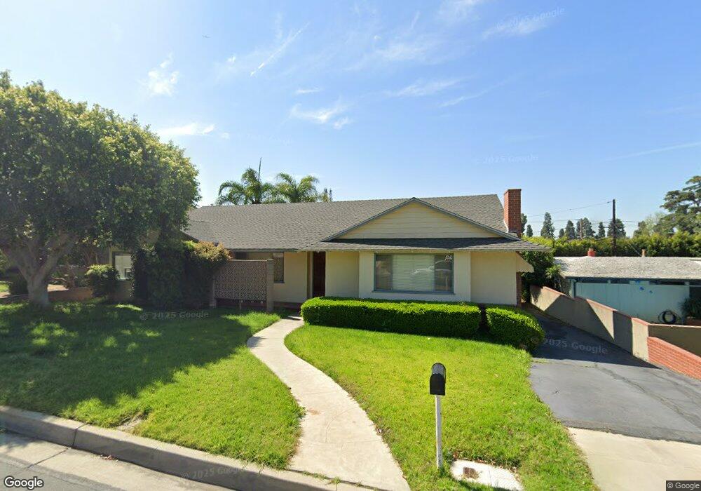
11810 Norino Dr Whittier, CA 90601
West Whittier NeighborhoodEstimated Value: $776,000 - $1,097,459
3
Beds
3
Baths
2,698
Sq Ft
$362/Sq Ft
Est. Value
About This Home
This home is located at 11810 Norino Dr, Whittier, CA 90601 and is currently estimated at $975,865, approximately $361 per square foot. 11810 Norino Dr is a home located in Los Angeles County with nearby schools including Longfellow Elementary School, Walter F. Dexter Middle School, and Whittier High School.
Ownership History
Date
Name
Owned For
Owner Type
Purchase Details
Closed on
Aug 18, 2025
Sold by
Roberts Edwin R
Bought by
Edwin Ross Roberts Trust and Roberts
Current Estimated Value
Purchase Details
Closed on
Nov 13, 2001
Sold by
Roberts Edwin R
Bought by
Roberts Edwin R
Home Financials for this Owner
Home Financials are based on the most recent Mortgage that was taken out on this home.
Original Mortgage
$249,000
Interest Rate
6.63%
Purchase Details
Closed on
May 15, 2000
Sold by
Roberts Gloria J
Bought by
Roberts Edwin R
Home Financials for this Owner
Home Financials are based on the most recent Mortgage that was taken out on this home.
Original Mortgage
$61,000
Interest Rate
8.08%
Mortgage Type
Stand Alone Second
Create a Home Valuation Report for This Property
The Home Valuation Report is an in-depth analysis detailing your home's value as well as a comparison with similar homes in the area
Home Values in the Area
Average Home Value in this Area
Purchase History
| Date | Buyer | Sale Price | Title Company |
|---|---|---|---|
| Edwin Ross Roberts Trust | -- | Title Trust Services | |
| Roberts Edwin R | -- | North American Title Co | |
| Roberts Edwin R | -- | Gateway Title Company |
Source: Public Records
Mortgage History
| Date | Status | Borrower | Loan Amount |
|---|---|---|---|
| Previous Owner | Roberts Edwin R | $249,000 | |
| Previous Owner | Roberts Edwin R | $61,000 |
Source: Public Records
Tax History Compared to Growth
Tax History
| Year | Tax Paid | Tax Assessment Tax Assessment Total Assessment is a certain percentage of the fair market value that is determined by local assessors to be the total taxable value of land and additions on the property. | Land | Improvement |
|---|---|---|---|---|
| 2025 | $4,712 | $351,394 | $181,554 | $169,840 |
| 2024 | $4,712 | $344,505 | $177,995 | $166,510 |
| 2023 | $4,662 | $337,751 | $174,505 | $163,246 |
| 2022 | $4,543 | $331,130 | $171,084 | $160,046 |
| 2021 | $4,430 | $324,638 | $167,730 | $156,908 |
| 2019 | $4,366 | $315,011 | $162,756 | $152,255 |
| 2018 | $4,181 | $308,835 | $159,565 | $149,270 |
| 2016 | $4,031 | $296,845 | $153,370 | $143,475 |
| 2015 | $3,898 | $292,387 | $151,067 | $141,320 |
| 2014 | $3,843 | $286,660 | $148,108 | $138,552 |
Source: Public Records
Map
Nearby Homes
- 11511 Beverly Dr
- 11759 S Circle Dr
- 5307 Woodward Ln
- 5315 Bihr Ct
- 5518 Norwalk Blvd
- 11302 Maple St
- 10605 Cordoba Ct
- 5115 Castelotte Ct
- 5107 Vista Verde Way
- 11840 Nixon Ln
- 11905 Mendenhall Ln
- 12031 Beverly Blvd Unit 1D
- 12417 Rose Dr
- 5655 Pickering Ave
- 5840 Citrus Ave
- 11338 Ridgegate Dr
- 11447 Broadway Ave
- 11273 Dorland Dr
- 4503 Silver Tip Dr
- 6222 Magnolia Ave
- 11802 Norino Dr
- 11818 Norino Dr
- 11815 Beverly Dr
- 11805 Beverly Dr
- 11824 Norino Dr
- 11809 Norino Dr
- 11823 Beverly Dr
- 11744 Norino Dr
- 11803 Norino Dr
- 11817 Norino Dr
- 11831 Beverly Dr
- 11738 Norino Dr
- 11733 Beverly Dr
- 5316 Rideout Way
- 11743 Norino Dr
- 11836 Norino Dr
- 11830 Norino Dr
- 11837 Beverly Dr
- 11732 Norino Dr
- 11831 Norino Dr