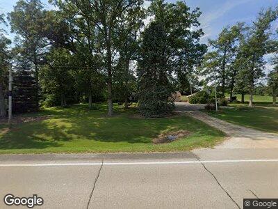
1184 Highway 67 Sabula, IA 52070
Estimated Value: $246,000 - $341,000
3
Beds
2
Baths
2,680
Sq Ft
$113/Sq Ft
Est. Value
About This Home
This home is located at 1184 Highway 67, Sabula, IA 52070 and is currently estimated at $302,343, approximately $112 per square foot. 1184 Highway 67 is a home located in Clinton County with nearby schools including Easton Valley Elementary School and Easton Valley Middle & High School.
Ownership History
Date
Name
Owned For
Owner Type
Purchase Details
Closed on
Dec 21, 2023
Sold by
Levetzow Robert A and Levetzow Dianne M
Bought by
Marburger Shane and Mickelson Jaclyn
Current Estimated Value
Purchase Details
Closed on
Jul 6, 2023
Sold by
Clark Patricia K
Bought by
Levetzow Robert A and Levetzow Dianne M
Create a Home Valuation Report for This Property
The Home Valuation Report is an in-depth analysis detailing your home's value as well as a comparison with similar homes in the area
Home Values in the Area
Average Home Value in this Area
Purchase History
| Date | Buyer | Sale Price | Title Company |
|---|---|---|---|
| Marburger Shane | $265,000 | None Listed On Document | |
| Levetzow Robert A | -- | None Listed On Document |
Source: Public Records
Mortgage History
| Date | Status | Borrower | Loan Amount |
|---|---|---|---|
| Previous Owner | Levetzow Robert A | $45,000 |
Source: Public Records
Tax History Compared to Growth
Tax History
| Year | Tax Paid | Tax Assessment Tax Assessment Total Assessment is a certain percentage of the fair market value that is determined by local assessors to be the total taxable value of land and additions on the property. | Land | Improvement |
|---|---|---|---|---|
| 2024 | $3,304 | $296,680 | $52,000 | $244,680 |
| 2023 | $3,304 | $296,680 | $52,000 | $244,680 |
| 2022 | $2,980 | $276,780 | $52,000 | $224,780 |
| 2021 | $2,966 | $212,260 | $28,400 | $183,860 |
| 2020 | $2,966 | $203,500 | $28,400 | $175,100 |
| 2019 | $2,998 | $203,500 | $0 | $0 |
| 2018 | $3,350 | $250,200 | $0 | $0 |
| 2017 | $3,350 | $250,200 | $0 | $0 |
| 2016 | $2,616 | $182,900 | $0 | $0 |
| 2015 | $2,616 | $167,640 | $0 | $0 |
| 2014 | $2,338 | $167,640 | $0 | $0 |
| 2013 | $2,186 | $0 | $0 | $0 |
Source: Public Records
Map
Nearby Homes
- 1298 475th Ave
- 1295 475th Ave
- 4600 Riverview Rd
- 4828 Pheasant Dr
- 907 Broad St
- 816 Broad St
- Lot 3 Squire Cir
- Lot 1 Squire Cir
- Lot 20 Squire Cir
- 7379 Riverview Rd
- 707 Broad St
- 616 Elk St
- 207 Madison St
- 302 Bank St
- 512 Broad St
- 3638 Illinois Route 84
- 4460 160th St
- 10462 Sandburr Ct
- 10290 One Mile Rd
- TBD 607th Ave