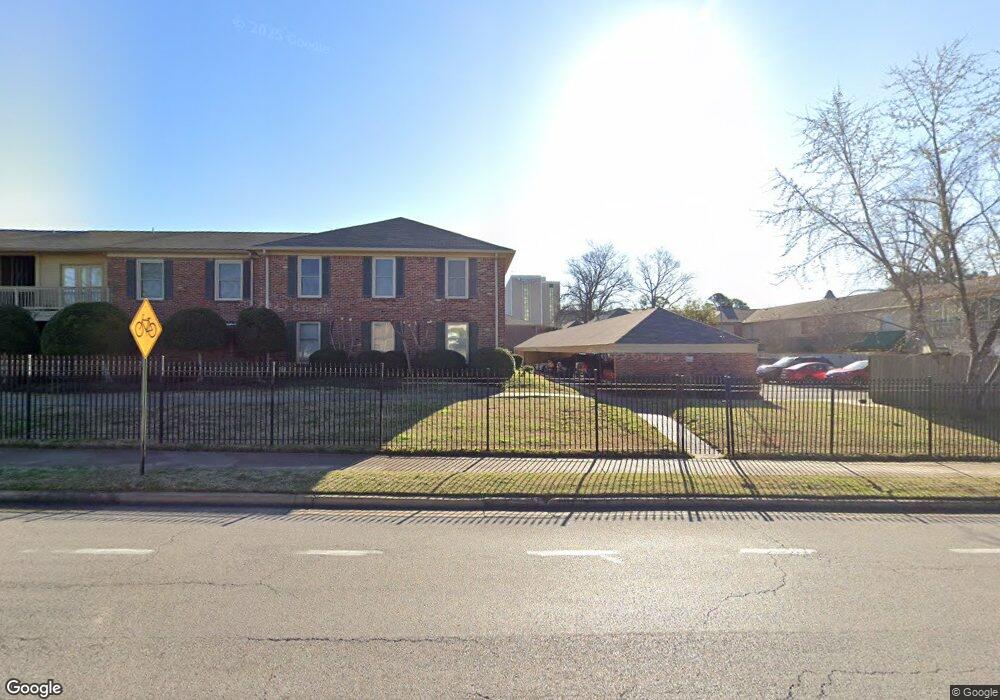
1184 Lynnfield Rd Unit 1 Memphis, TN 38119
Kirby Woods NeighborhoodEstimated Value: $173,000 - $184,000
3
Beds
2
Baths
1,389
Sq Ft
$128/Sq Ft
Est. Value
About This Home
This home is located at 1184 Lynnfield Rd Unit 1, Memphis, TN 38119 and is currently estimated at $177,847, approximately $128 per square foot. 1184 Lynnfield Rd Unit 1 is a home located in Shelby County with nearby schools including Balmoral Ridgeway Elementary School, Ridgeway Middle School, and Ridgeway High School.
Ownership History
Date
Name
Owned For
Owner Type
Purchase Details
Closed on
Sep 15, 2021
Sold by
Marshall I And M Sue Jaffe Trust and Jaffe Marshall I
Bought by
Shaeffer Christi
Current Estimated Value
Home Financials for this Owner
Home Financials are based on the most recent Mortgage that was taken out on this home.
Original Mortgage
$138,571
Outstanding Balance
$126,089
Interest Rate
2.8%
Mortgage Type
New Conventional
Estimated Equity
$51,758
Purchase Details
Closed on
Jul 30, 1999
Sold by
Weems Nell B
Bought by
Jaffe Marshall I and Jaffe M
Create a Home Valuation Report for This Property
The Home Valuation Report is an in-depth analysis detailing your home's value as well as a comparison with similar homes in the area
Home Values in the Area
Average Home Value in this Area
Purchase History
| Date | Buyer | Sale Price | Title Company |
|---|---|---|---|
| Shaeffer Christi | $145,865 | Southern Trust Title | |
| Jaffe Marshall I | $88,500 | -- |
Source: Public Records
Mortgage History
| Date | Status | Borrower | Loan Amount |
|---|---|---|---|
| Open | Shaeffer Christi | $138,571 |
Source: Public Records
Tax History Compared to Growth
Tax History
| Year | Tax Paid | Tax Assessment Tax Assessment Total Assessment is a certain percentage of the fair market value that is determined by local assessors to be the total taxable value of land and additions on the property. | Land | Improvement |
|---|---|---|---|---|
| 2025 | $1,051 | $43,500 | $3,875 | $39,625 |
| 2024 | $1,051 | $31,000 | $3,875 | $27,125 |
| 2023 | $1,888 | $31,000 | $3,875 | $27,125 |
| 2022 | $1,888 | $31,000 | $3,875 | $27,125 |
| 2021 | $841 | $31,000 | $3,875 | $27,125 |
| 2020 | $1,697 | $23,425 | $3,875 | $19,550 |
| 2019 | $749 | $23,425 | $3,875 | $19,550 |
| 2018 | $749 | $23,425 | $3,875 | $19,550 |
| 2017 | $766 | $23,425 | $3,875 | $19,550 |
| 2016 | $896 | $20,500 | $0 | $0 |
| 2014 | $896 | $20,500 | $0 | $0 |
Source: Public Records
Map
Nearby Homes
- 5845 Park Ave Unit 5845
- 1205 Bristol Dr Unit 18
- 5867 Park Ave Unit 5867
- 1212 Bristol Dr
- 5920 Julian Ct Unit 4
- 1220 Chamberlain Dr Unit 1
- 5906 Noyes Ct Unit 4
- 5904 Roxbury Dr Unit 5904
- 5691 Park Ave
- 1164 Brookfield Rd
- 5512 Park Ave
- 1279 W Crestwood Dr
- 1121 Park Green Cove
- 1220 E Irvin Dr
- 5492 Park Ave
- 5476 E East End Village Dr
- 5478 N Rolling Oaks Dr
- 5482 Park Ave
- 5480 Park Ave
- 1149 E Irvin Dr
- 1184 Lynnfield Rd Unit 4
- 1184 Lynnfield Rd Unit 3
- 1184 Lynnfield Rd Unit 2
- 5841 Park Ave Unit 4
- 5841 Park Ave Unit 3
- 5841 Park Ave Unit 2
- 5844 Suffolk Ct Unit 3
- 5844 Suffolk Ct Unit 2
- 5844 Suffolk Ct Unit 1
- 5846 Suffolk Ct Unit 1
- 5846 Suffolk Ct Unit 2
- 5846 Suffolk Ct Unit 3
- 5846 Suffolk Ct Unit 4
- 1185 Bristol Dr Unit 1
- 1185 Bristol Dr Unit 2
- 1185 Bristol Dr Unit 3
- 1185 Bristol Dr Unit 4
- 5847 Park Ave
- 5849 Park Ave Unit 5849
- 5851 Park Ave Unit 5891